


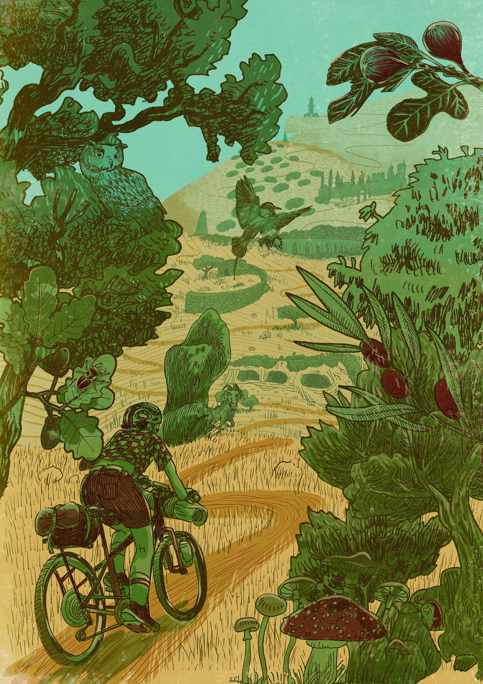
Ilustração // Illustration: almirante reis
Travessia do maciço calcário estremenho
Western Limestone Massif Crossing
PORTUGAL
Western Limestone Massif Crossing
PORTUGAL
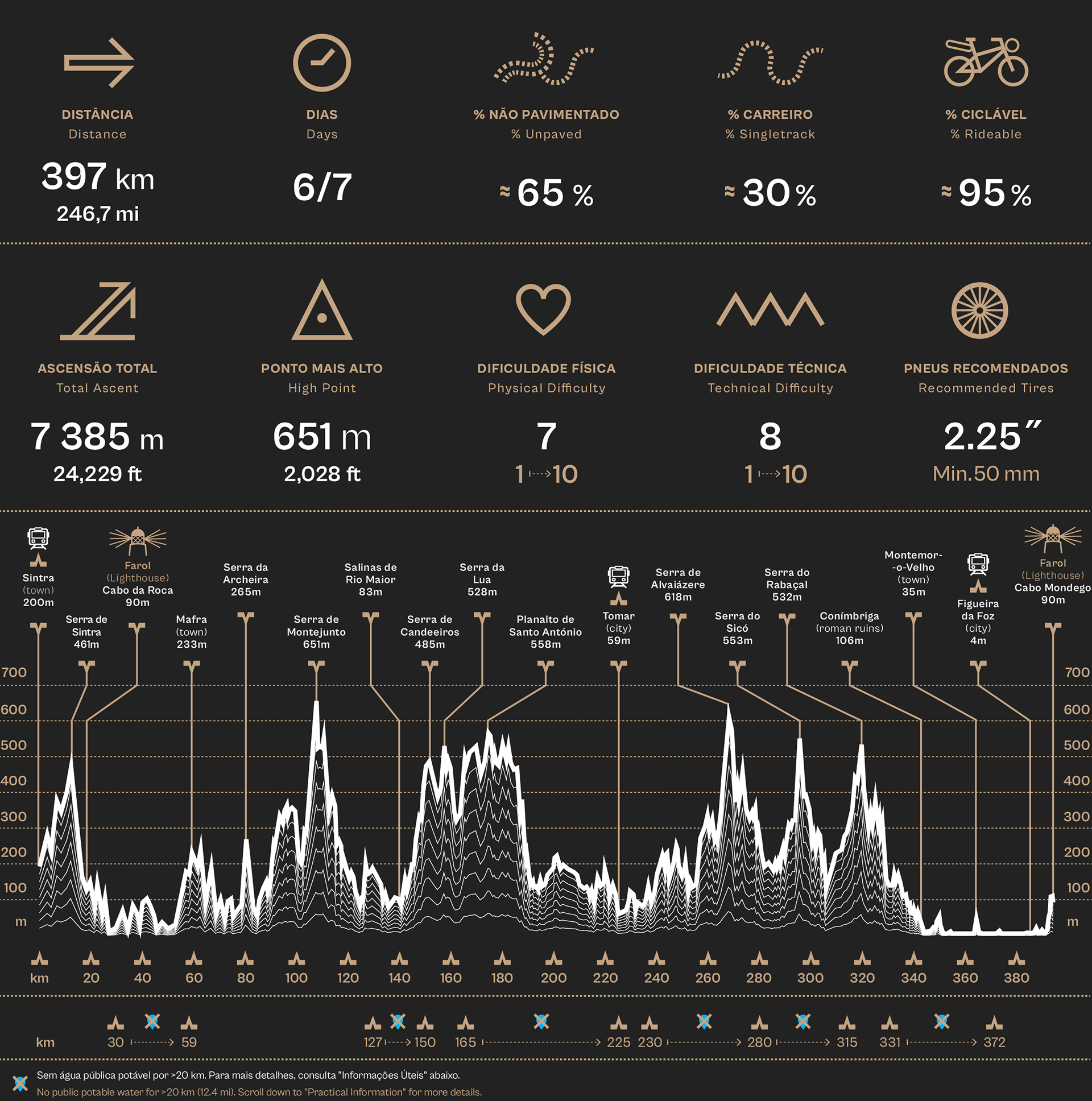
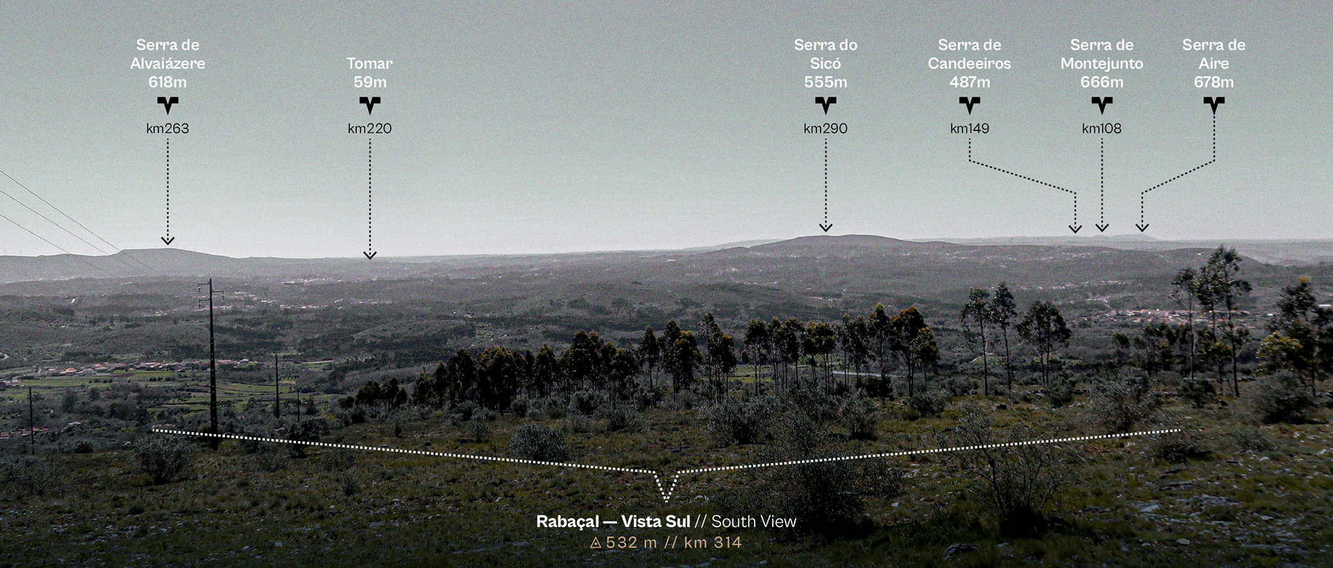
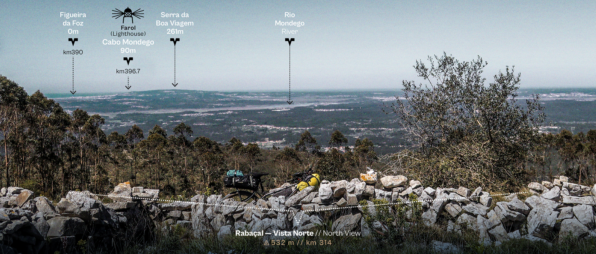
O QUE SÃO LAPIÁS? // What are LAPIÁS (karren) ?
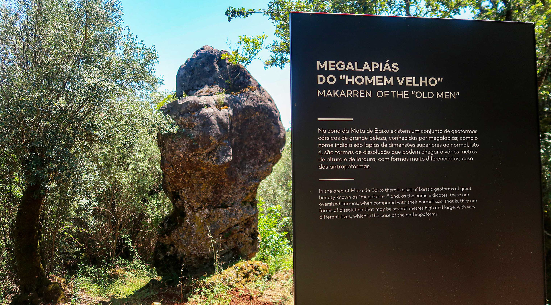
É o rendilhado de rocha nua esculpido pela água no calcário. Esta paisagem escultural e labiríntica — que surge tanto em campos vastos como em rochas isoladas — define a identidade visual e técnica desta rota. Alguns destes afloramentos são tão imponentes que são designados de Megalapiás, e vais cruzar-te com vários deles ao longo do percurso.
It is the intricate lacework of bare rock sculpted into the limestone by water. This sculptural and labyrinthine landscape — appearing as both vast fields and isolated crags — defines the visual and technical identity of this route. Some of these outcrops are so massive they are known as Megalapias (Megakarran), and you will cross paths with several of them along the way.
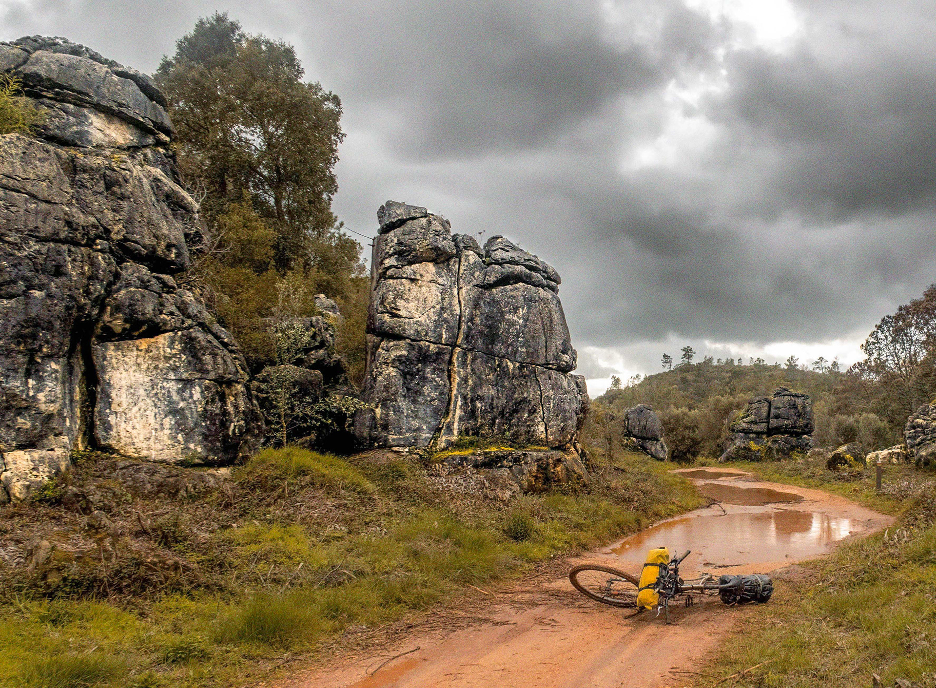
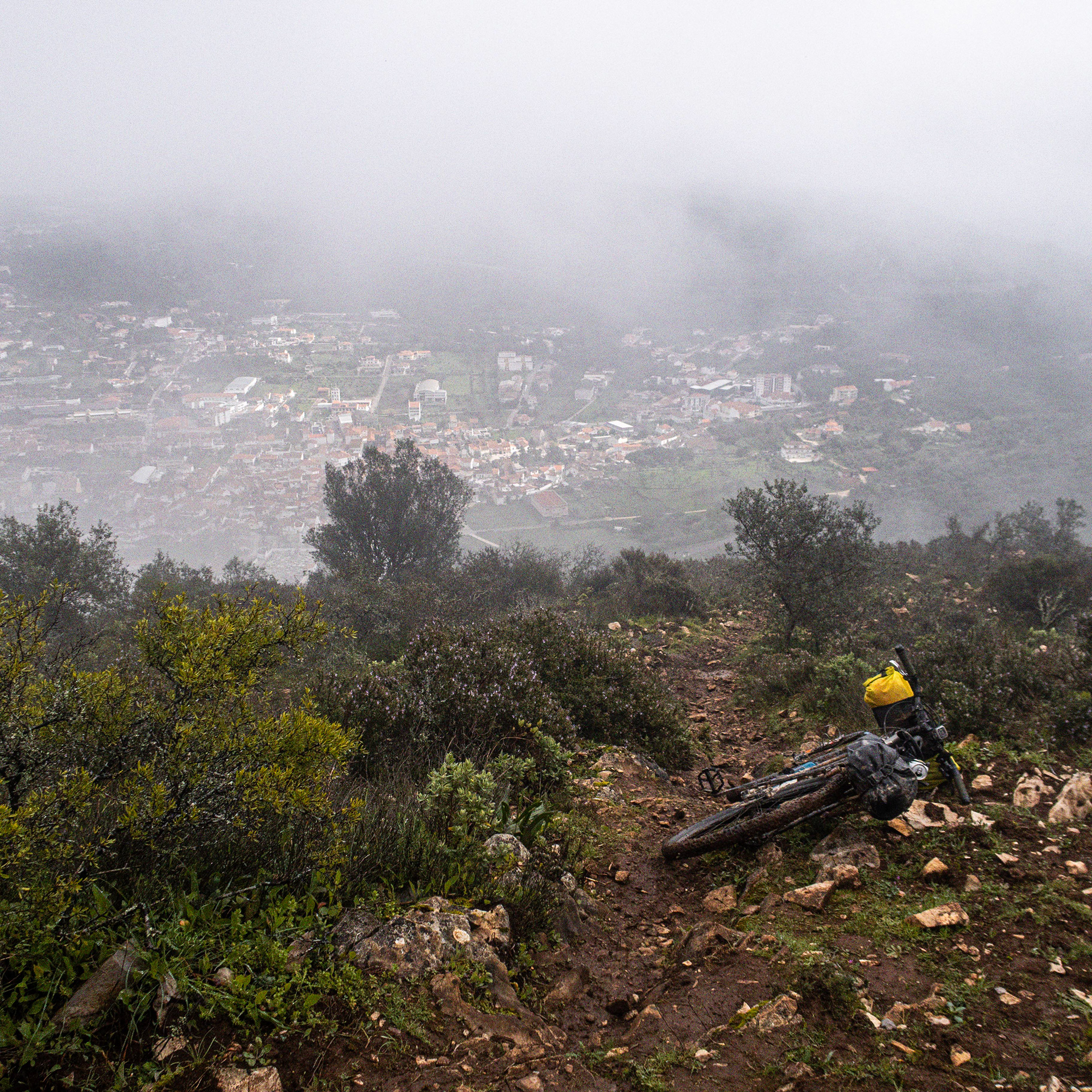
Megalapiás na base da Serra de Aire // Megakarren pavements at the base of Serra de Aire
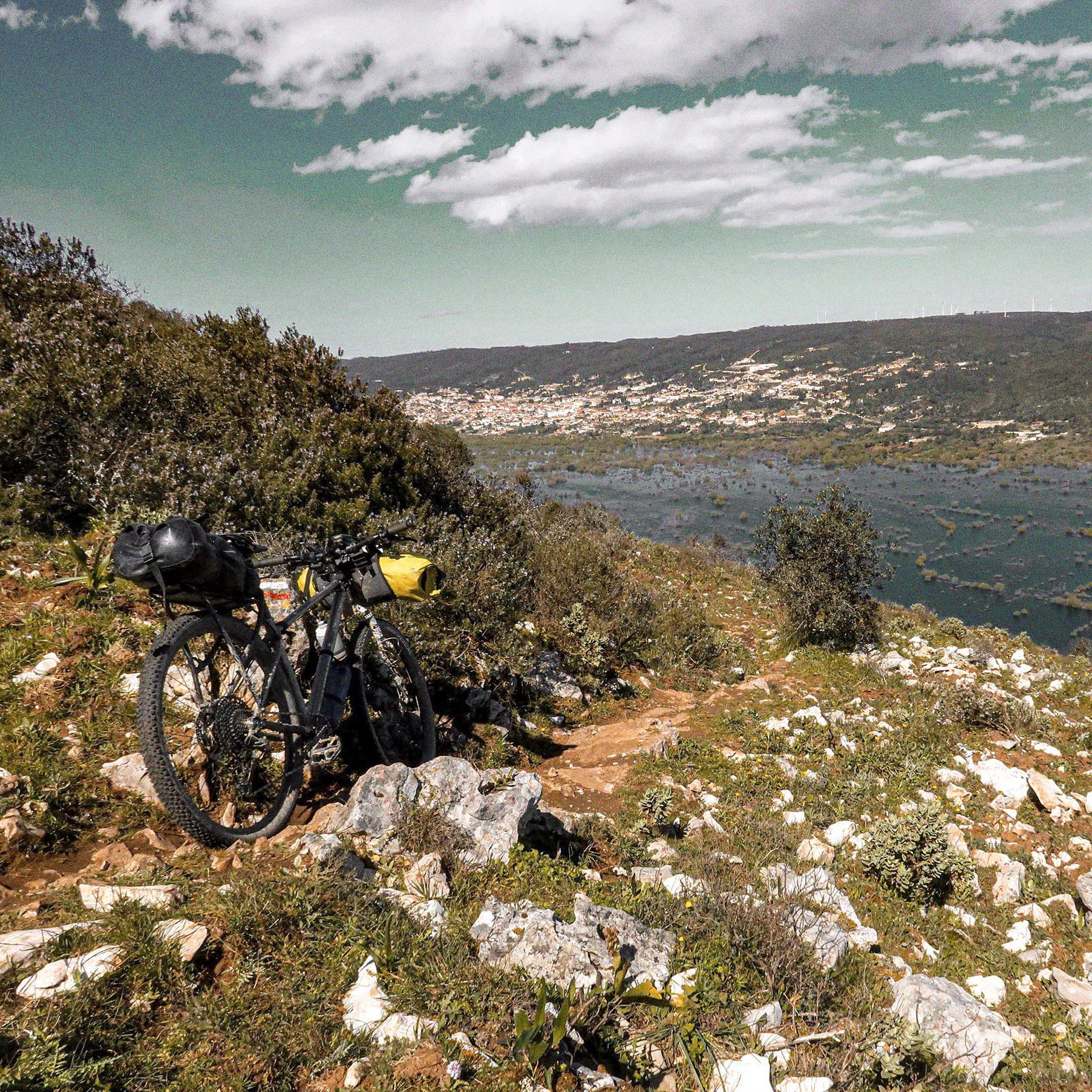
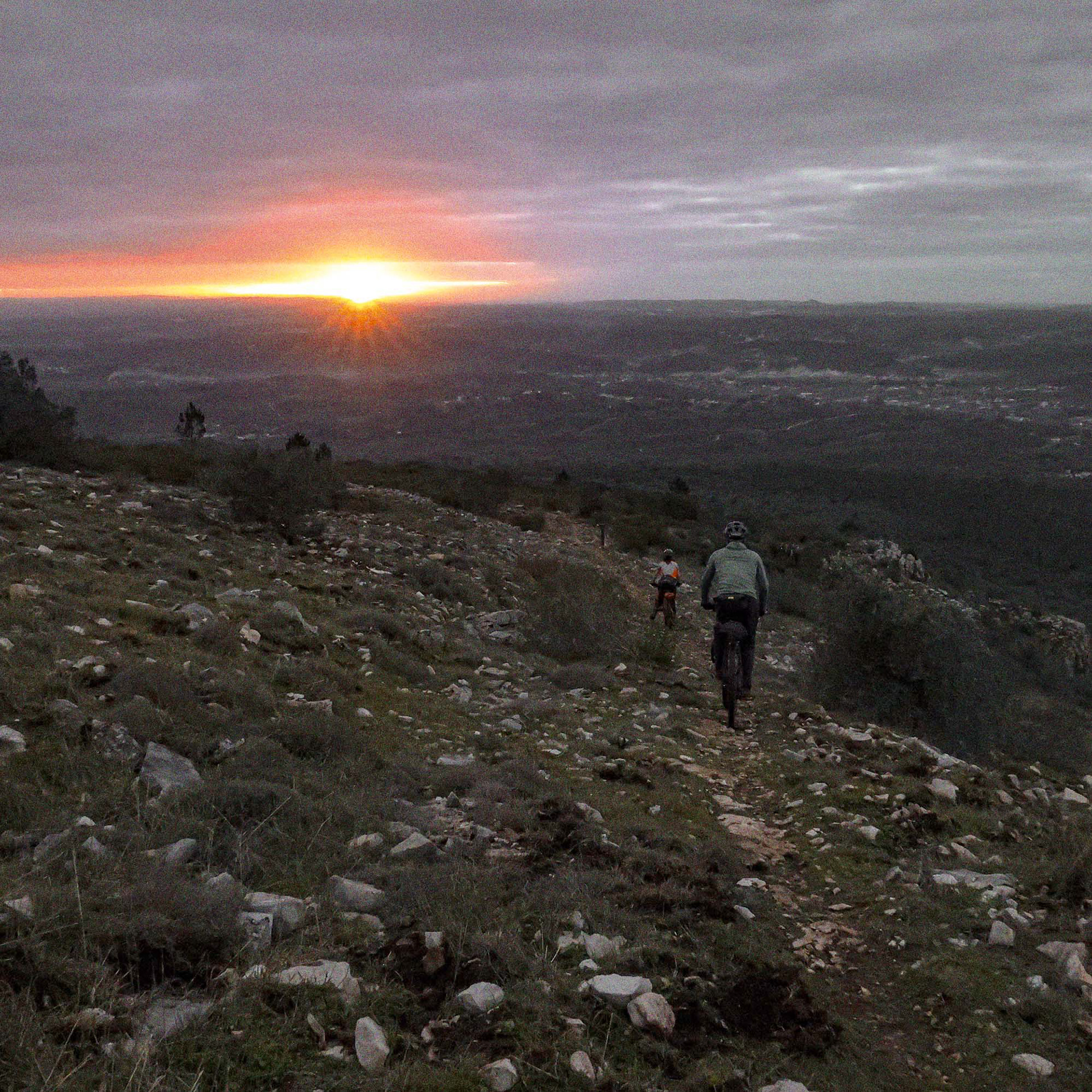
Descida pelo campo de lapiás com vista para o polje de Minde inundado, o raro "Mar de Minde" // Descending the karren pavement field with a view of the flooded Minde polje, the rare "Sea of Minde"
Campo de lapiás na descida da Serra de Alvaiázere, antes da procura de um local para bivacar // Karren pavement field on the Serra de Alvaiázere descent, before scouting for a bivouac spot
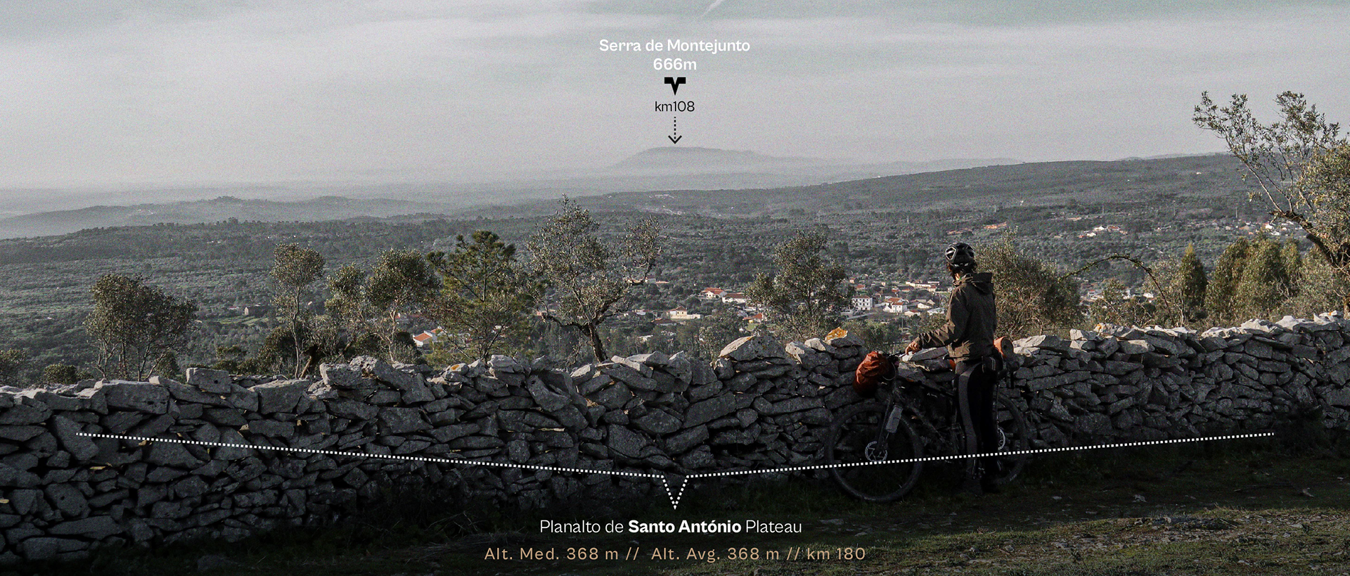
Ideia para uma TRAVESSIA Cársica // idea for a Portuguese karst crossing
O desenho desta rota surgiu por mero acaso. Uso a bicicleta diariamente para as minhas deslocações e habituei-me a transformar a rotina em prazer — mesmo quando o trajeto dita centenas de quilómetros. Atualmente, divido a minha vida pendular entre Sobreiro (Mafra) e Tomar, a minha terra natal, uma ligação que faço regularmente. No entanto, sempre que tenho oportunidade e o tempo o permite, escolho trocar a viagem habitual de autocarro e comboio pela bicicleta. Nessas ocasiões, os meus alforges carregam não só o TEIXO estúdio-oficina, mas também o equipamento de aventura necessário para garantir total autonomia para os três dias que a viagem demora a cumprir. O que seria uma deslocação rotineira transforma-se, assim, numa descoberto permanente.
Ao chegar a casa, a curiosidade leva-me a analisar cada detalhe do traçado, descartar o que não me agrada e, na próxima oportunidade, experimentar uma alternativa melhor. Ao contrário da maioria das rotas de que desenho, onde por vezes só as percorro uma única vez, nesta continuo a ter a oportunidade de testar inúmeras variantes. Esta obsessão por refinar o percurso permite-me construir aquele que acredito ser o melhor traçado possível.
Com o tempo, tornou-se lógico transformar esta experiência pessoal num projeto estruturado para partilha: a ROTA LAPIÁS. Foi precisamente o nascimento desta ideia que me impulsionou a explorar muito para além do meu eixo habitual de viagem. Para dar à rota relevância estética e logística, decidi desenhar um percurso que unisse muito mais do que os dois locais onde vivo. O itinerário expandiu-se para ligar dois pontos icónicos, desvendando o centro de Portugal litoral e interior: o Cabo da Roca e o Cabo Mondego, utilizando os seus faróis históricos como balizas desta aventura. É a criação de uma rota que se quer única, ligando a força da costa atlântica e o arranque no granito da serra de Sintra à forte identidade territorial do intrincado Maciço Calcário Estremenho.
The idea for this route came about entirely by chance. I use my bicycle every day for transportation and have grown accustomed to turning routine into pleasure — even when that routine involves travelling hundreds of kilometers. Today, I divide my life between Sobreiro (Mafra) and Tomar, the town where I was born, making the journey between the two on a regular basis. Whenever possible, however, I choose to swap the usual trip by public transport for a journey by bicycle. On those occasions, my panniers carry not only the TEIXO estúdio-oficina, but also all the adventure equipment required to remain fully self-sufficient during the three days it takes to complete the journey.
Once I arrive home, curiosity inevitably leads me to analyse every detail of the route, discard what does not work, and experiment with a better alternative the next time. Unlike most of the routes I design and ride only once, this one has given me the opportunity to test countless variations. That constant desire for refinement has allowed me to shape what I believe is the best possible version of the route.
Over time, this personal experience evolved into a structured project intended to be shared with others: the LÁPIAS ROUTE.The very birth of this idea encouraged me to explore far beyond my usual travel corridor. To give the route both aesthetic and logistical significance, I decided to design an itinerary that connected far more than just two towns. The route expanded to link two iconic landmarks, crossing central Portugal from coast to inland: Cabo da Roca and Cabo Mondego, using their historic lighthouses as symbolic waypoints for the adventure.The ambition was to create something unique, connecting the raw power of the Atlantic coastline and the granite landscapes of the Sintra Mountains with the strong identity imposed by the karren formations of the Estremenho Massif.
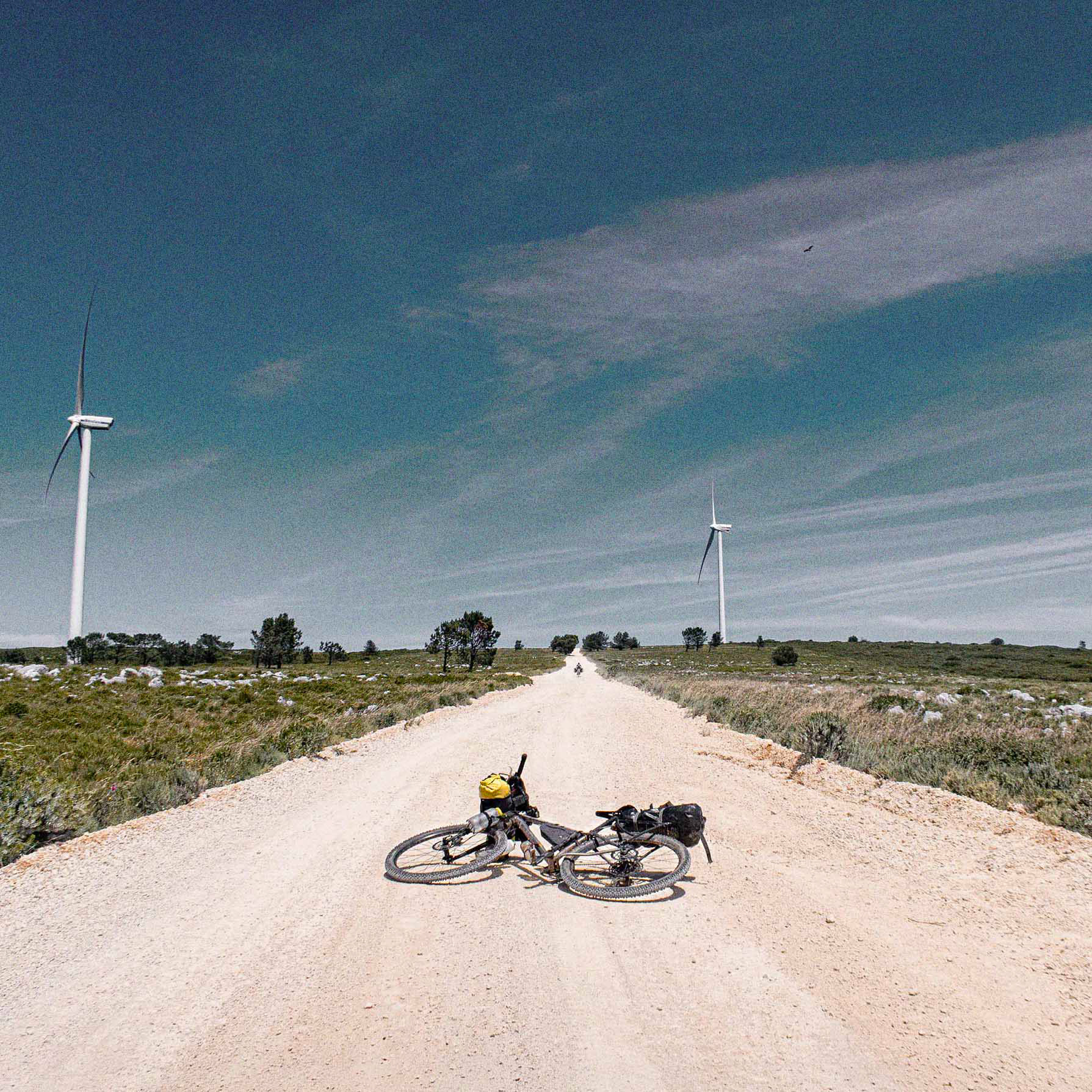
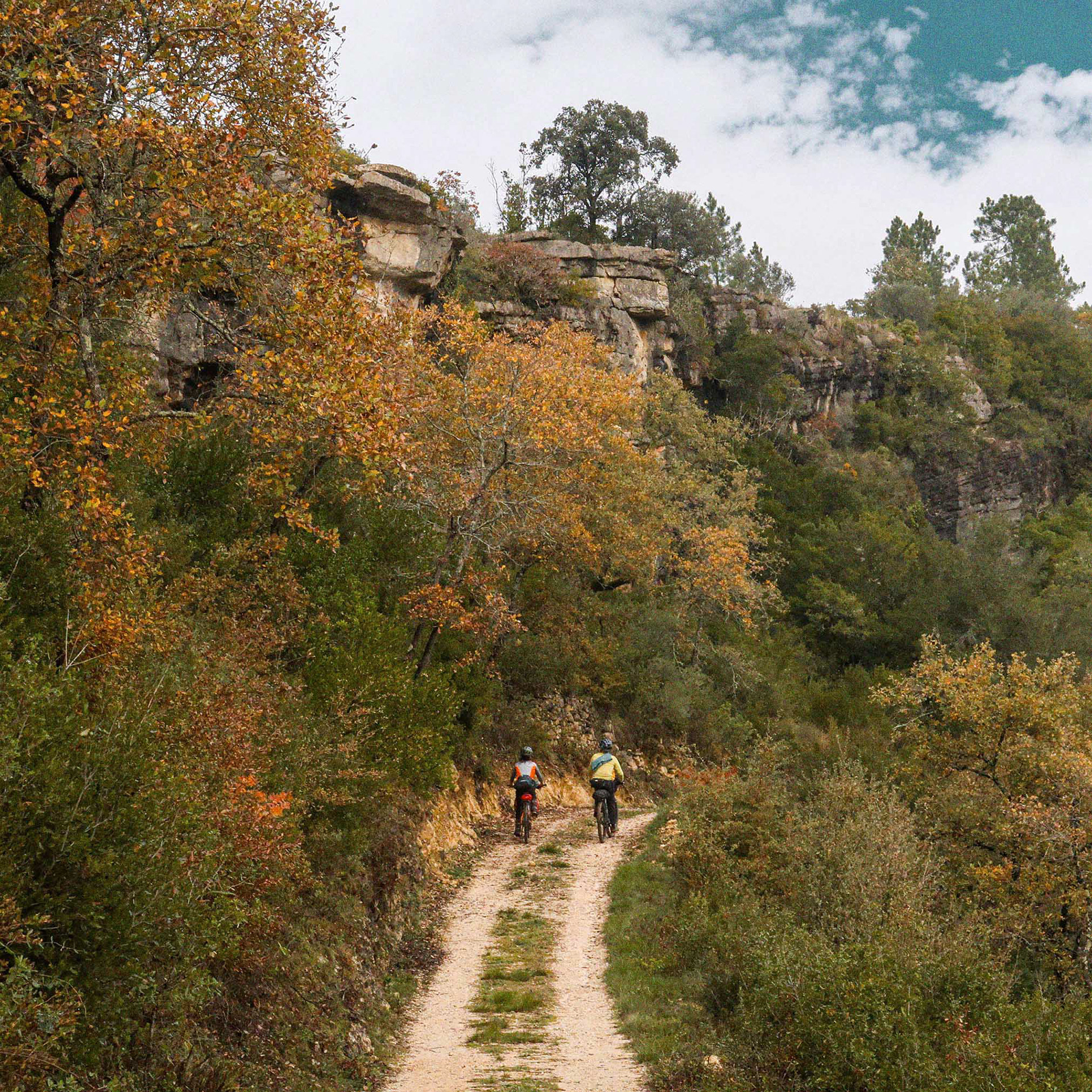
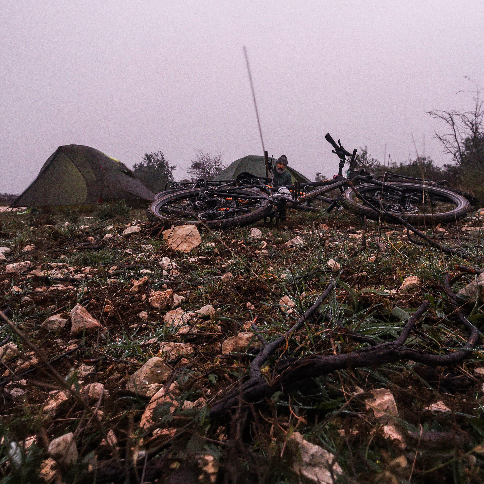
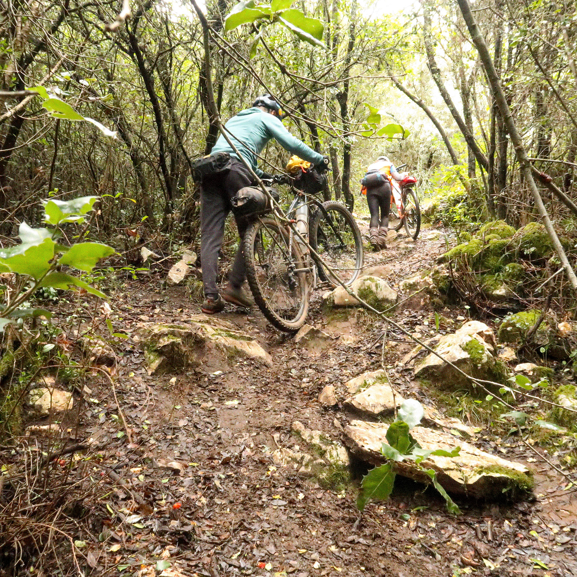
A ROTA LAPIÁS é um convite à tua exploração lenta através de uma mescla de terrenos, num sobe e desce constante: desde secções exigentes de bicicleta à mão e carreiros técnicos, até ao puro gravel e tranquilas estradas de alcatrão. Entre grutas profundas e um potencial de escalada gigante, esta é uma rota onde os teus pés de gato ganham um lugar cativo nos alforges. O trilho serpenteia por zonas de agricultura tradicional mediterrânea e espaços naturais onde a flora é a protagonista, sendo uma das regiões botânicas mais ricas de Portugal; dependendo da época, a própria natureza oferece-te bagas e frutos se a conheceres bem.
O traçado não foi desenhado para ser duro, mas também não se condicionou para evitar as secções mais difíceis. A prioridade absoluta foi a envolvência e o conhecimento do território, incluindo locais cuja espetacularidade seria impossível ignorar — como as arribas atlânticas da costa oeste, a imponente encosta de Alvados, o canhão do Rio Nabão ou o cume e Vale de Poios na Serra de Sicó e as suas aldeias. O percurso molda-se, assim, pela riqueza ecológica, geológica e cultural.
Terás tempo para saborear uma cerveja artesanal feita na serra ou um vinho autêntico acompanhado por queijo local, enquanto cruzas relíquias como os raros bosques de carvalho-português (Quercus faginea). Nas secções mais duras, as formas imaginativas que o lapiás desenha na rocha oferecem-te um desafio lúdico: encontrar figuras esculpidas pelo tempo — uma distração que te ajuda a esquecer as dores nas pernas, convidando-te a parar para contemplar, desenhar ou fotografar.
Poucos percursos na Europa reúnem uma transição de cenários tão radical em menos de 400 quilómetros: um arranque vertical no granito e o impacto cru das falésias atlânticas servem de introdução à suavidade das colinas vitivinícolas do Oeste, o prelúdio perfeito para aquela que é a verdadeira alma e a grande extensão desta rota: o labirinto de pedra do calcário, que apenas cede no final perante o suave vale e o grande estuário do Mondego.
The LÁPIAS ROUTE is an invitation to slow exploration across a diverse mix of terrain, in a constant rhythm of climbing and descending. Riders will encounter everything from demanding hike-a-bike sections and technical singletrack to pure gravel roads and peaceful stretches of tarmac. Between deep cave systems and world-class climbing potential, this is a route where a pair of climbing shoes or lightweight hiking footwear deserves a permanent place in your panniers.The trail crosses traditional farming landscapes and natural environments where flora takes centre stage, passing through one of Portugal's richest botanical regions. Depending on the season, nature itself provides berries and wild fruits for those who know where to look.
The route was never designed to be deliberately difficult, yet neither was it altered to avoid its more challenging sections. The priority has always been immersion and discovery, incorporating places that would simply be impossible to ignore — from the Atlantic cliffs of Portugal's western coast to the striking slopes of Alvados, the Nabão River canyon, and the summit and Poios Valley in the Serra de Sicó, together with its traditional villages.In this way, the route is shaped by ecological, geological and cultural richness.
There is time to enjoy a craft beer brewed in the mountains or a glass of wine accompanied by local cheese while passing relics such as the rare Portuguese oak woodlands (Quercus faginea). Even on the toughest sections, the imaginative shapes carved into the limestone by the karren formations offer a challenge of their own: spotting figures sculpted by time itself. It is a welcome distraction that helps ease the hardship of the ride, inviting riders to stop, observe, sketch, or simply capture the moment through a camera lens.
Few routes offer such a dramatic transition of landscapes in less than 400 kilometers. The journey begins with the raw impact of the Atlantic cliffs before gradually yielding to the gentler vineyard-covered hills of western Portugal. Yet these landscapes are merely a prelude to what becomes the true soul—and longest chapter—of the route: a vast limestone labyrinth that dominates the journey almost to its conclusion, only finally relenting before the soft valley and broad estuary of the Mondego River.
© Diogo Tavares @digstavares
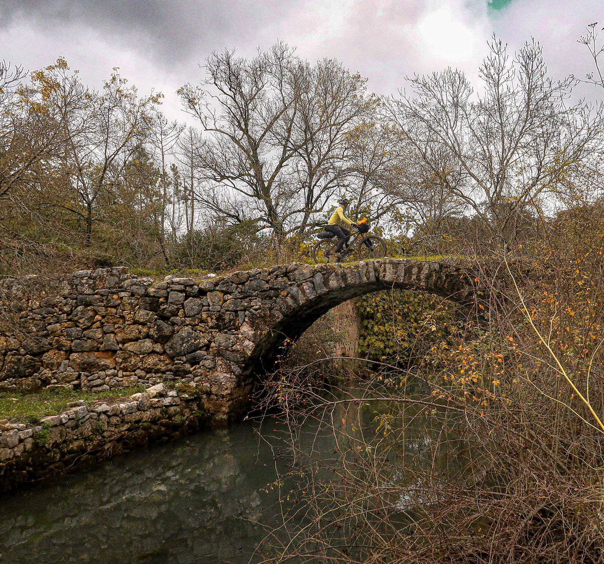
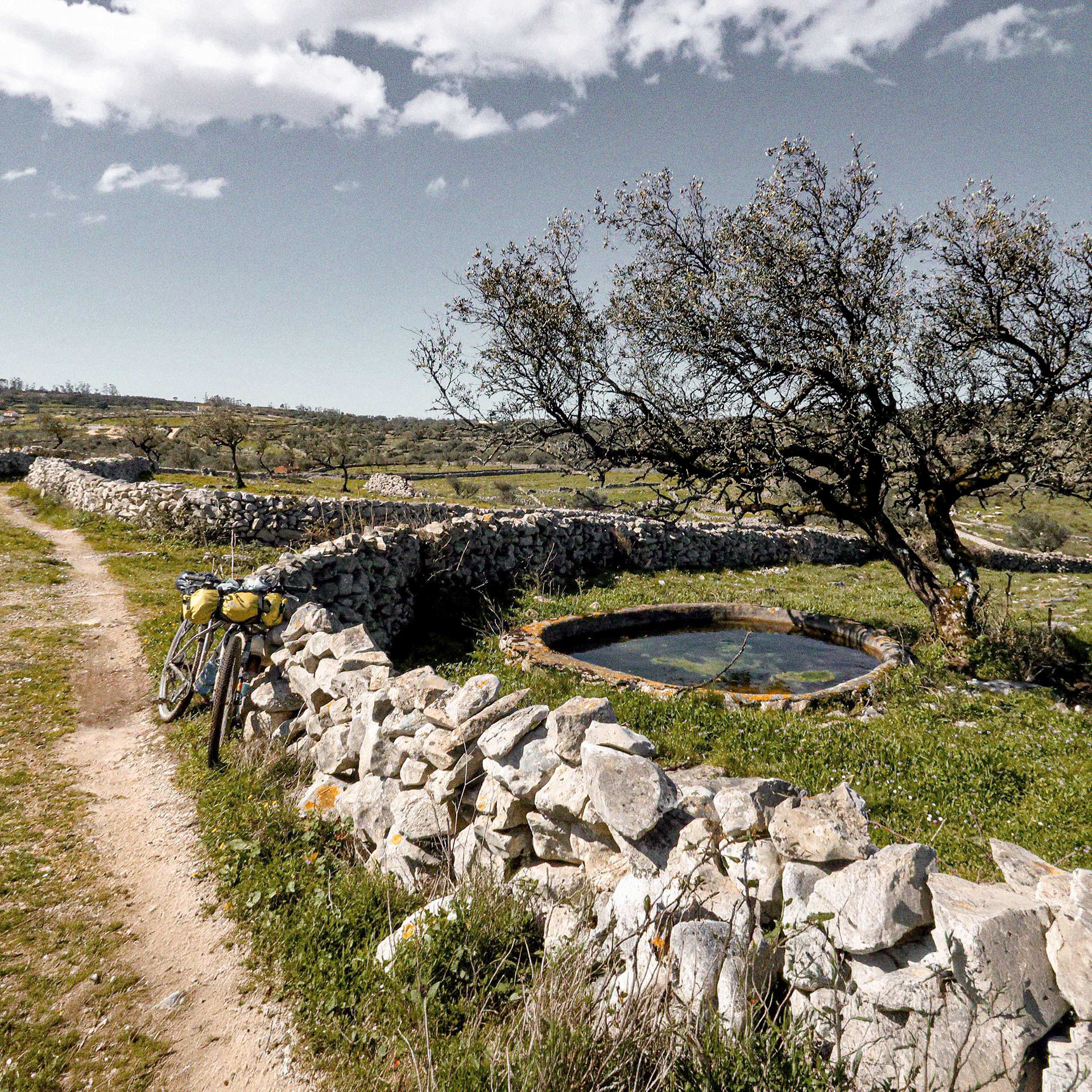
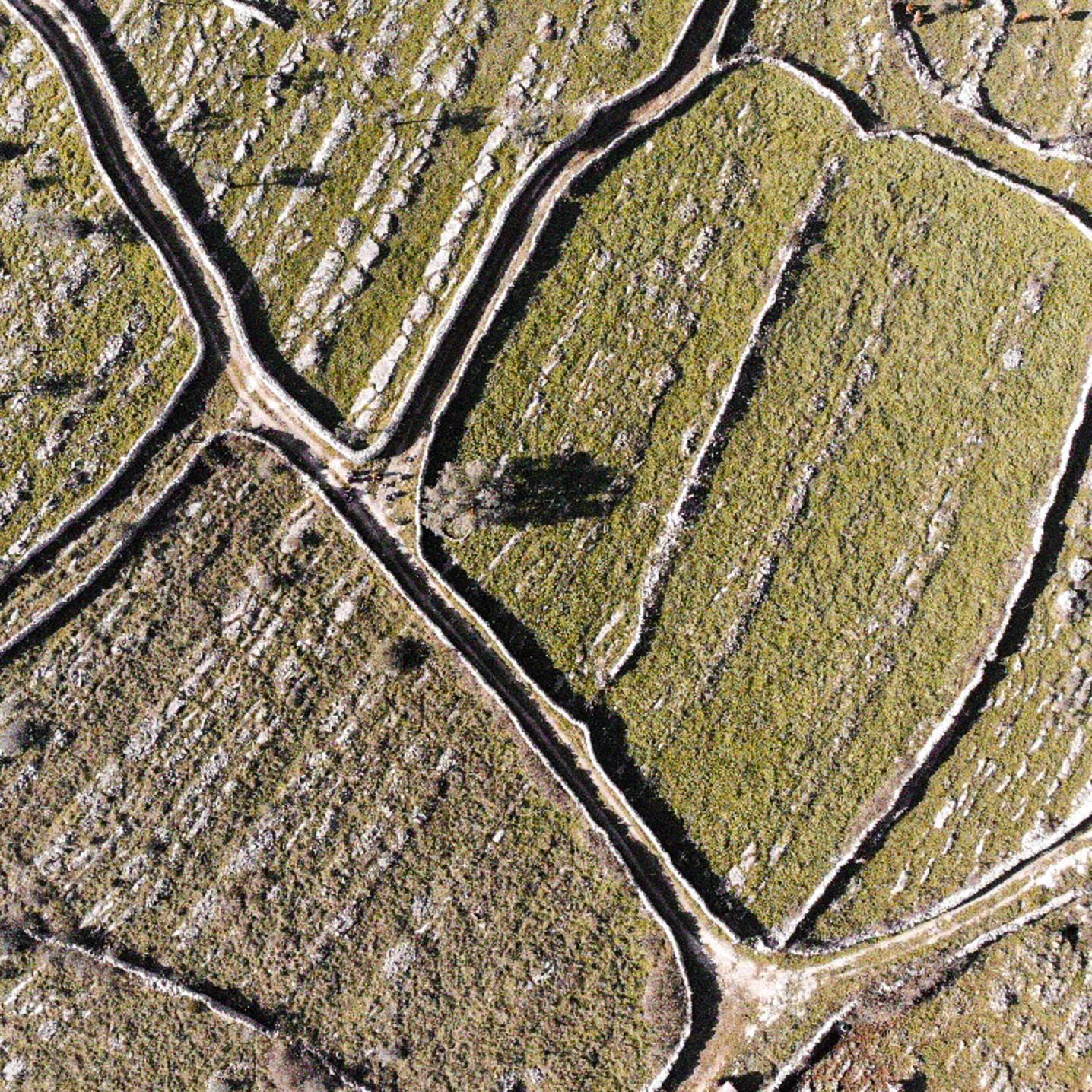
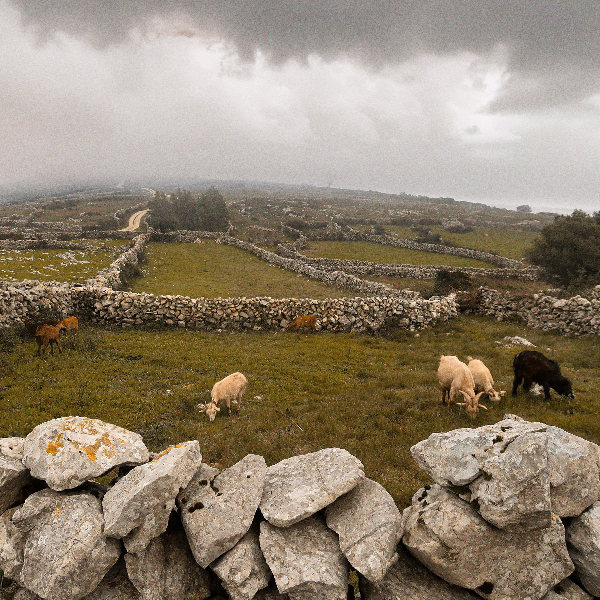
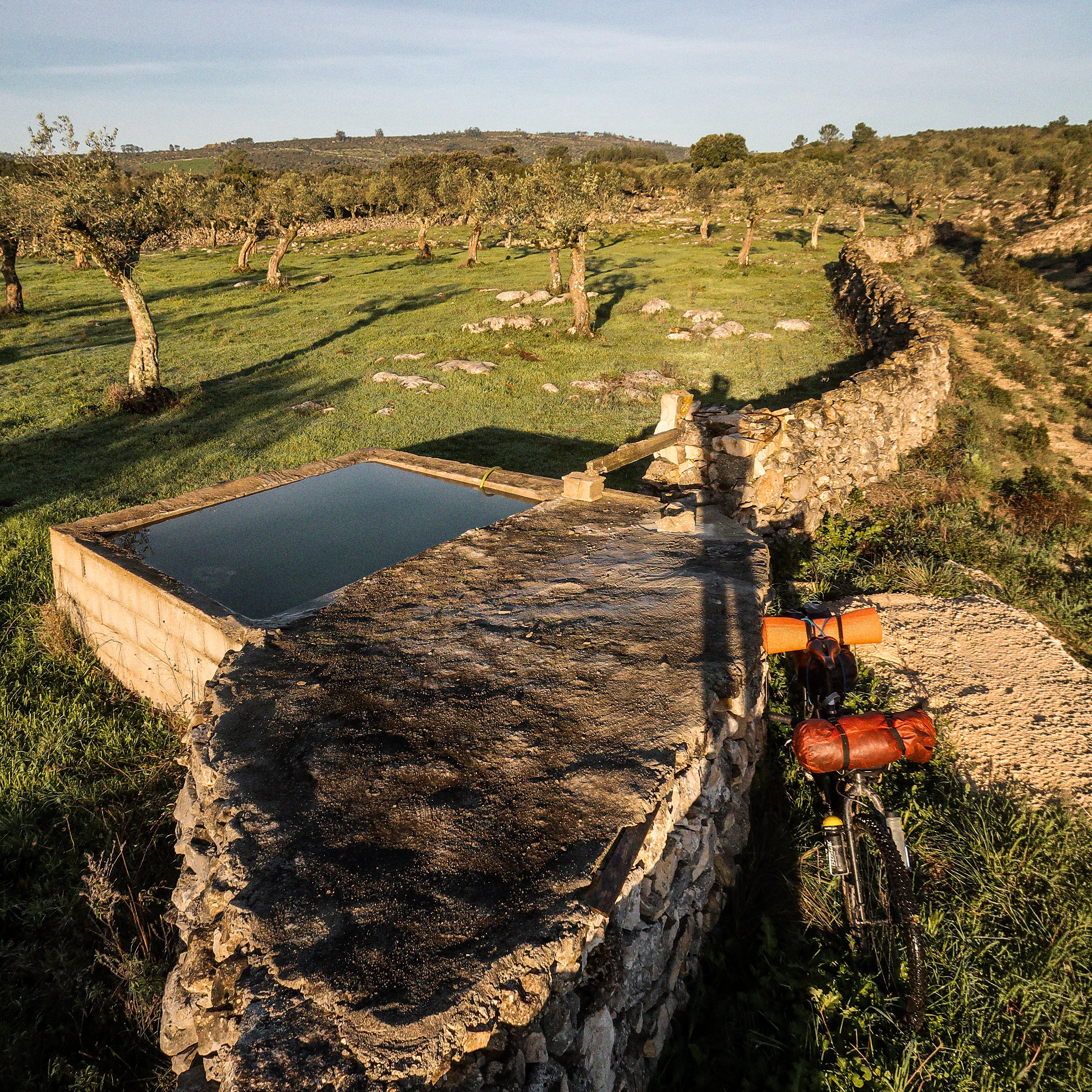
Esculturas de pedra posta. Quilómetros de muros que marcam a paisagem cársica, erguidos à mão para delimitar as antigas propriedades e libertar as terras da pedra para permitir a agricultura e a pastorícia. Na rocha nua, onde a água teima em fugir para o subsolo, açudes e engenhosos poços de pedra retêm a vida à superfície. Nesta rota, a pedra não serve apenas para separar ou reter, serve também para unir nas pontes seculares que cruzamos e que continuam a cumprir a sua função. // Sculptures of dry stone. Kilometers of walls mark the karst landscape, handcrafted to define ancient properties and clear the land of stones to allow for farming and herding. On the bare rock, where water relentlessly escapes into the underground, check dams and ingenious stone wells trap life at the surface. Along this route, stone does not just separate or retain—it also connects, through centuries-old bridges that we cross and that continue to serve their purpose.
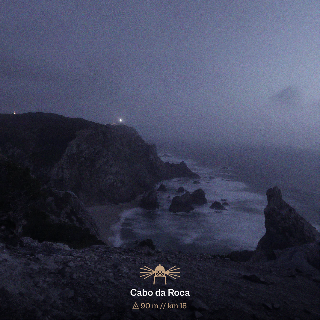
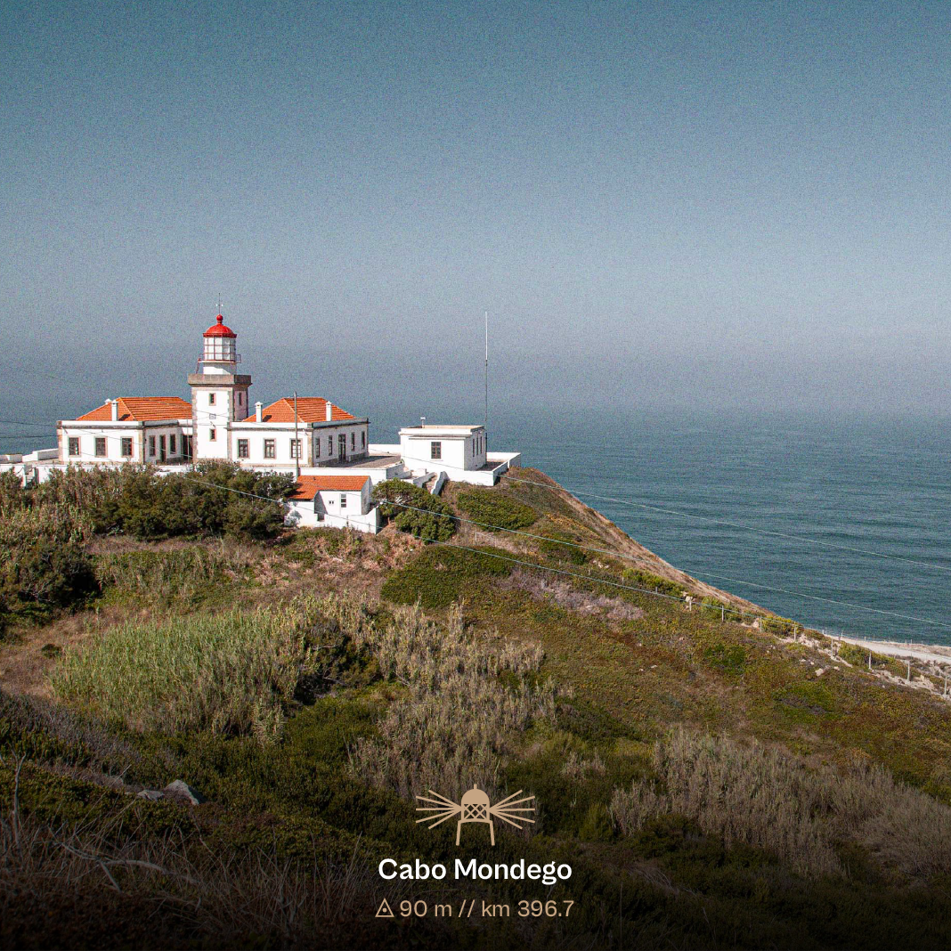
Os dois cabos que a Lapiás une. // The two capes connected by the Lapiás route.
Fotografia do Cabo Mondego // Photo at Cabo Mondego: © Fernando Romão — Wildlife Portugal
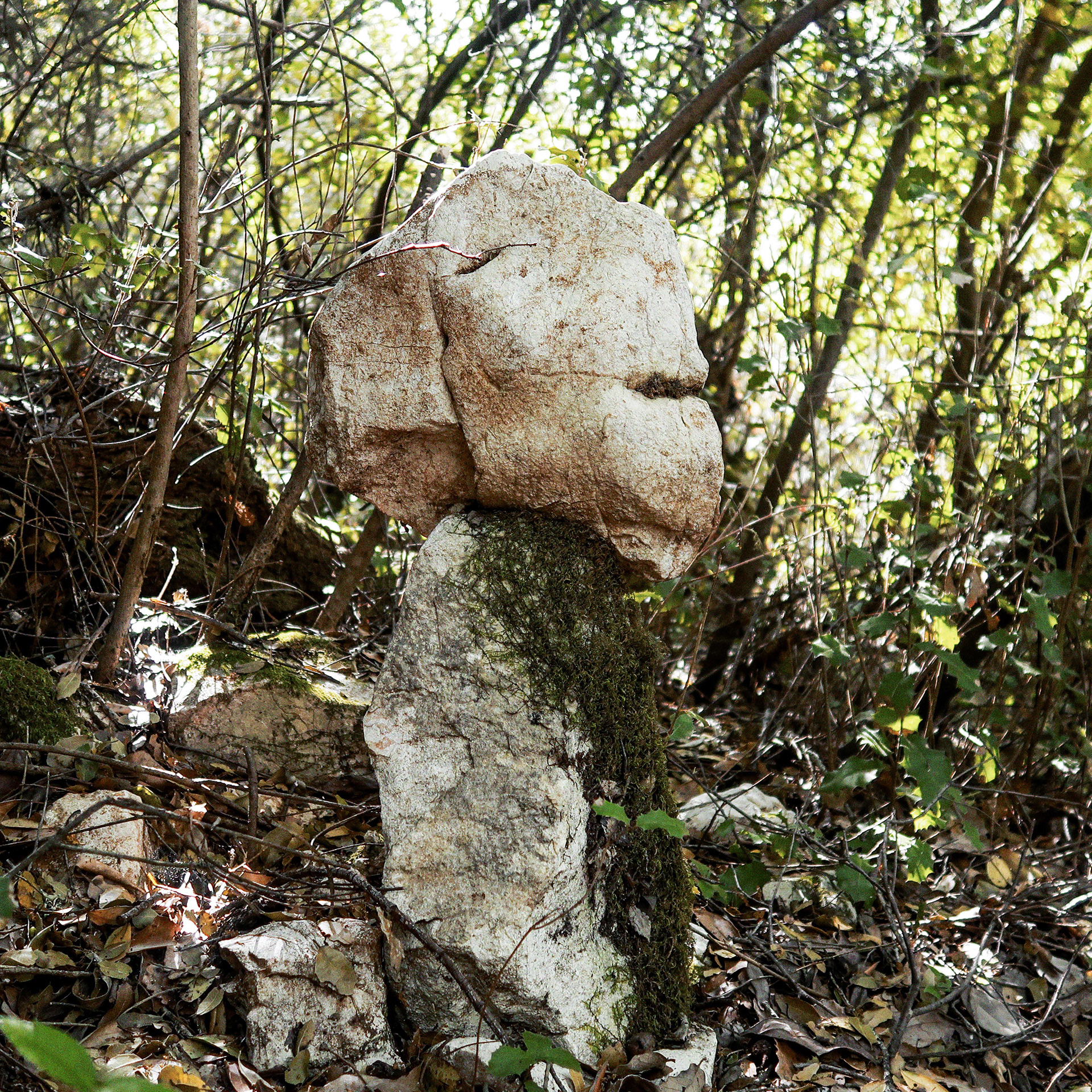
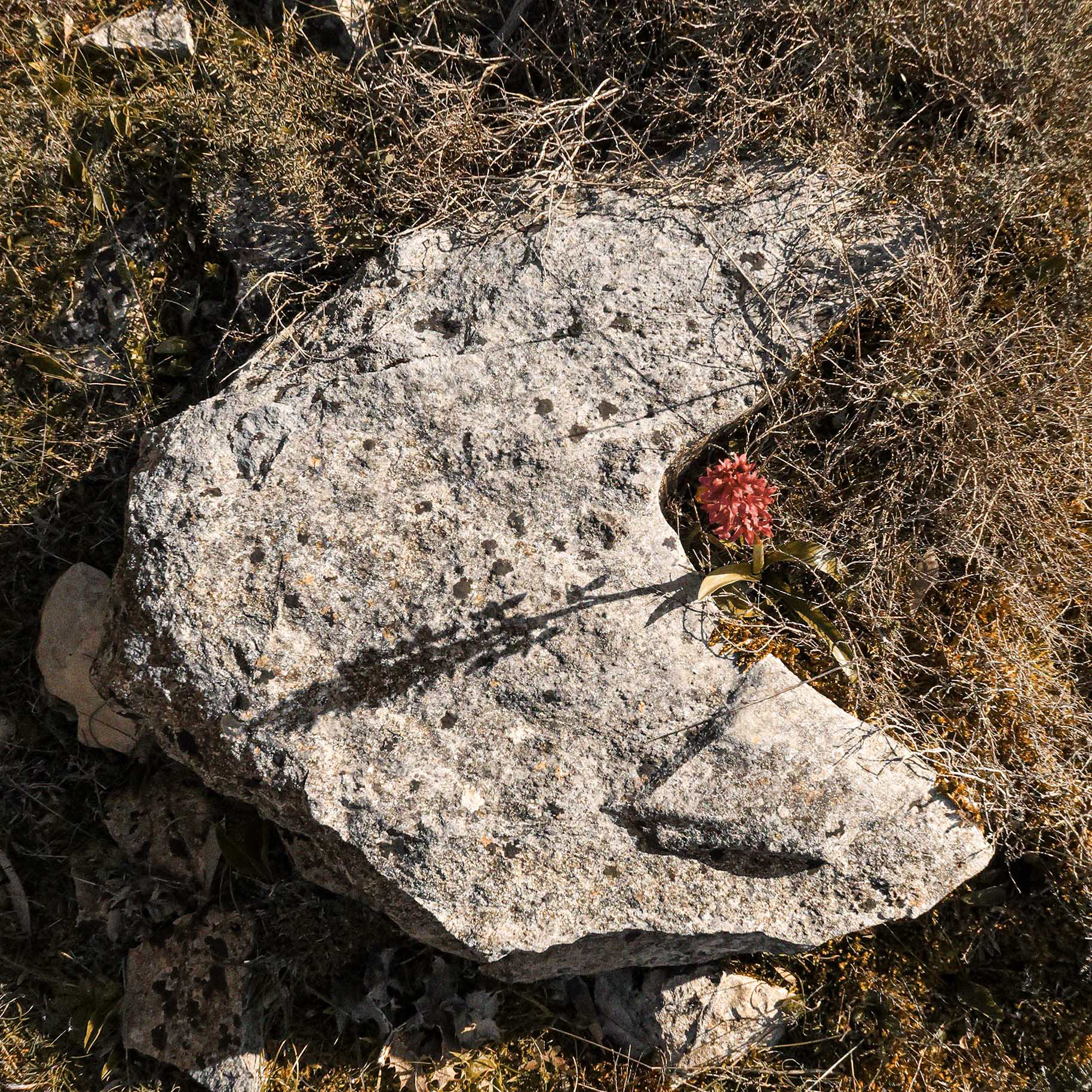
𓁿 bestas meigas // Benevolent Beasts
Ao longo da Lapiás, o ruído e os diálogos internos vão pesando na cabeça, mas o caminho surpreende-nos com as bestas meigas. Elas não estão lá para nos deitar abaixo, mas para nos fazer seguir em frente. Mesmo que as que vos apresento não vos sobressaltem a imaginação, muitas outras entidades continuam adormecidas em rochas, em plantas, em muros, em pessoas…. Fotografa, desenha, escreve, deixem uma pegada criativa na vossa viagem e partilhem comigo.
Along the Lapiás route, the noise and internal dialogues weigh heavy on your mind, but the trail surprises us with the benevolent beasts. They are not there to break you, but to keep you moving forward. Even if the ones presented to you do not spark your imagination, many other entities lie dormant in rocks, plants, stone walls, and people... Photograph, sketch, write—leave a creative footprint on your journey, and share it with me.

ZIMBRO
[ km 24 // 38.806165, -9.482878 ]
Zimbro nasceu diferente e demorou a ser aceite dentro das bestas. Não é rocha; é raiz, tronco, não tem cabeça nem corpo. Adora a diferença, é resistente e transmite este conhecimento. Está aos nossos pés e é preciso cuidado para não o pisar.
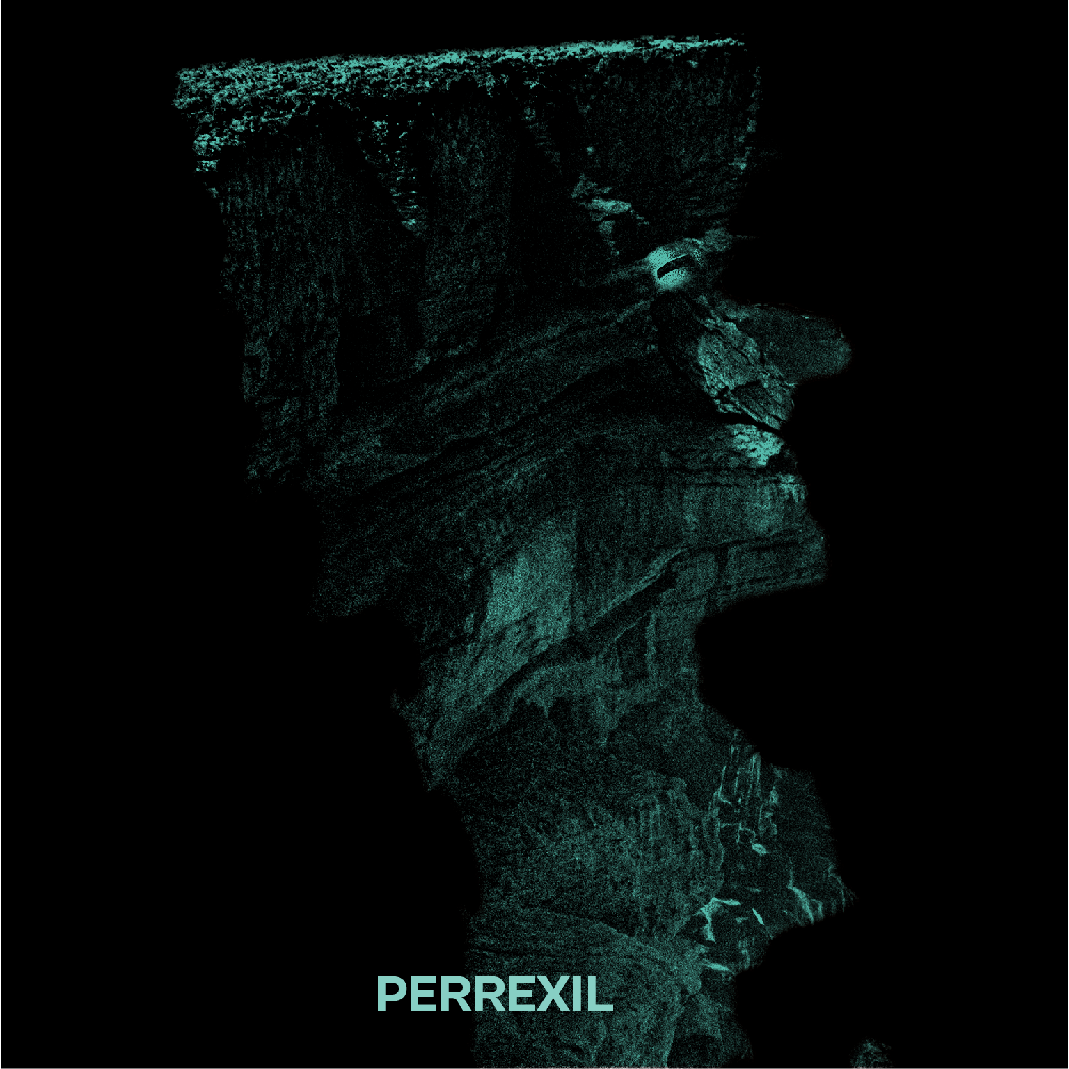
PERREXIL
[ km 28.9 // 38.834372, -9.467596 ]
Perrexil sacia-se apenas de salitre e o horizonte é o seu domínio. Entre marés colhe do oceano apenas o pulsar da rocha. Para a veres, tens de desafiar as violentas nortadas.
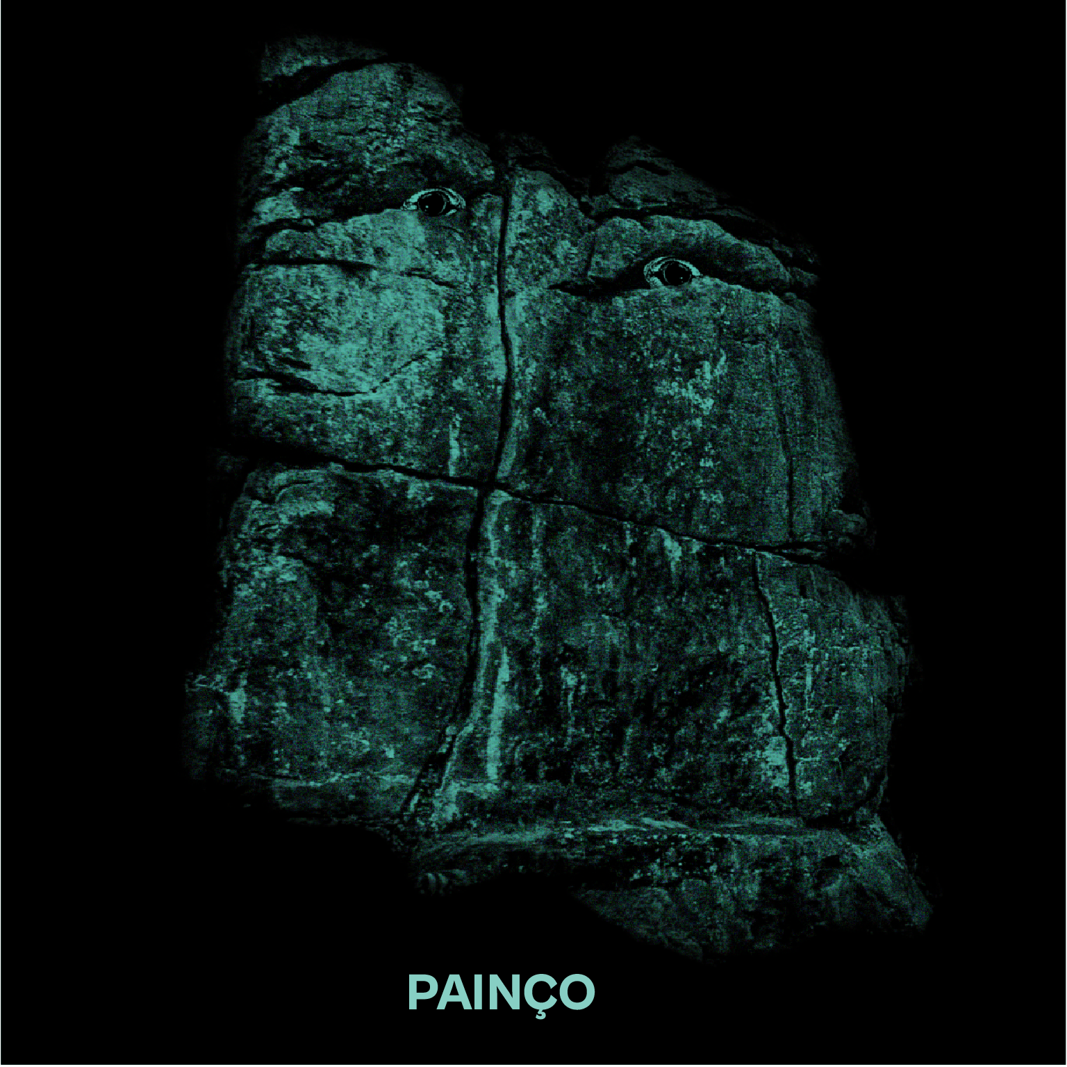
Painço
[ km 199.3 // 39.525647, -8.601050 ]
Painço é agricultor, impede que as forças se esgotem. Mesmo quando a mente nos quer parar. Surge-nos imponente. Sem descrição.
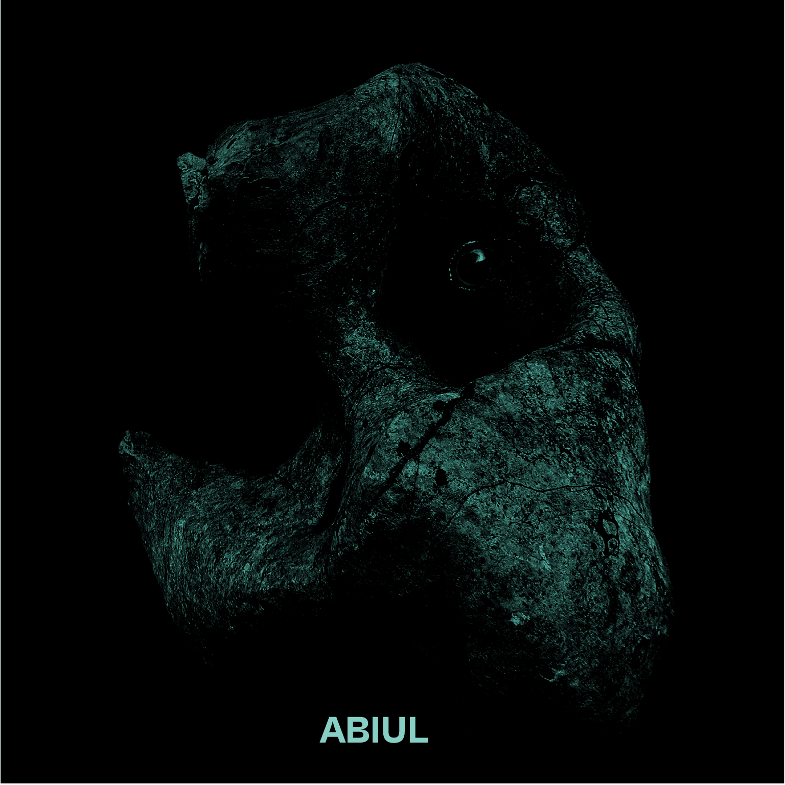
Abiul
[ km 303.4 // 39.968119, -8.555874 ]
Abiul. Pai de todas as bestas. Protetor dos seres mais frágeis. Para o encontrar, é preciso arriscar fora da rota.
ZIMBRO
[ km 24 // 38.806165, -9.482878 ]
Zimbro was born different and took time to be accepted among the beasts. He is not rock; he is root and trunk, with neither head nor body. He loves difference, is resilient, and passes on this knowledge. He is at our feet, and care must be taken not to step on him.
PERREXIL
[ km 28.9 // 38.834372, -9.467596 ]
Perrexil feeds only on saltpetre and the horizon is her domain. Between tides she harvests the ocean for the rock's heartbeat. To see her, you must brave the violent northern winds.
Painço
[ km 199.3 // 39.525647, -8.601050 ]
Painço is a farmer, preventing our strength from draining. Even when the mind wants us to stop. He stands before us, imposing. Beyond description.
Abiul
[ km 303.4 // 39.968119, -8.555874 ]
Abiul. Father of all beasts. Protector of the most fragile. To find him, you must risk going off route.
SERRA DE SINTRA, cabo da roca e COSTA ATLÂNTICA // Sintra Mountains, cabo da roca and Atlantic Coast
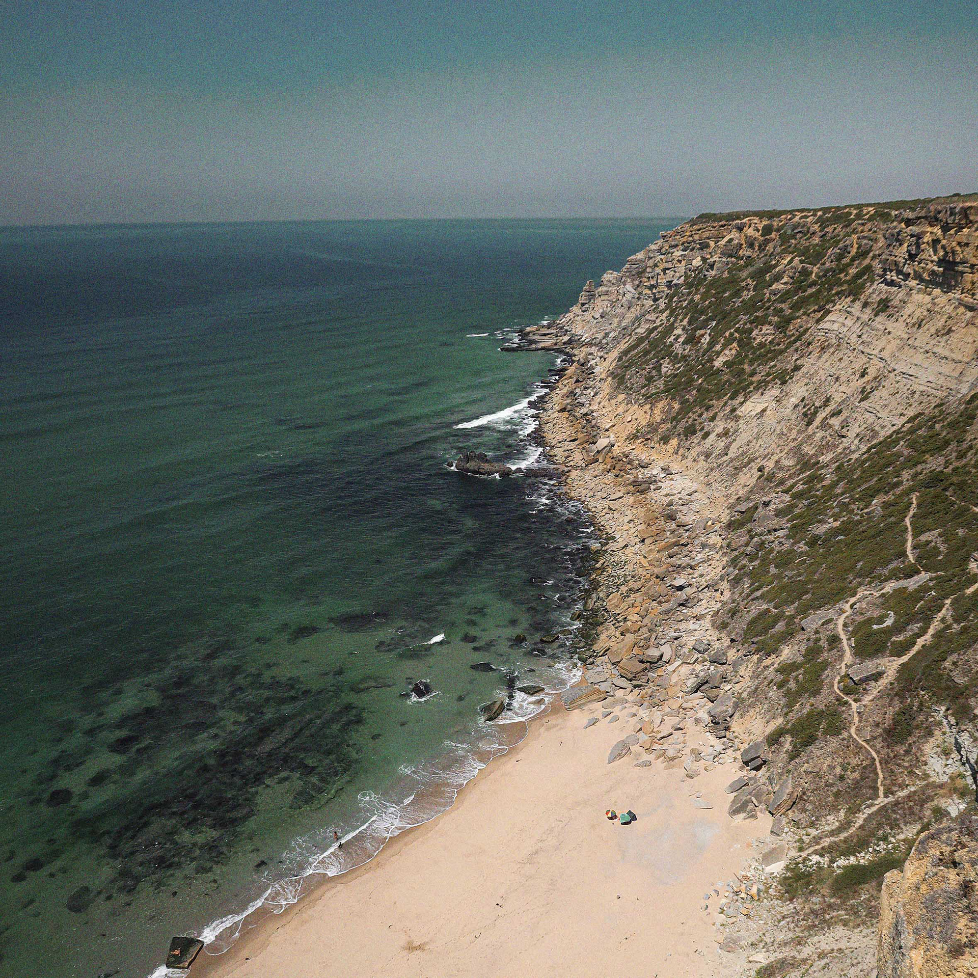
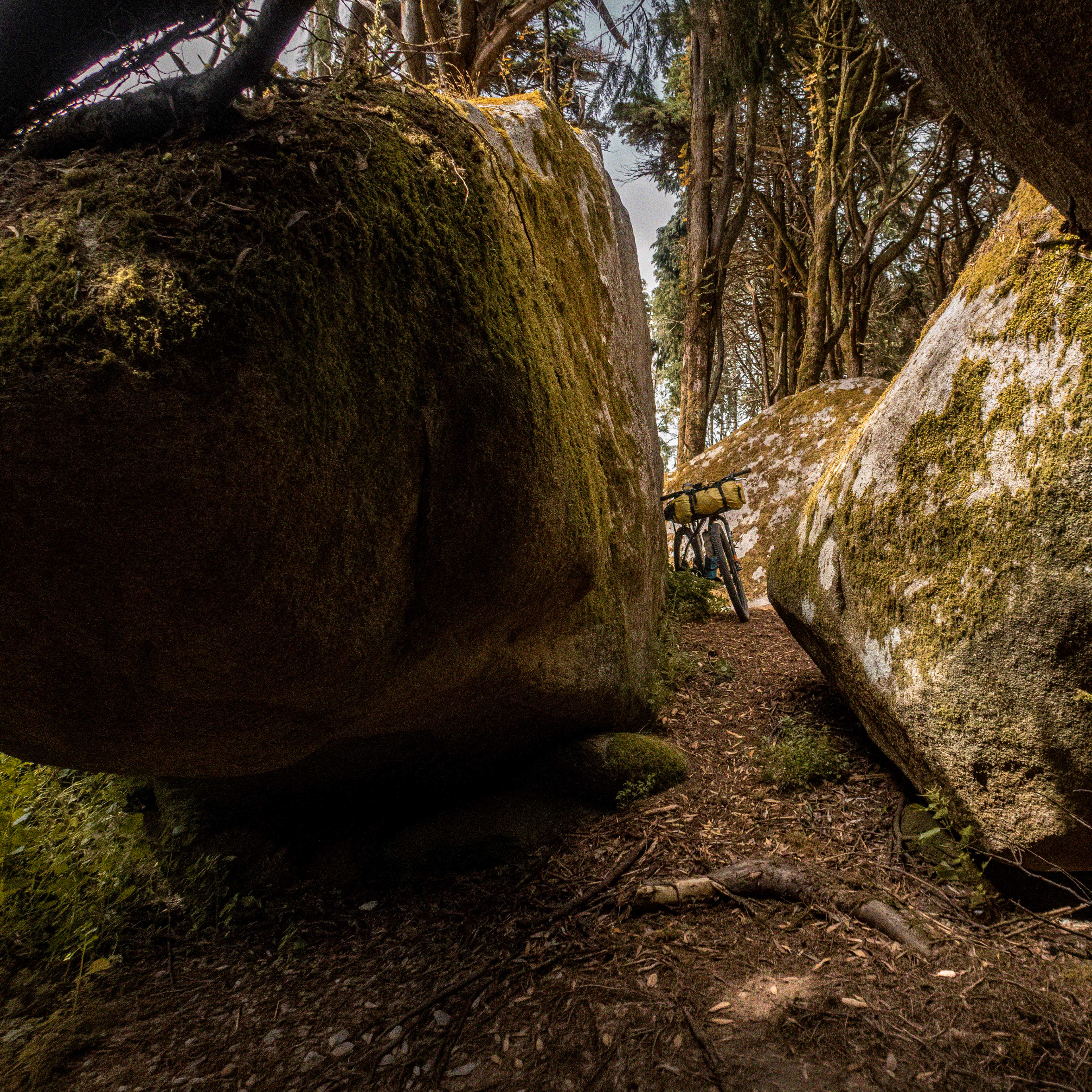
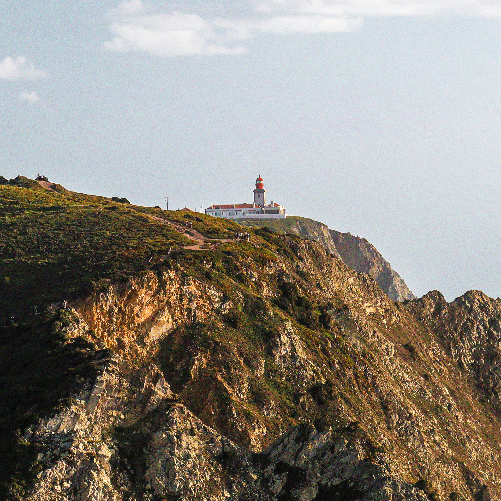
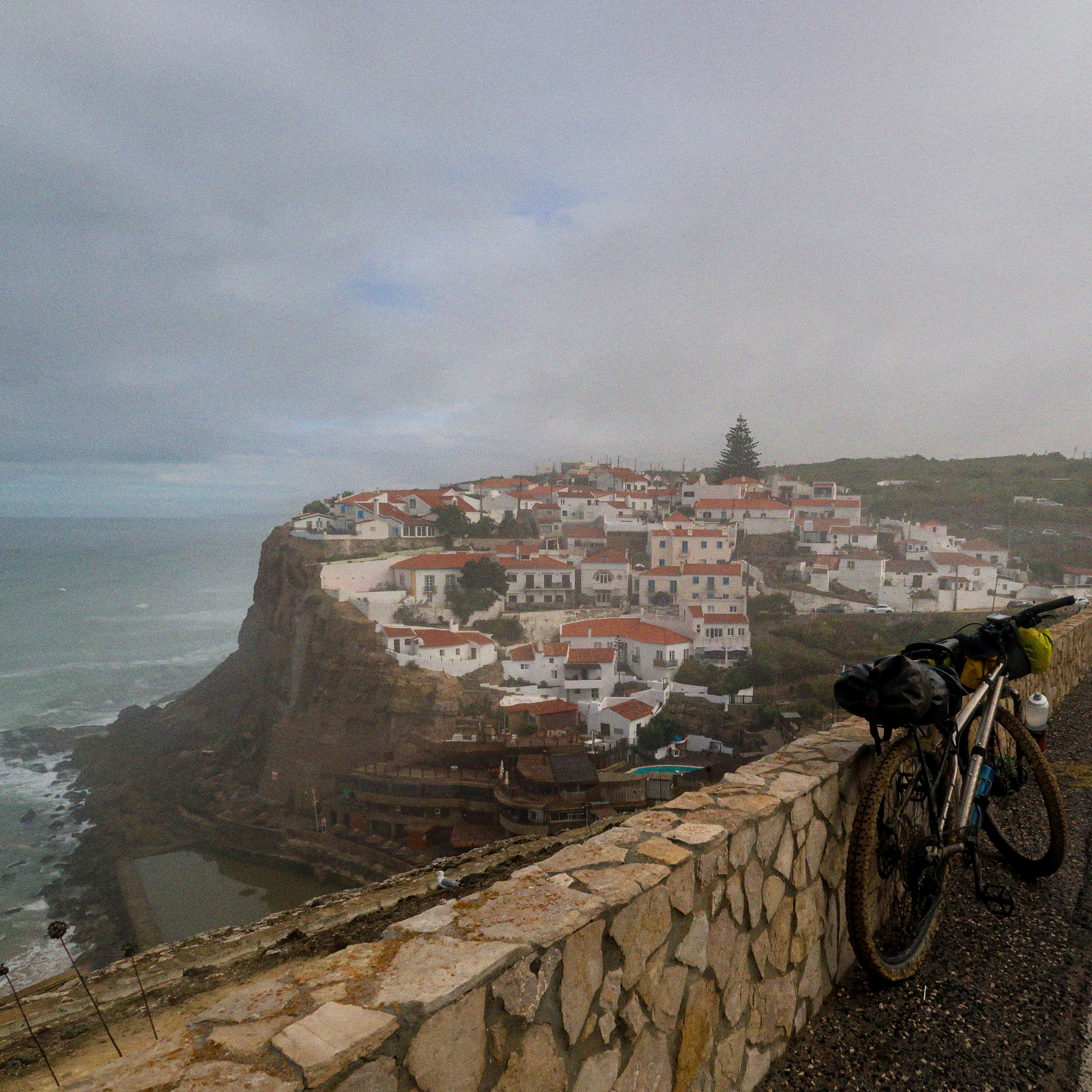
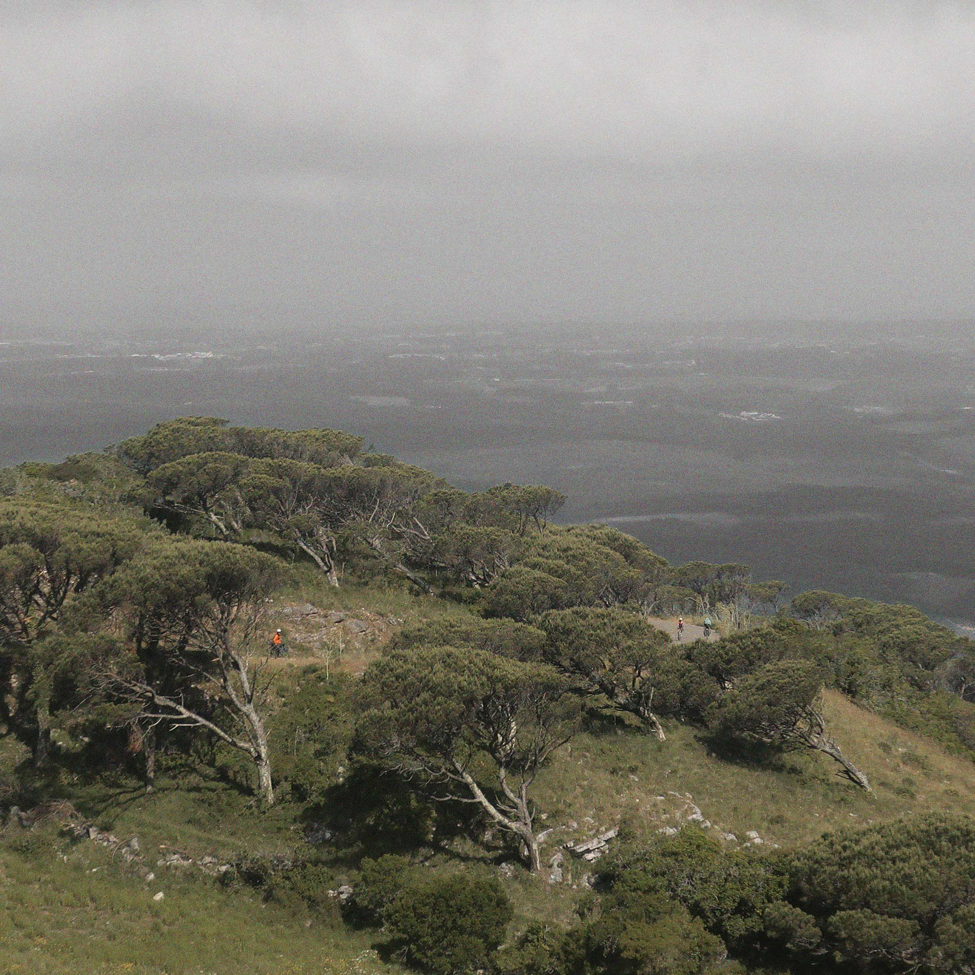
Para alcançar o Cabo da Roca, o nosso ponto de partida ideal foi a mítica vila de Sintra. O desafio começou logo com uma subida imponente. Antes de avançar para o topo, demos dois dedos de conversa com os praticantes de boulder que desafiavam os blocos de granito da serra — formações únicas em toda a viagem. Logo a seguir, fomos recompensados no topo da Peninha por uma vista brutal. Dali, o horizonte estende-se por toda a Península de Setúbal e pela costa sul de Portugal. Após a descida e de cruzar a Azóia, é no Cabo da Roca — o ponto mais ocidental da Europa Continental e onde se inícia a longa travessia europeia de bicicleta no Eixo Oeste-Este que termina em Ufa / Vladivostok (Rússia) — que a verdadeira aventura ganha vida, inaugurando os primeiros desafios técnicos ao longo da costa oeste. Aqui, a rota faz jus ao nome, com alguns dos campos de lapiás costeiros mais importantes do país.
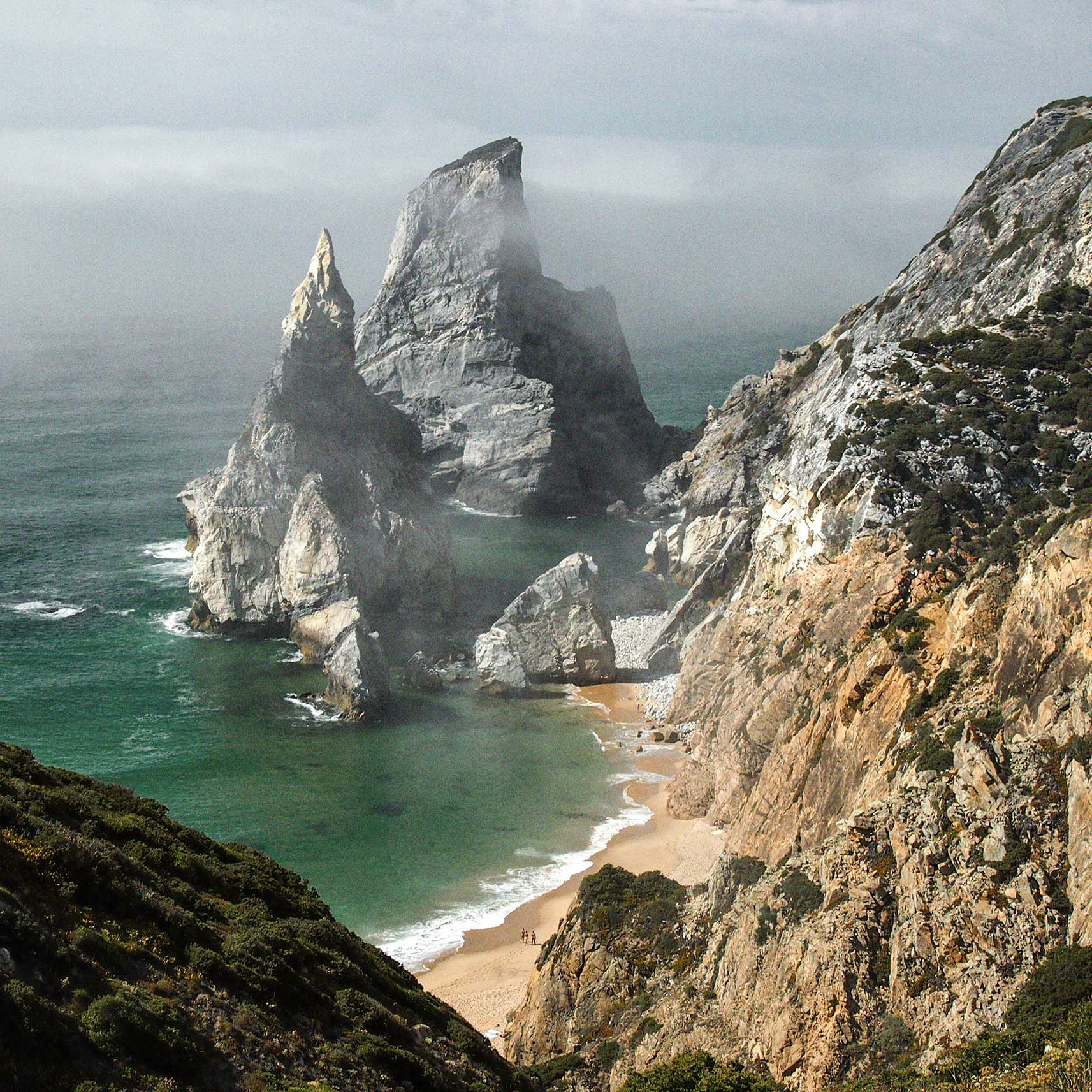
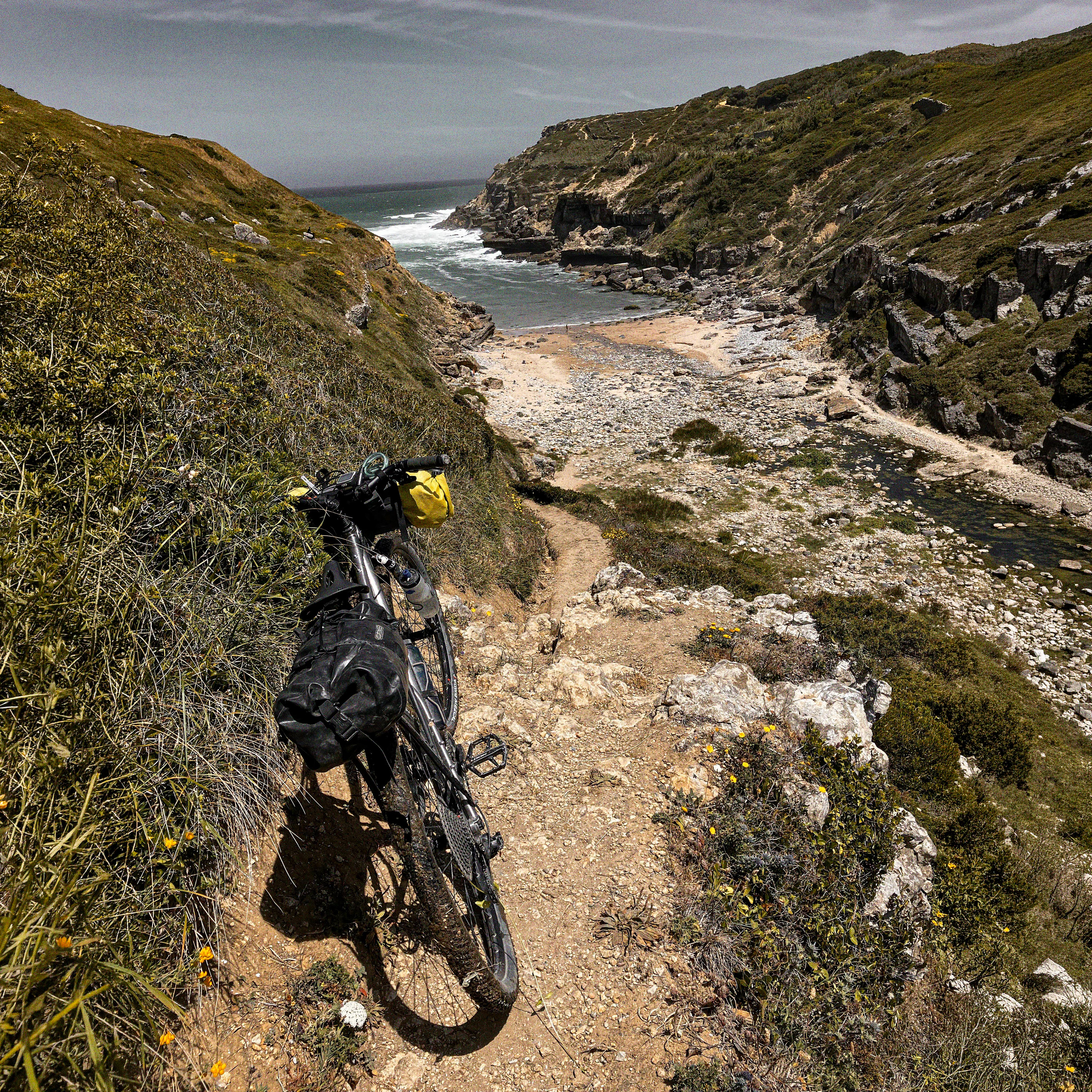
Antes ainda de dar início aos trilhos nas falésias da costa oeste, embora fora do trilho principal, a quase inacessível Praia da Ursa exigiu-nos um desvio, seja para a admirar do topo ou para os mais audazes que poderão descer para um bivaque à sombra dos seus grandes rochedos de calcário, onde o cenário é impressionante.
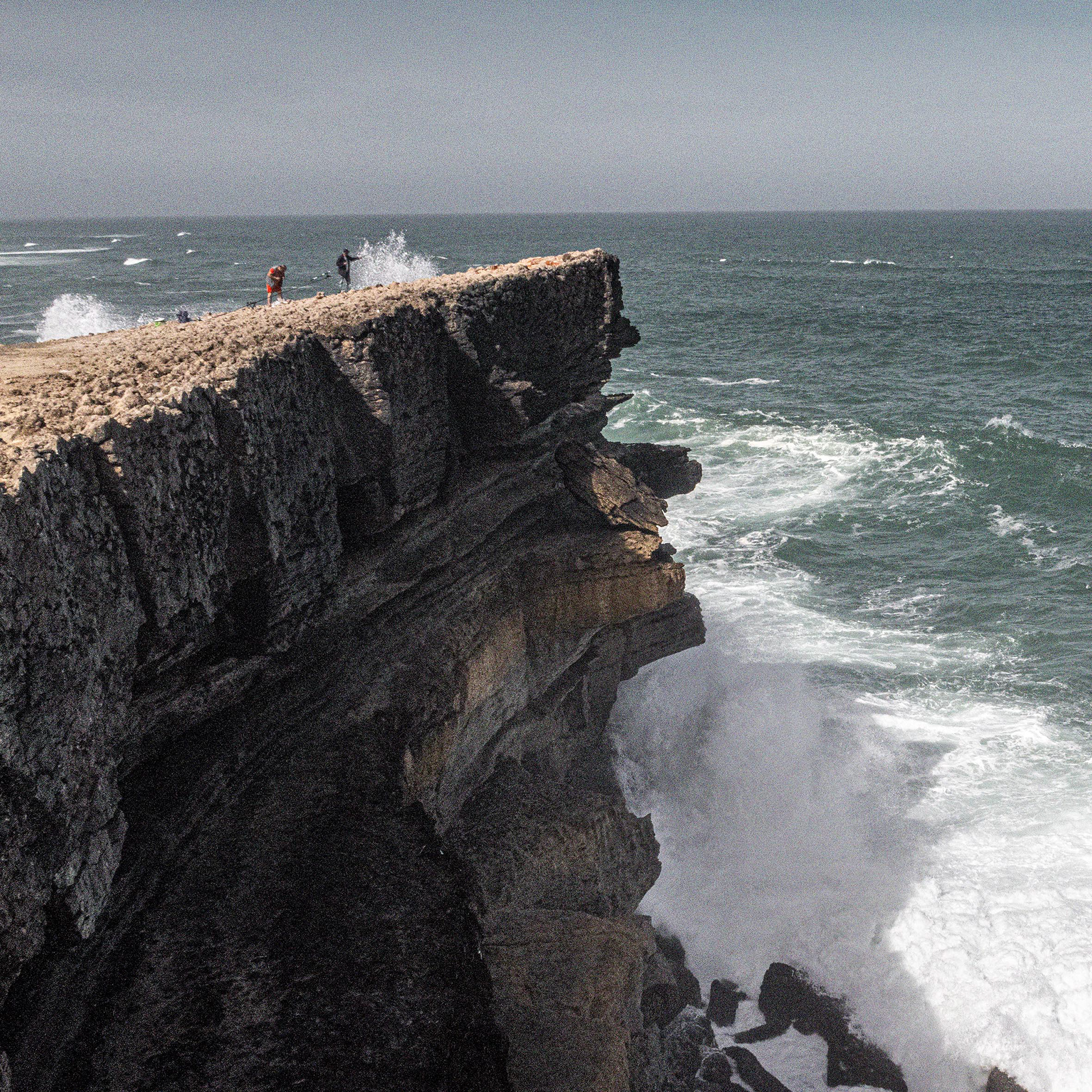
De volta ao traçado, pedalámos literalmente ao longo das falésias. Sentimos o isolamento a ser quebrado apenas por um pescador solitário empoleirado no abismo e por um casal a fazer BTT que nos acenou ao passar nas arribas.
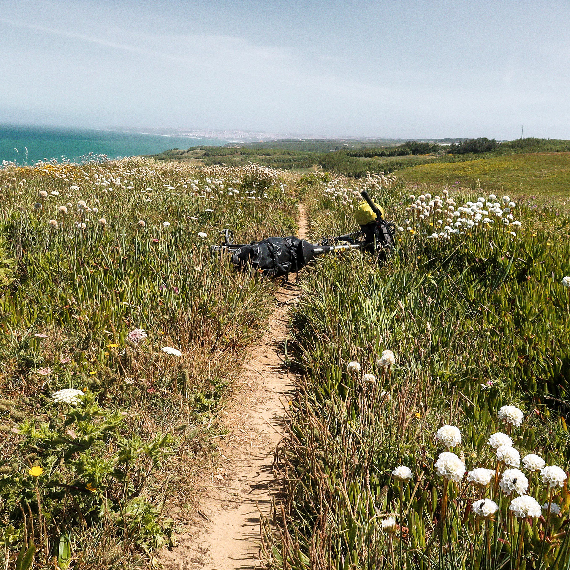
Destaca-se a histórica parede calcária que guarda, na sua face vertical virada ao mar, pegadas fossilizadas de dinossauros com mais de 100 milhões de anos. A partir daqui, o oceano acompanhou-nos com horizontes atlânticos soberbos até à Ericeira, Reserva Mundial de Surf.
Este esforço inicial pediu uma paragem merecida na esplanada da praia de S. Julião, saboreando uma cerveja fresca com o mar em fundo.
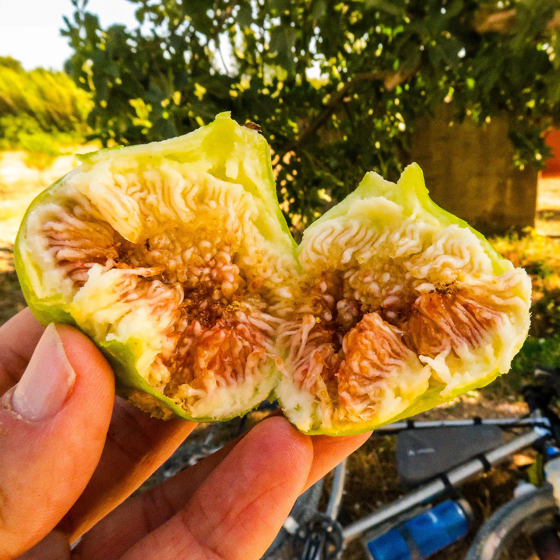
Logo após a Foz do Lisandro, a aproximação a Mafra fez-se por um vale tranquilo onde, em agosto, se podem colher e comer as amoras, os frutos silvestres mais comuns em Portugal. Foi aqui que tivemos o primeiro vislumbre real do que seria o percurso. O trilho despediu-se do mar, trocando a brisa pelo interior e rumando ao colosso geológico do Maciço Calcário Estremenho.
To reach Cabo da Roca, our ideal starting point was the legendary town of Sintra. The challenge began immediately with an imposing climb. Before pushing on towards the summit, we stopped for a brief chat with the boulderers tackling the granite blocks of the mountain—formations that would remain unique throughout the entire journey. Shortly after, we were rewarded at the top of Peninha by a brutal view. From here, the horizon stretches across the Setúbal Peninsula and along Portugal’s southern coastline. After the descent and crossing Azóia, it is at Cabo da Roca — the westernmost point of Continental Europe and the starting point of the long West-East European cycling crossing, which ends in Ufa / Vladivostok (Russia) — that the true adventure comes to life, opening the first technical challenges along the west coast. Here, the route lives up to its name, with some of the most important coastal karren fields in the country.
Even before starting the trails along the west coast cliffs, although outside the main route, the nearly inaccessible Praia da Ursa demanded a detour, whether to admire it from the top or for the more daring who might descend for a bivouac in the shade of its large limestone rocks, where the scenery is impressive.
Back on track, we pedalled literally along the cliffs. We felt the isolation broken only by a solitary fisherman perched on the abyss and a mountain biking couple who waved as they passed on the cliffs.
A highlight is the historic limestone wall that preserves, on its vertical face facing the sea, fossilised dinosaur footprints more than 100 million years old. From here, the ocean accompanied us with superb Atlantic horizons all the way to Ericeira, a World Surfing Reserve.
This initial effort called for a well-deserved stop at the terrace of S. Julião beach, enjoying a cold beer with the sea in the background.
Right after Foz do Lisandro, the approach to Mafra took place through a peaceful valley where, in August, you can pick and eat blackberries, the most common wild berries in Portugal. It was here that we had our first real glimpse of what the route would be. The trail said goodbye to the sea, trading the breeze for the interior and heading towards the geological colossus of the Estremenho Limestone Massif.
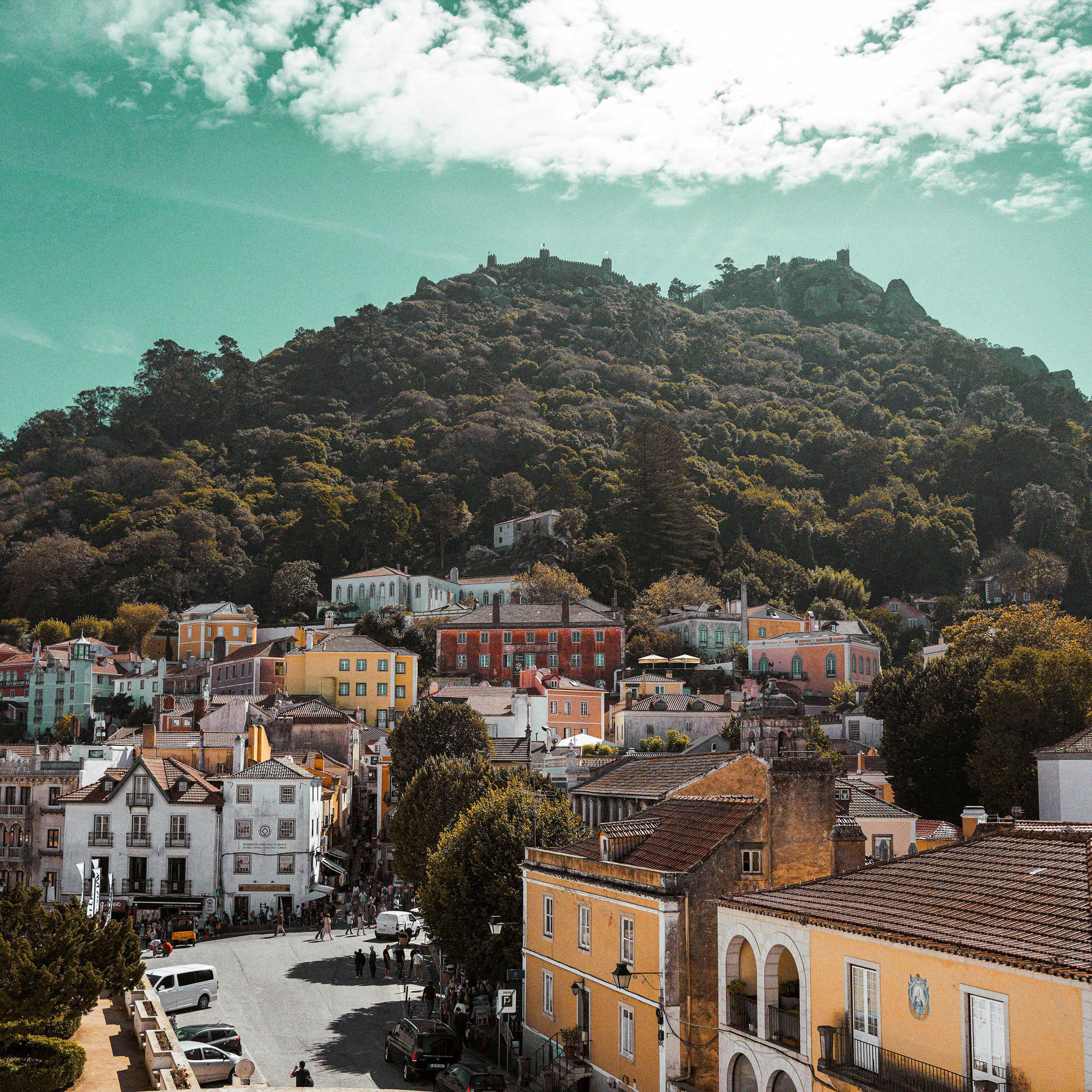
Sintra // © Yomex Owo
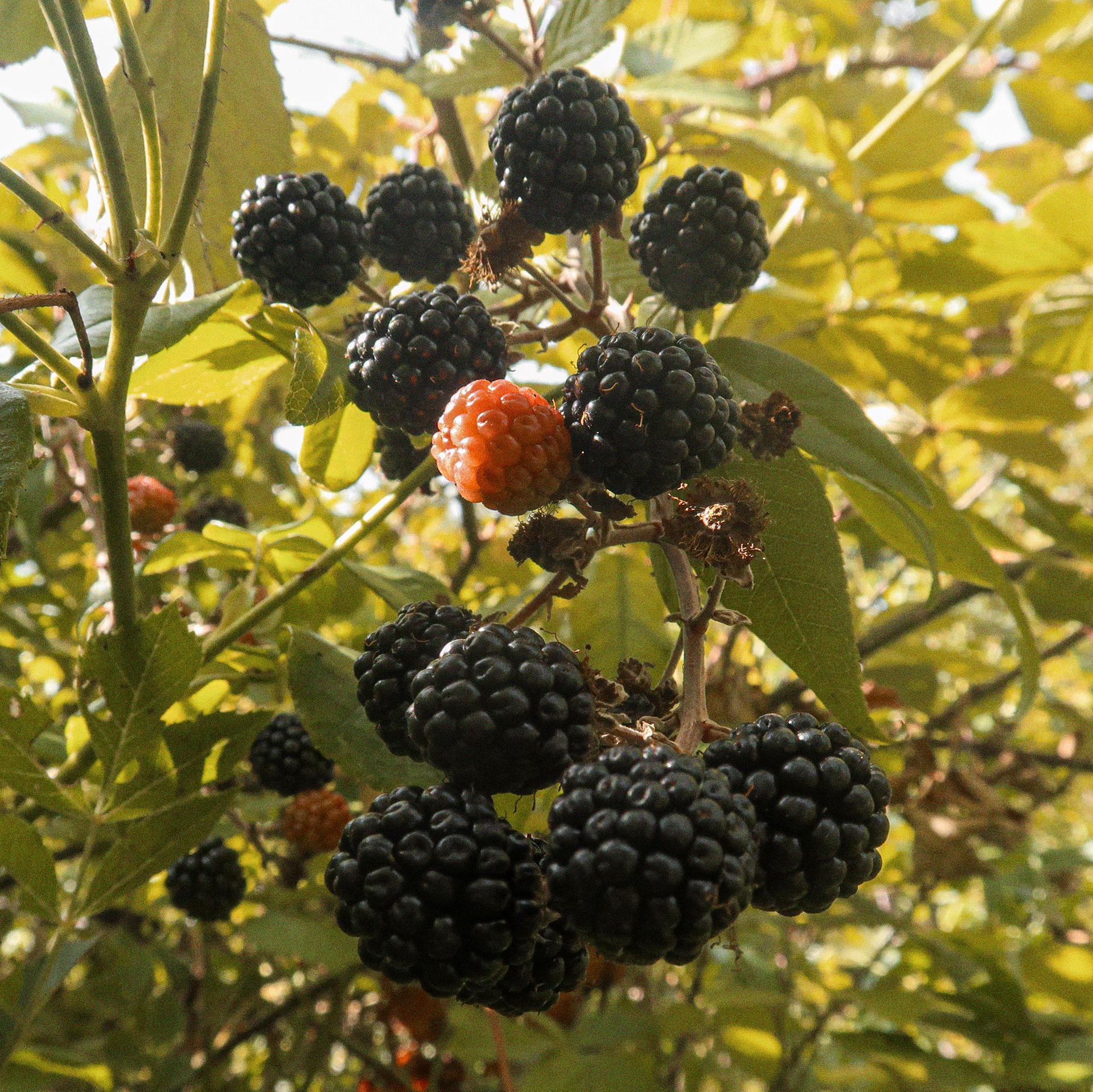
Amoras — Fruto silvestre comestível // Blackberries — Edible wild fruit (Rubus fruticosus)
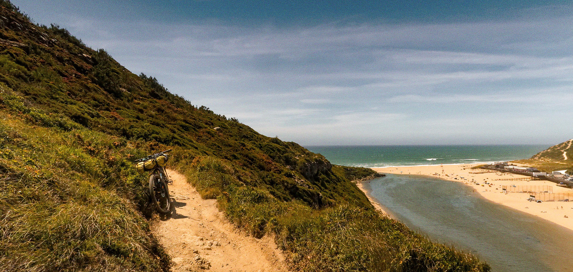
Oeste e serra de montejunto // West Region and the Montejunto Mountains
A vila de Mafra assinalou o início de uma etapa que nos conduziria ao teto desta rota. Parámos ainda nas Vizinhas, mesmo de frente para o convento onde comprámos pão artesanal e tomámos o pequeno almoço. Antes de voltar aos trilhos, ainda tivemos tempo para uma paragem cultural e visitar o Museu Nacional da Música, instalado no Palácio Nacional de Mafra.
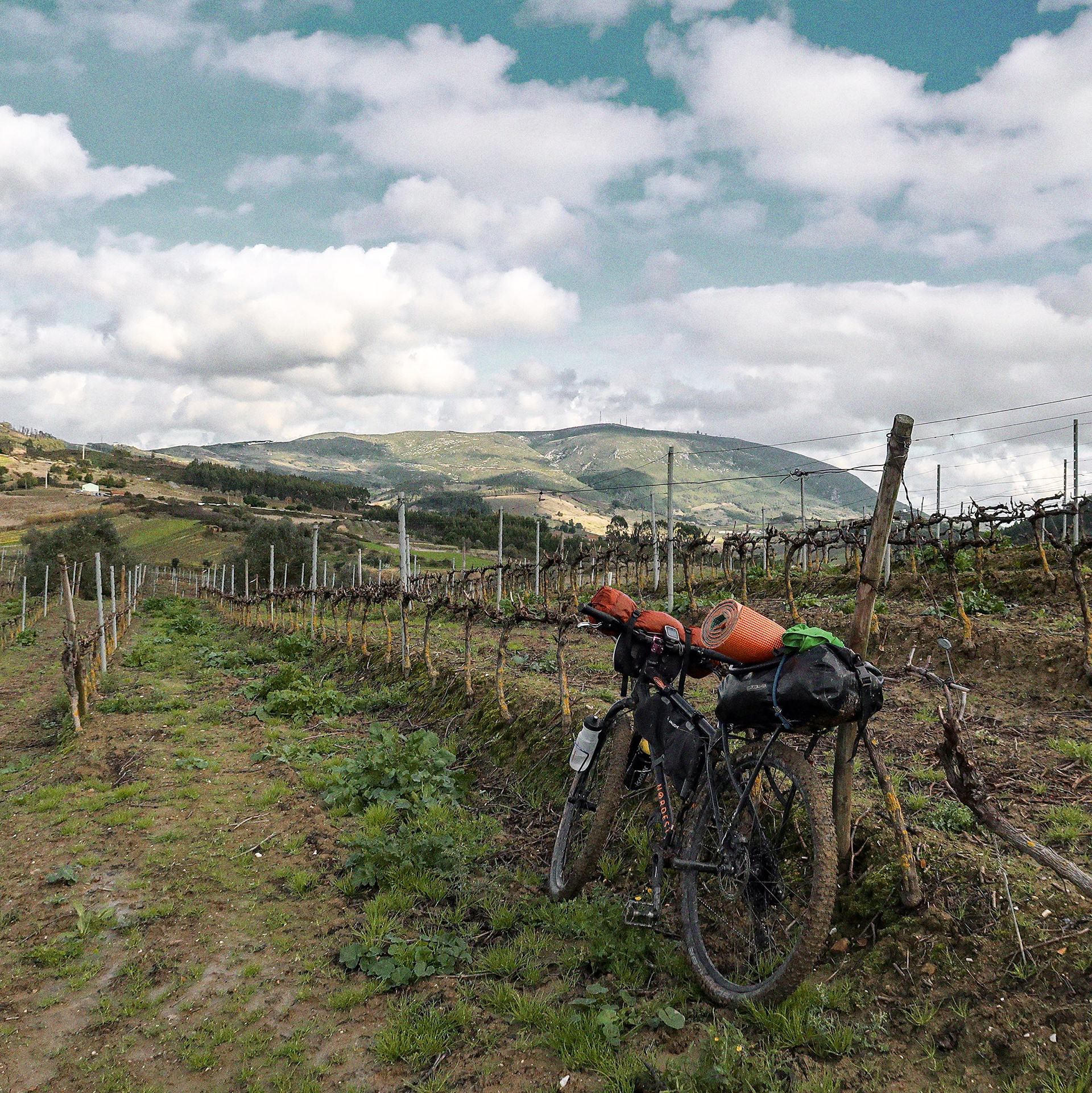
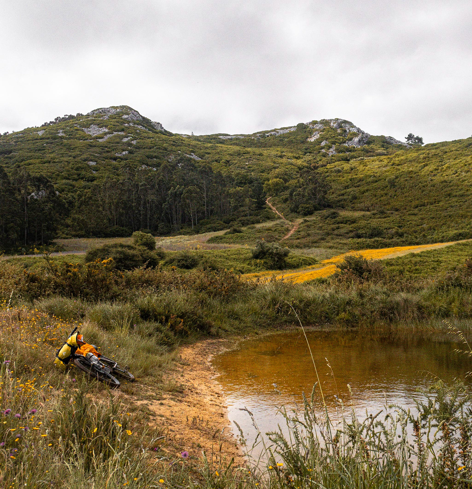
Neste dia serpenteámos por campos agrícolas divididos entre vinhas e pomares de pêra-rocha. Ao alcançar as Serras do Socorro e da Archeira, as subidas curtas e desafiantes quebraram qualquer monotonia. No Centro Interpretativo destas serras, conhecemos um pouco melhor esta zona protegida; o local conta ainda com uma oportuna torneira exterior onde reabastecemos de água. Ao longo das várias aldeias do percurso, não faltaram oportunidades para provar o vinho produzido localmente.
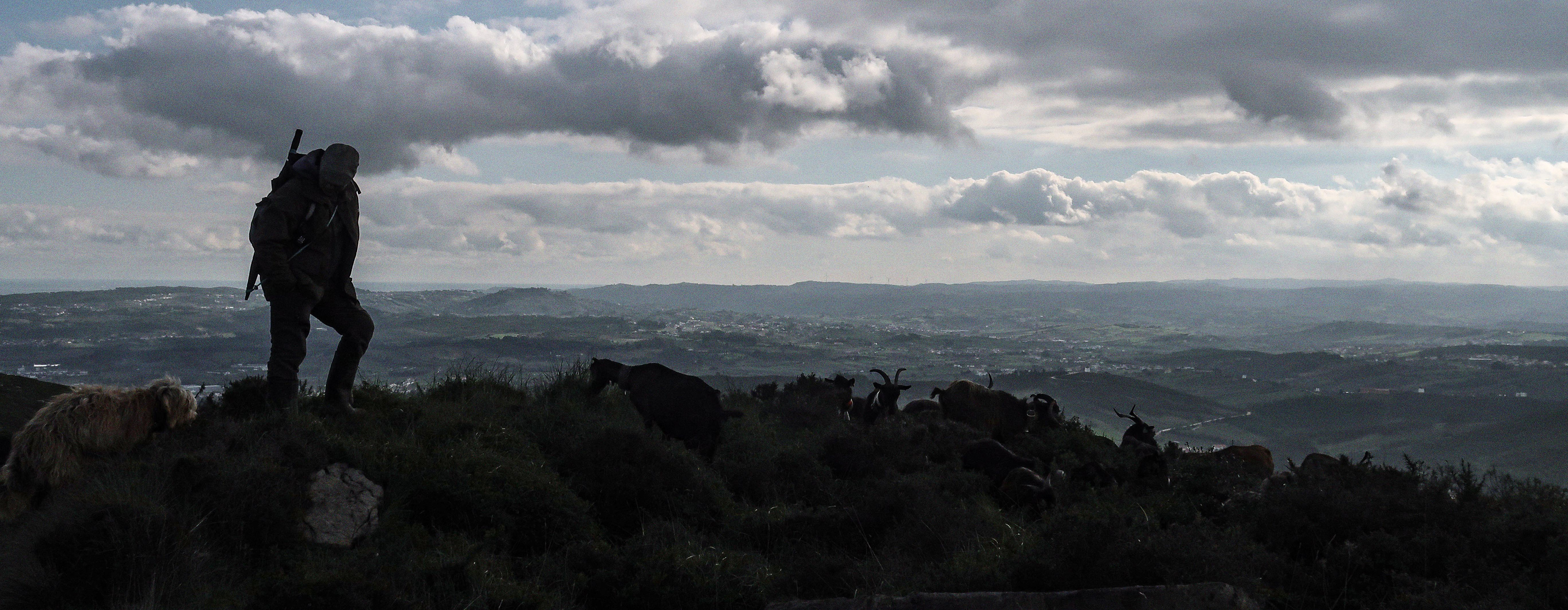
O grande desafio geológico aproximava-se: a Serra de Montejunto. Antes do ataque ao cume reforçámos o jantar num supermercado local em Vila Verde dos Francos e trocámos dois dedos de coversa com quem se apressava para voltar ao trabalho da tarde. Já nas encostas da serra, cruzámo-nos com um pastor que nos apresentou algumas das suas cabras que por aqui andam diariamente — o pretexto ideal para recuperar o fôlego. Por aqui ainda é comum observar rebanhos a serem pastoreados exatamente da mesma forma que há dezenas anos. Por ser uma subida de referência na região, com alguma sorte cruzámos-nos com ciclistas profissionais do World Tour em pleno treino, parecia o João Almeida, mas ia demasiado rápido.
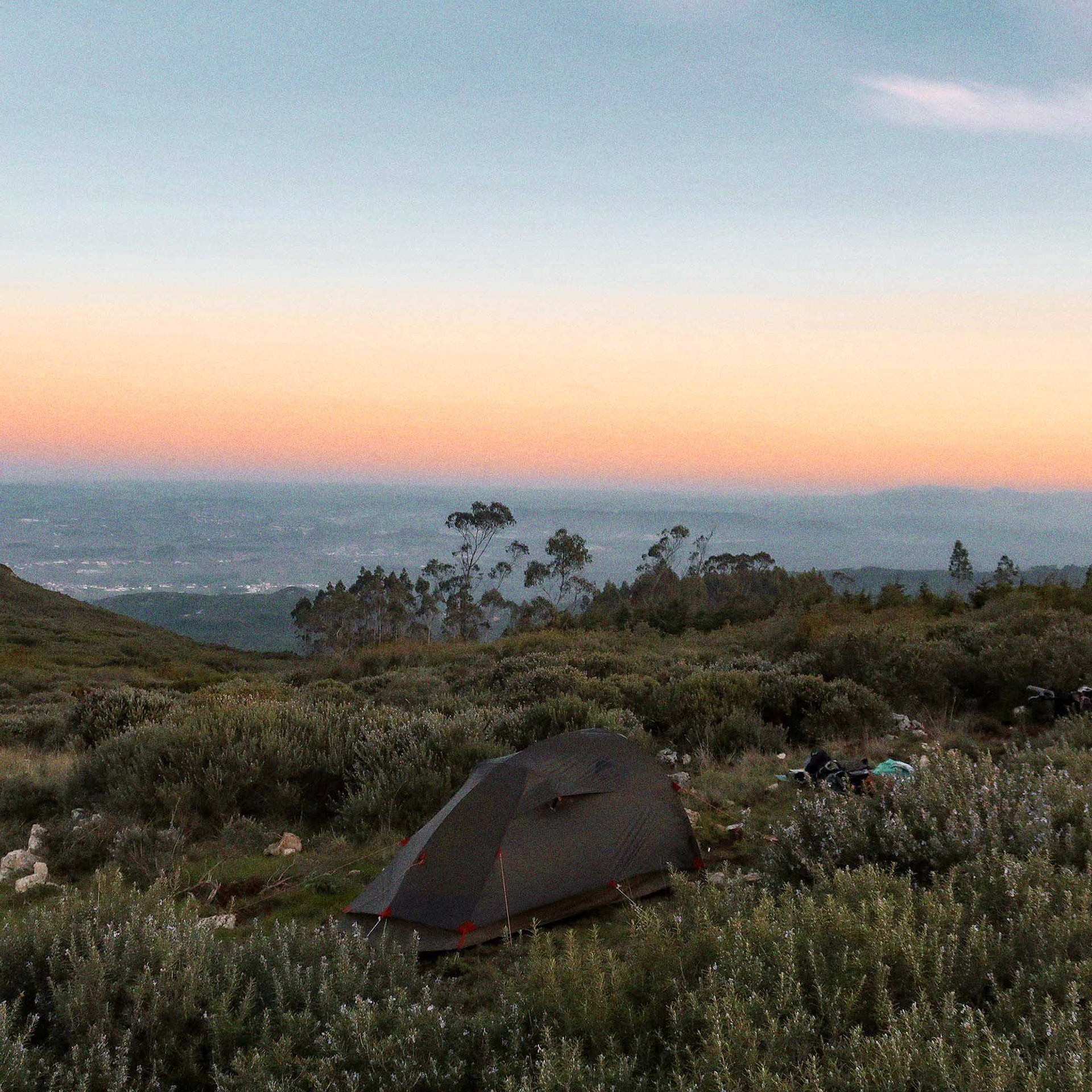
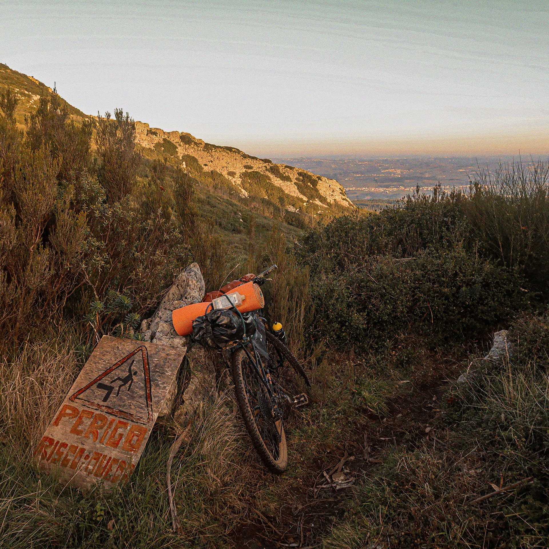
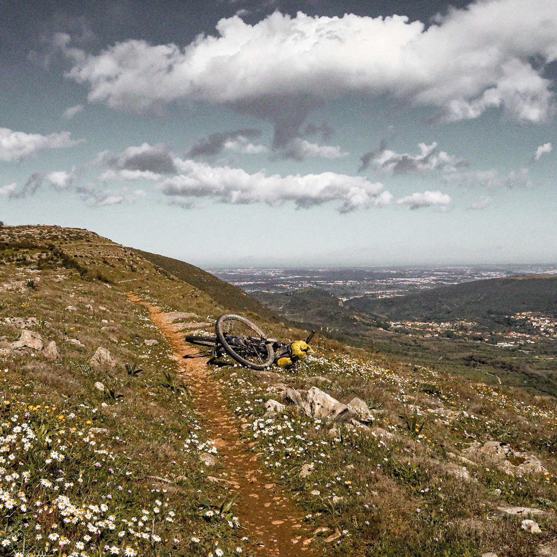
De seguida, enfrentámos a subida ao cume. Conquistar o topo foi alcançar o ponto mais alto da aventura. Sob um céu limpo, o esforço foi recompensado com uma vista panorâmica incrível: para trás observámos o caminho já superado; para a frente avistava-se a silhueta distante da Serra do Sicó. Iniciámos então a descida em direção ao parque de merendas para um merecido descanso. Só depois, já na vertente norte, montámos as nossas tendas para passar a noite.
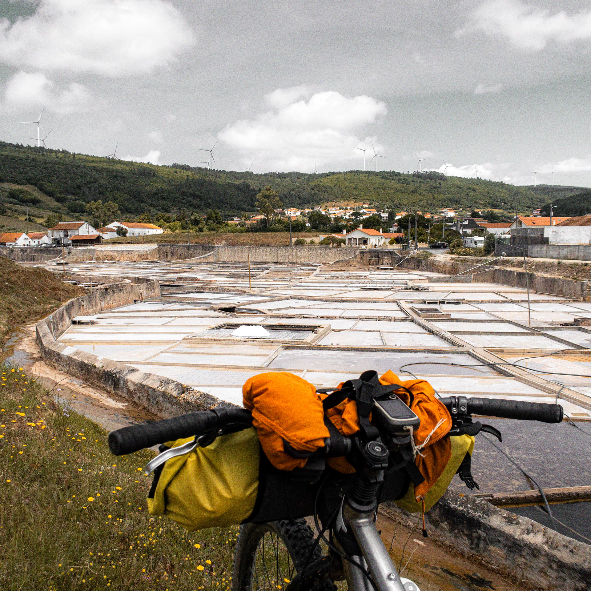
A despedida final da montanha fez-se através de uma descida técnica em singletrack, que deu lugar à travessia de uma antiga calçada romana e ao contacto direto com o restante desta área protegida. Só depois é que o traçado seguiu na direcção das singulares Salinas de Rio Maior, situadas na base da Serra de Candeeiros, onde aproveitámos para petiscar.
The town of Mafra marked the beginning of a stage that would lead us to the highest point of the entire route.We made an early stop in Vizinhas, directly opposite the monastery, where we bought artisan bread and enjoyed breakfast. Before returning to the trails, there was still time for a cultural detour and a visit to the Museu Nacional da Música, now housed within the Palácio Nacional de Mafra.
Throughout the day, we wound our way through agricultural landscapes dominated by vineyards and Rocha pear orchards. Upon reaching the Serra do Socorro and Serra da Archeira, a succession of short but demanding climbs quickly dispelled any sense of monotony. At the mountains' Interpretation Centre, we learned more about this protected area and took advantage of the conveniently placed outdoor water tap to refill our bottles.The villages along the route offered plenty of opportunities to sample locally produced wines.
Meanwhile, the day's great geological landmark was drawing ever closer: the Serra de Montejunto. Before making our assault on the summit, we stocked up on supplies at a local supermarket in Vila Verde dos Francos and exchanged a few words with residents hurrying back to their afternoon work. Already on the mountain slopes, we met a shepherd who introduced us to some of the goats he tends here every day — the perfect excuse to catch our breath. In this region, it is still common to see flocks being managed much as they were decades ago. As one of the area's benchmark cycling climbs, Montejunto occasionally attracts professional riders. With a bit of luck, you might even spot WorldTour cyclists training on its roads. One rider looked remarkably like João Almeida, although he was moving far too quickly for us to be certain.
The summit climb came next. Reaching the top meant standing at the highest point of the entire adventure. Under clear skies, the effort was rewarded with extraordinary panoramic views. Looking back, we could trace the ground already covered; looking ahead, the distant silhouette of the Serra de Sicó appeared on the horizon.From there, we began the descent towards a picnic area for a well-earned break. Only later, on the mountain's northern flank, did we bivouac and settle in for the night.
Our final farewell to Montejunto came via a technical singletrack descent, followed by the crossing of an ancient Roman road and a deeper immersion into the remainder of this protected landscape. Only then did the route turn towards the unique Salt Pans of Rio Maior, located at the foot of the Serra de Candeeiros, where we stopped to enjoy a few local snacks before continuing our journey.
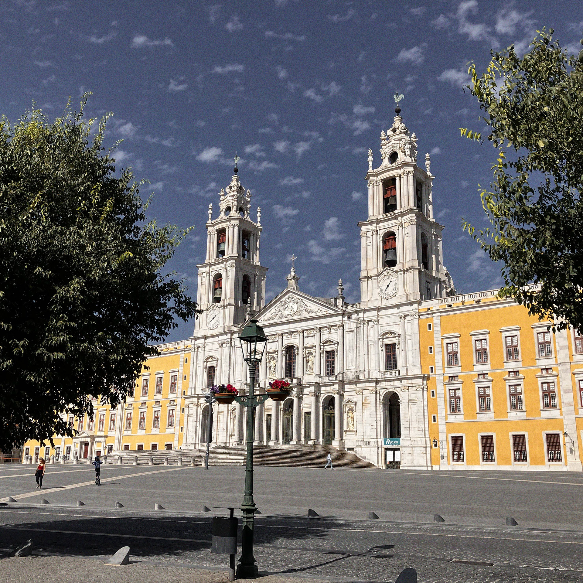
Mafra National Palace, a UNESCO World Heritage Site
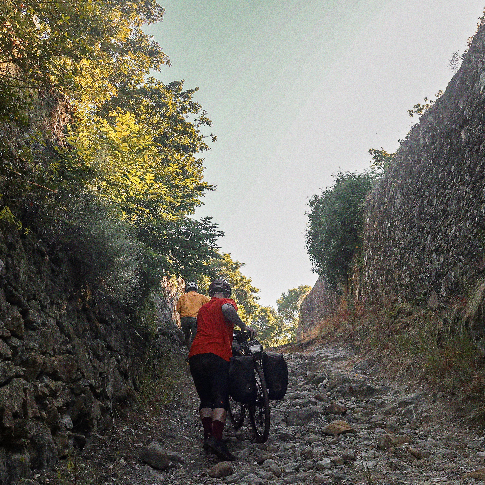
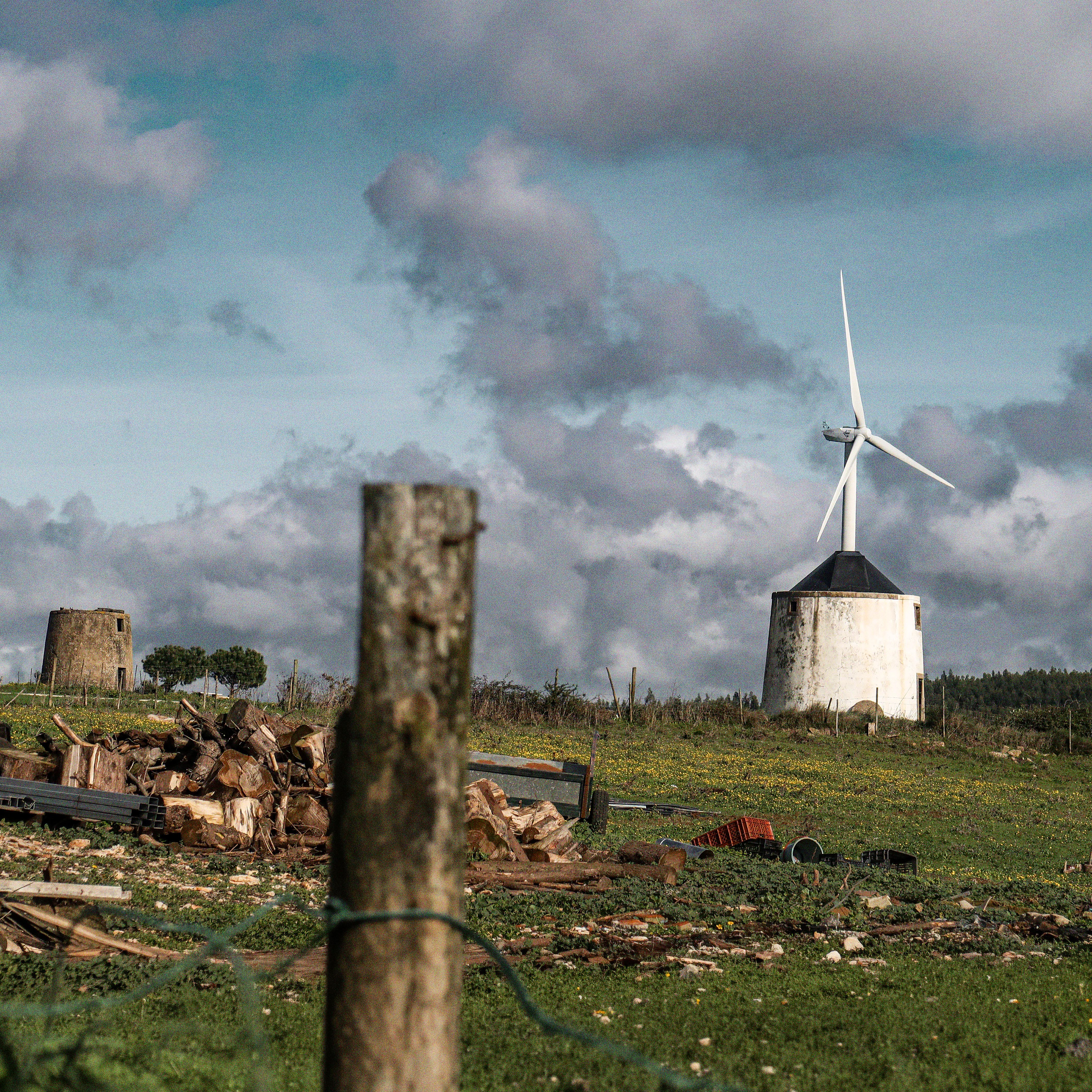
PN Serras de aire e candeeiros // Aire E Candeeiros Natural Park
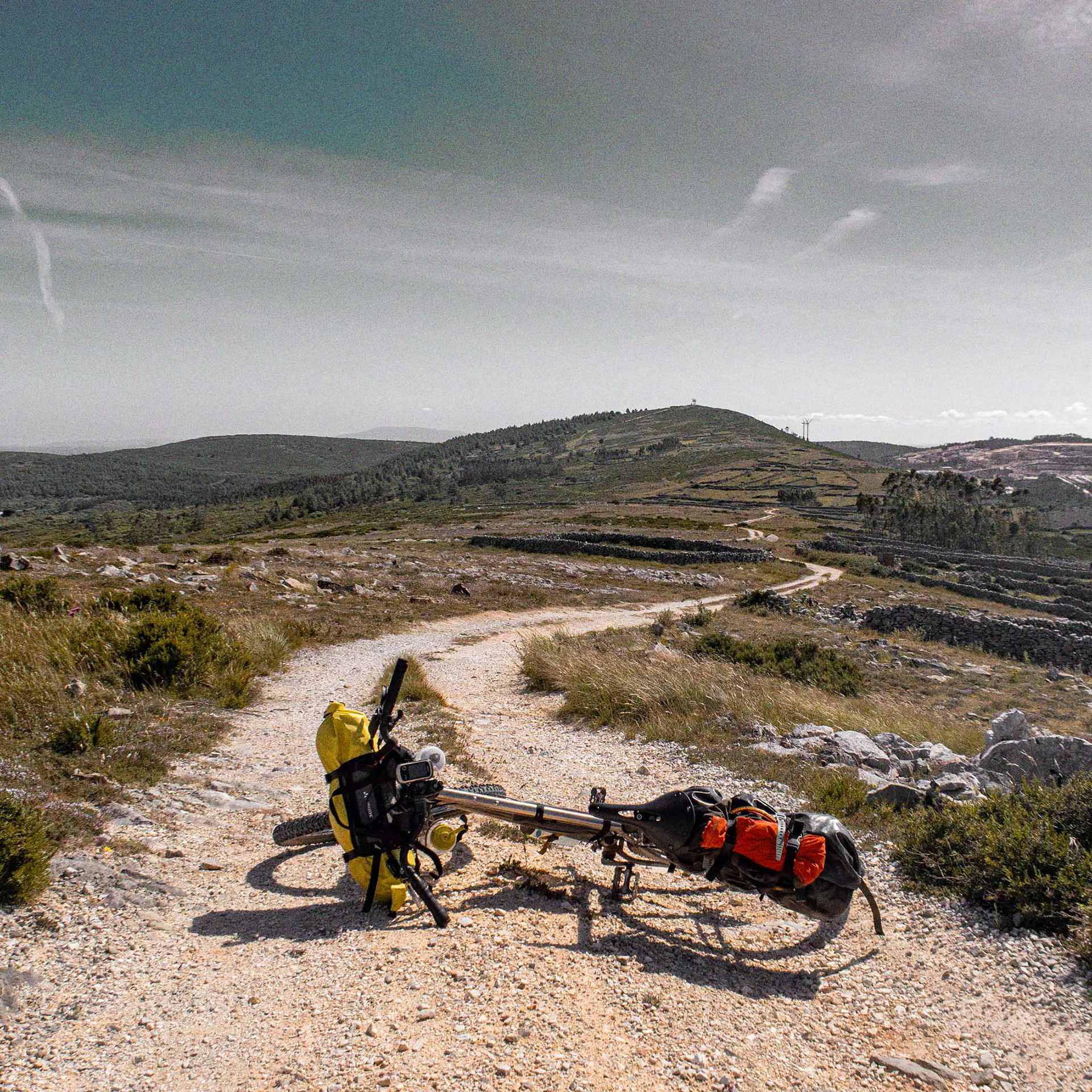
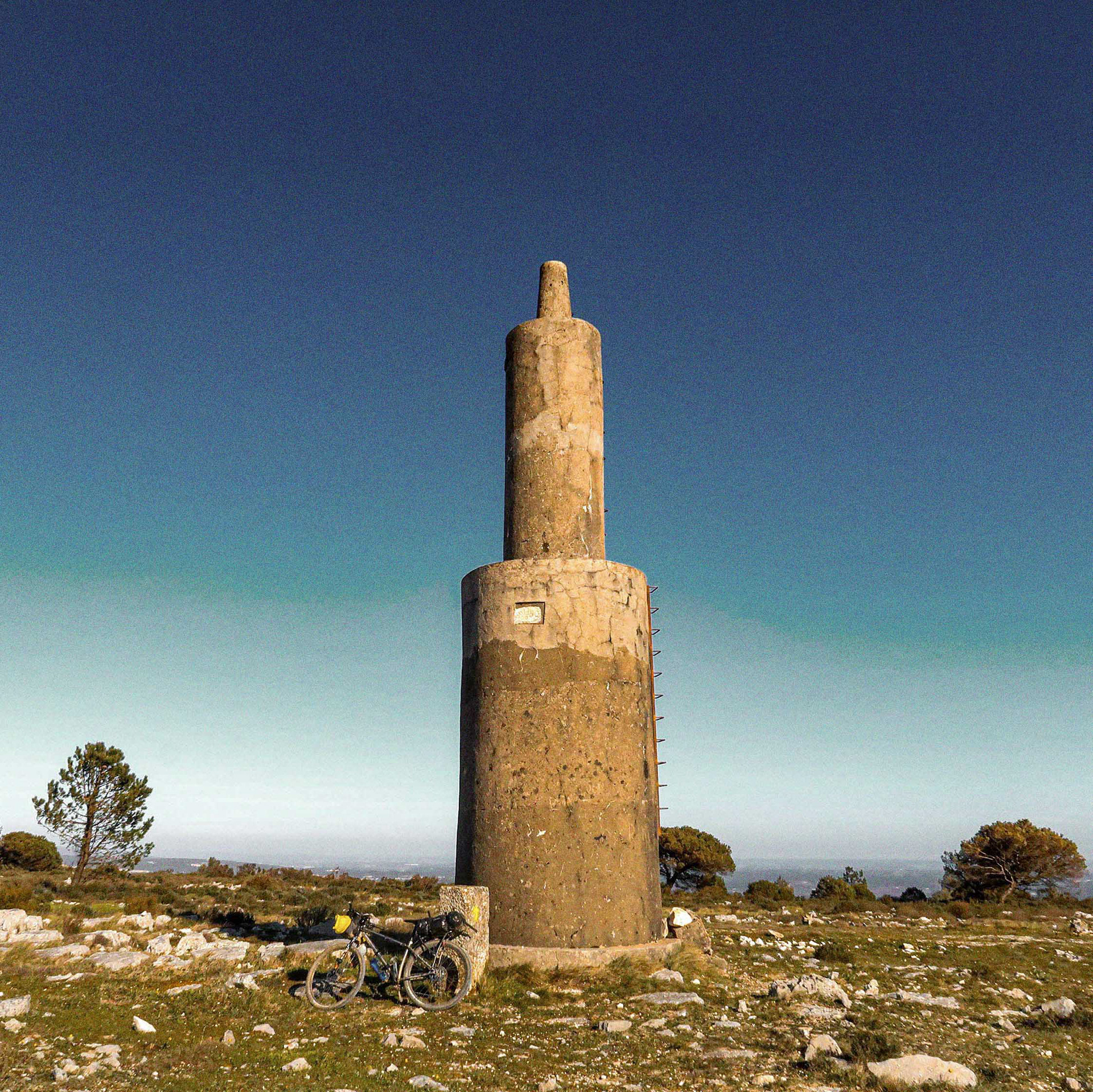
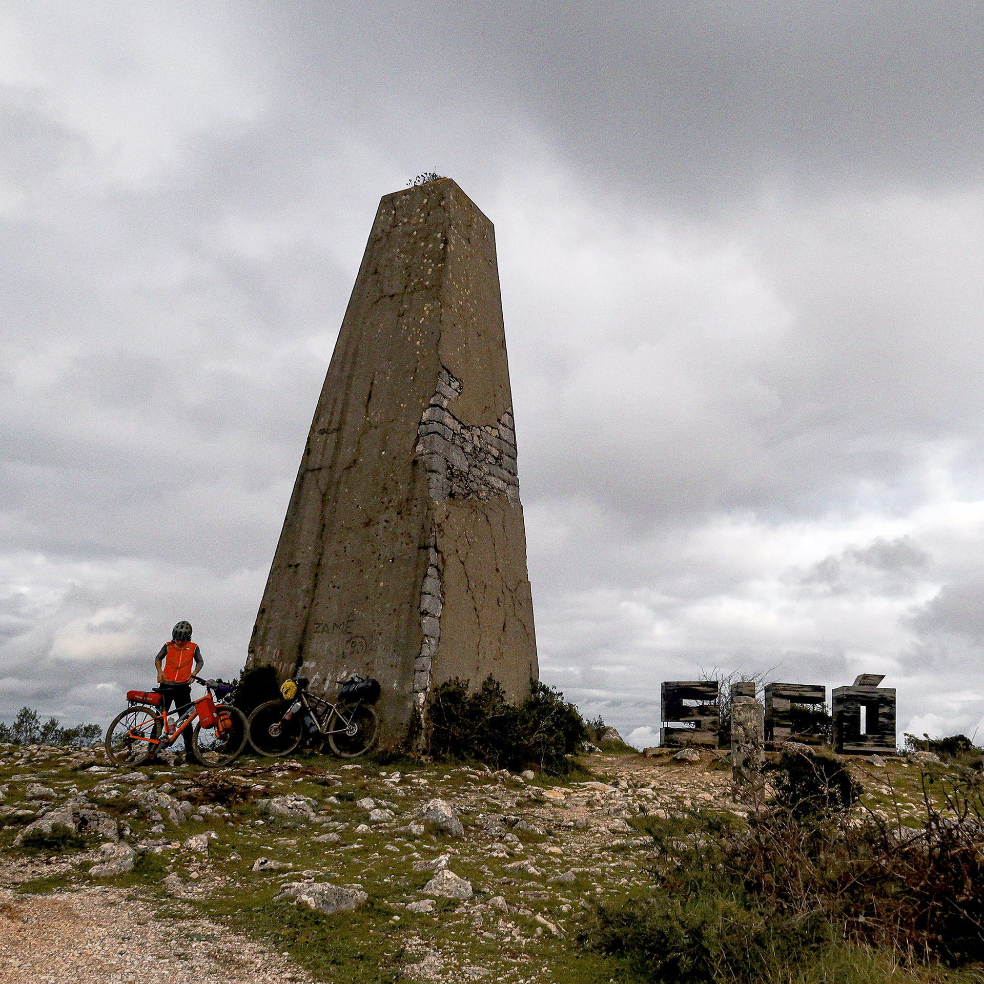
Saindo das Salinas, a rota apontou a mais um cume: a Serra de Candeeiros e o seu gigante marco geodésico. Este foi o início de uma sucessão contínua de serras calcárias que só daria tréguas perto do final da viagem. Entrámos num território escondido e discreto para as rotas turísticas. O percurso desenvolveu-se sobre um autêntico maciço oco, esculpido por uma vasta rede de grutas e algares profundos que sustentam uma flora e fauna únicas.
Os extensos campos de lapiás exigiram-nos condução técnica e atenção redobrada para evitar furos ou cortes nos pneus. Depois de Candeeiros, a inspiradora Serra da Lua ofereceu-nos uma descida memorável.
A travessia destas cumeadas foi feita num isolamento quase total, sem cruzarmos praticamente ninguém. Pelo caminho, encontrámos apenas um criador de gado focado a recompor um muro de pedra seca, antes de a rota contornar o primeiro grande trecho de campo de lapiás na serra.
Logo a seguir à Mendiga, tomámos banho nas piscinas de água de nascente de São Bento para um efeito revigorante. Acabámos por pernoitar nas imediações procurando um local discreto.
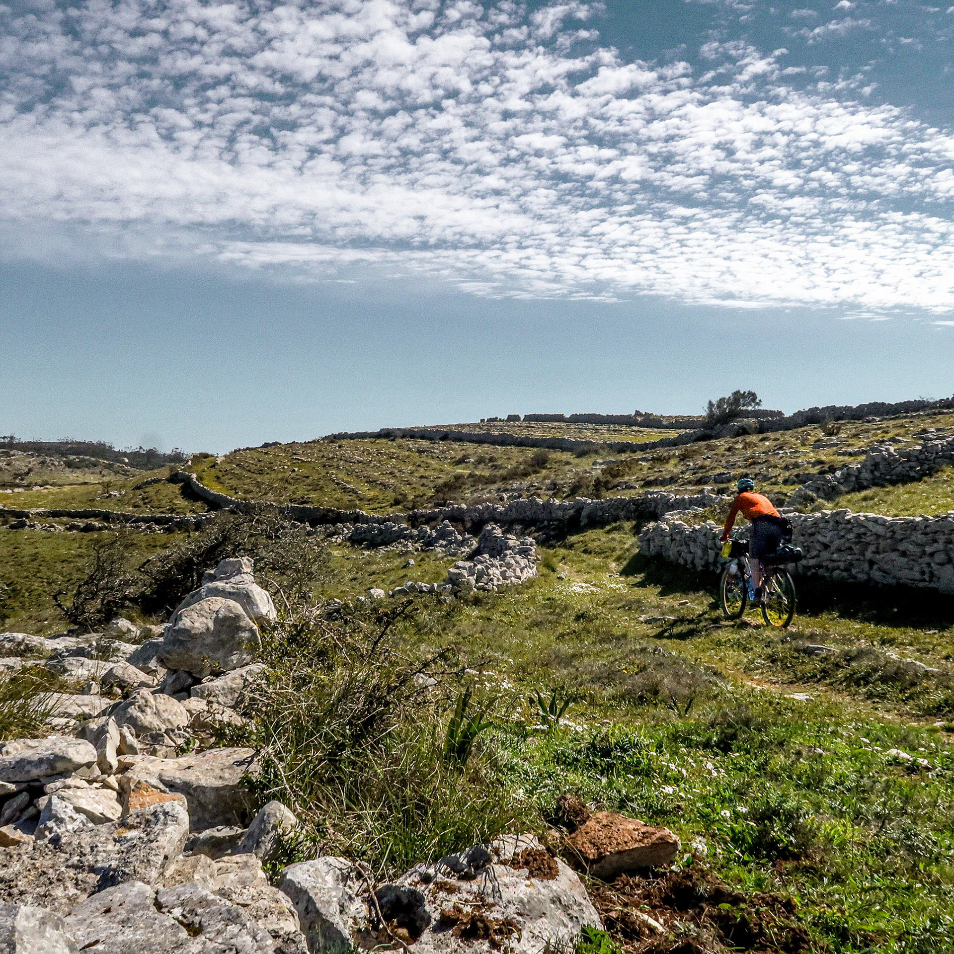
No dia seguinte, o cenário abriu-se para o imenso Planalto de Santo António e para as imponentes encostas de Alvados. O trilho técnico rasgou uma paisagem de lapiás e rochas recortadas, onde muros de pedra seca dividem as parcelas da terra vermelha. Esta região é árida e dura, caracterizada por solos onde a intervenção humana teve de moldar a rocha para viabilizar a agricultura. Ao longo do percurso, encontrámos os “maroiços”: amontoados de pedra solta que resultaram da limpeza dos terrenos para permitir o cultivo.
Foi neste labirinto mineral que nos cruzámos com criadores de gado a trazer as vacas para o campo. Numa breve conversa, trocámos algumas palavras e percebemos que gerem mais de 100 cabeças de gado naquela imensidão de pedra.
Depois da descida, em Vale da Serra, o contacto humano regressou no café e mercearia Casa Manuel Órfão. Ali, deu para uma conversa com quem bebia café e abastecemos com o essencial. A aldeia fica precisamente na base do único grande cume desta cordilheira que ficará para uma próxima viagem, a Serra de Aire, com 679 metros de altitude. Para quem viaja com tempo, é possível fazer a subida a pé até ao topo deixando as bicicletas em segurança na aldeia, embora a caminhada implique uma subida algo exigente de 3 a 5 horas. Ao longo do percurso, existe a facilidade de comprar tudo localmente, apoiando o comércio de proximidade.
Depois da descida, em Vale da Serra, o contacto humano regressou no café e mercearia Casa Manuel Órfão. Ali, deu para uma conversa com quem bebia café e abastecemos com o essencial. A aldeia fica precisamente na base do único grande cume desta cordilheira que ficará para uma próxima viagem, a Serra de Aire, com 679 metros de altitude. Para quem viaja com tempo, é possível fazer a subida a pé até ao topo deixando as bicicletas em segurança na aldeia, embora a caminhada implique uma subida algo exigente de 3 a 5 horas. Ao longo do percurso, existe a facilidade de comprar tudo localmente, apoiando o comércio de proximidade.
Seguindo viagem, o trilho permite observar vários megalapiás que enquadram olivais tradicionais muito bem cuidados. No horizonte vimos trabalhos de poda das árvores para garantir a produtividade da próxima colheita. De seguida, enfrentámos o Canhão de Fungalvaz através de uma descida técnica que exige perícia, mas onde se consegue rolar com ritmo. O trilho conduziu-nos depois à aldeia de Fungalvaz, conhecida pelo seu Albergue de Peregrinos que rumam a Fátima.
A secção aproximou-nos finalmente do destino com a passagem, uns quilómetros antes, pelo monumental Aqueduto dos Pegões. A chegada a Tomar fez-se pelas traseiras do Convento de Cristo, onde podémos obeservar a cidade no miradouro junto da porta principal do secular castelo fundado pelos Cavaleiros Templário. Iniciámos então a descida em direção ao centro urbano.
Leaving the Rio Maior Salt Pans behind, the route set its sights on yet another summit: the Serra de Candeeiros and its towering geodetic marker. This marked the beginning of an almost uninterrupted succession of limestone ranges that would dominate the journey until its closing stages. We entered a hidden territory, well off the tourist trail. The route unfolded across what is essentially a vast hollow massif, sculpted over millions of years by an intricate network of caves, underground rivers and deep vertical sinkholes that sustain a unique ecosystem of flora and fauna.
The extensive karren fields demanded constant concentration and precise bike handling. Sharp limestone edges left little room for error, and avoiding punctures or sidewall cuts became part of the challenge. Beyond Candeeiros, the enchanting Serra da Lua rewarded the effort with one of the most memorable descents of the entire route.Crossing these ridgelines often felt like travelling through a forgotten landscape. For long stretches, we encountered virtually no one. The silence was broken only by the occasional sound of livestock and the sight of a farmer patiently rebuilding a dry-stone wall before the route skirted its first major karren field.
Shortly after passing through Mendiga, we stopped at the spring-fed pools of São Bento. The cold water provided a welcome reset after the heat and exposure of the limestone plateau. That evening, we found a discreet bivouac nearby and settled in for the night beneath an exceptionally dark sky.The following morning, the landscape opened dramatically onto the vast Santo António Plateau and the imposing slopes of Alvados.Here, the trail cuts through a striking world of exposed limestone and sculpted rock formations, where dry-stone walls divide parcels of deep red soil. This is a harsh and demanding landscape, shaped by generations of human persistence. Farming here was only made possible through the painstaking removal and rearrangement of stone.Along the way, we encountered the region's distinctive maroiços—large piles of loose limestone cleared from the fields to create cultivable land. These stone mounds have become as characteristic of the landscape as the karren itself.It was within this mineral labyrinth that we met several cattle farmers moving their herds across the plateau. During a brief conversation, we learned that more than one hundred head of cattle graze across this seemingly inhospitable expanse of rock.After a long descent, human contact returned in the village of Vale da Serra, at the small grocery store and café Casa Manuel Órfão. A conversation with locals over coffee provided a welcome glimpse into everyday life in this remote region while allowing us to restock essential supplies.
The village sits at the foot of the only major summit in the range not included in the route: Serra de Aire, which rises to 679 meters above sea level. Riders with additional time may choose to leave their bicycles safely in the village and hike to the summit, although the round trip requires a demanding three- to five-hour climb. Throughout the region, local shops provide ample opportunities to support small businesses and experience the area's strong sense of community. Continuing onward, the trail passes several impressive karren formations framing beautifully maintained traditional olive groves. In the distance, farmers could be seen pruning trees in preparation for the next harvest.
The route then drops into the Fungalvaz Canyon via a technical descent that rewards confident bike handling while remaining highly enjoyable to ride. At the bottom lies the village of Fungalvaz, known for its pilgrim hostel serving those walking towards Fátima.As the section draws to a close, the route passes one final landmark before reaching its destination: the monumental Aqueduto dos Pegões. A few kilometers later, Tomar appears on the horizon. The arrival is nothing short of memorable. Approaching from behind the Convento de Cristo, riders are rewarded with a magnificent viewpoint over the city beside the main gate of the Castelo de Tomar. From there, the route descends gently into the historic centre, where a well-earned pause awaits before the next chapter of the journey.
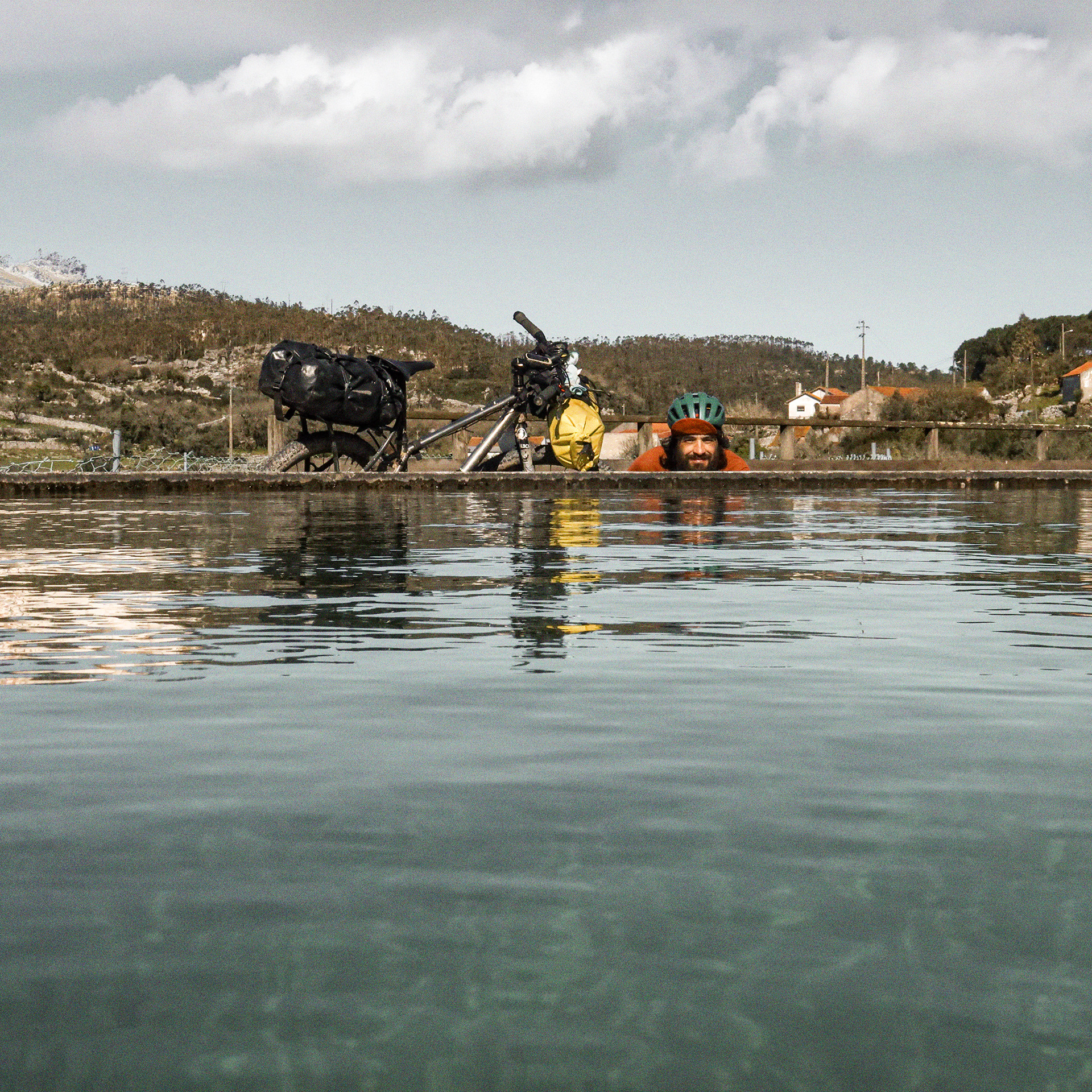
Recuperação em Tomar // Recovery in Tomar
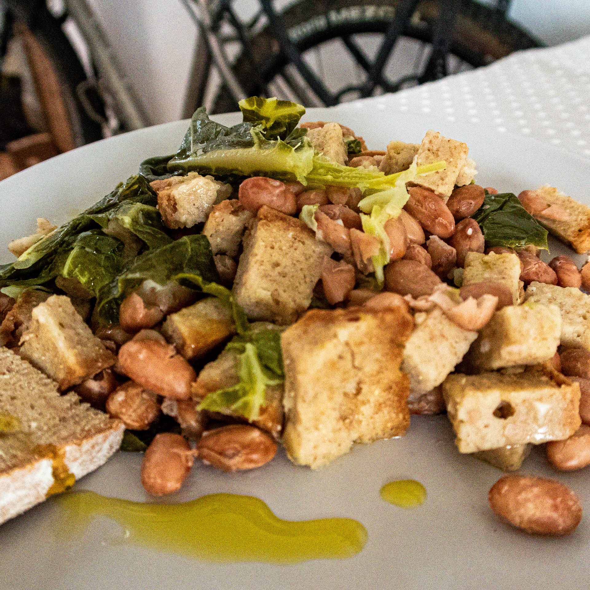
Tomar ofereceu o ponto de paragem ideal a meio da viagem. Foi o momento de gerir o esforço, lavar a roupa, tratar da manutenção das bicicletas e garantir uma noite de descanso profundo. Em Tomar a escolha de alojamento é muita, mas para manter o espírito da aventura há o Hostel 2300. Nós tivemos mais sorte, o conforto de casa permitiu-nos um menu típico caseiro desta região: sopa de feijão e migas de broa de milho com feijão com um bom vinho tinto produzido numa adega tomarense.
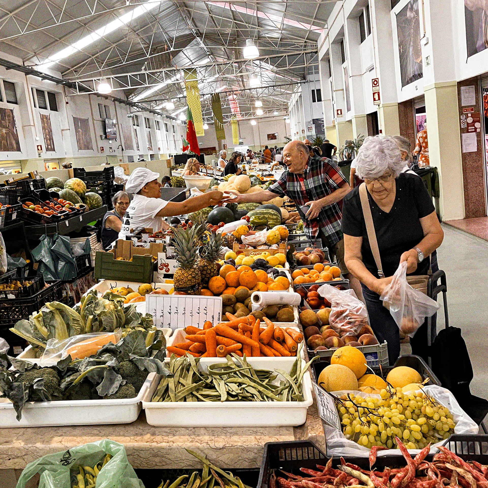
A manhã seguinte serviu para estender o descanso e a cidade convida a caminhar a pé pelo centro urbano. Ir ao Mercado Municipal de Tomar é obrigatório. É um local excelente para comprar produtos frescos e conversar com os vendedores. O mercado está aberto apenas de manhã, de terça-feira a sábado. Se a paragem coincidir com uma sexta-feira ou sábado, é possível falar e comprar diretamente aos próprios pequenos produtores da região.
Ainda deu tempo para uma ida ao Café Livraria Insensato antes de ir ver as novidades no Complexo Cultural da Levada que tem sempre exposições e um património industrial a visitar. Para quem gosta de fotografia o Centro de Estudos em Fotografia, tem sempre mostras focadas na imagem e no território. O Museu de Arte Contemporânea é pequeno mas tem uma coleção que mostra os principais autores de arte contemporânea da segunda metade do século XX. São paragens informais que não quebram o ritmo da viagem.
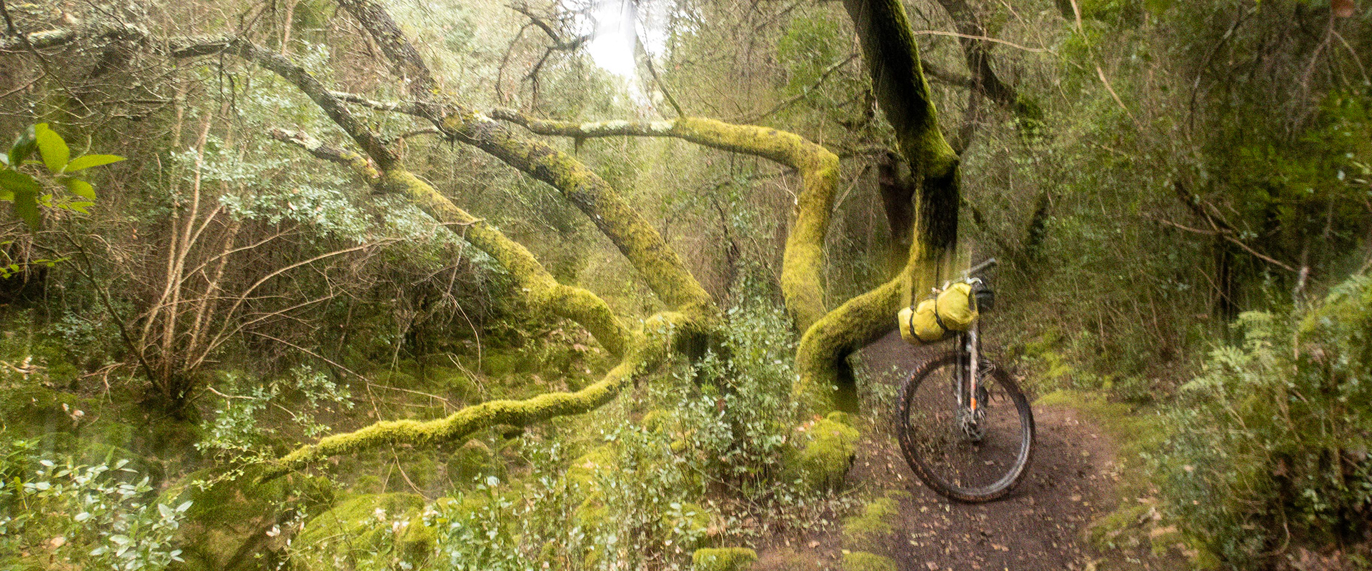
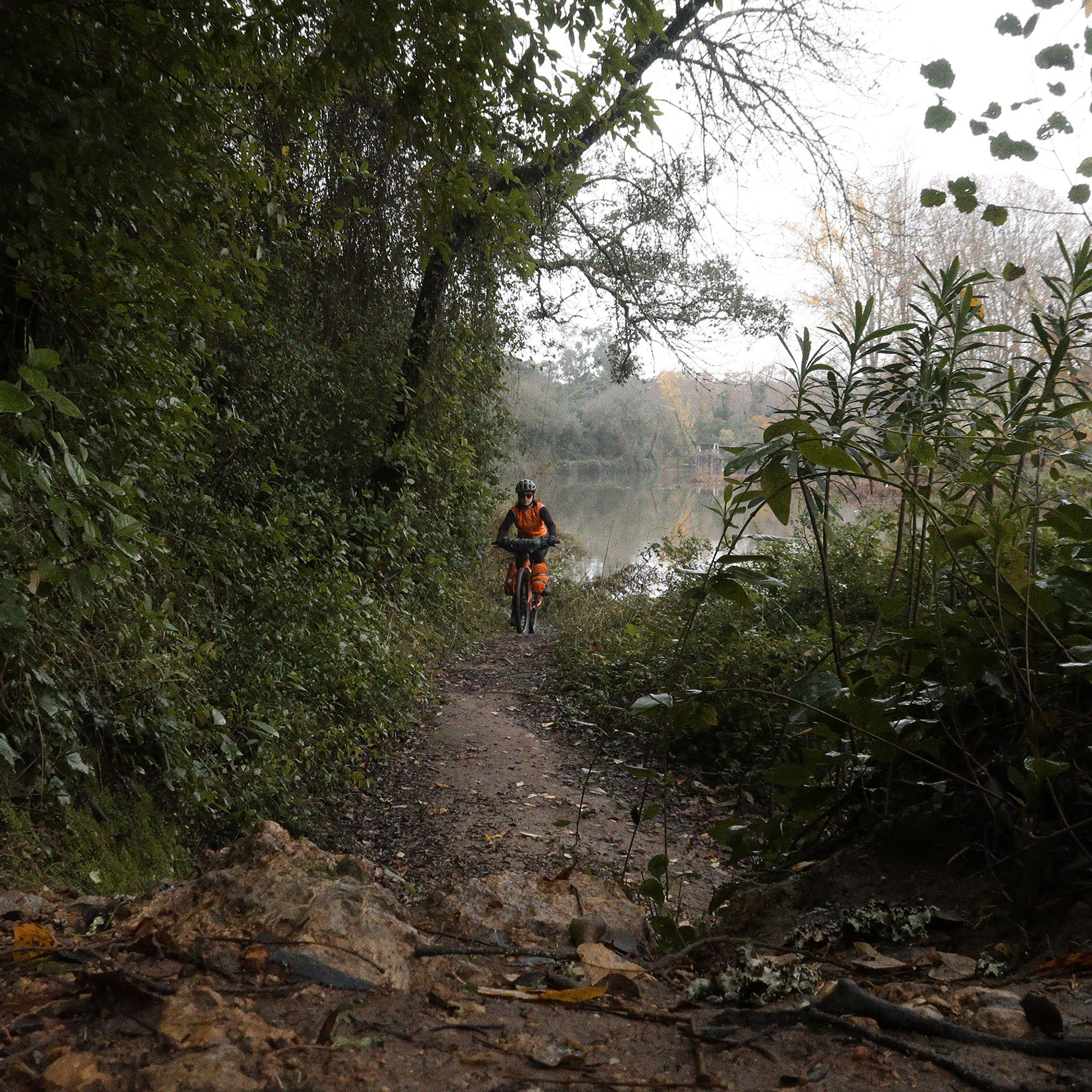
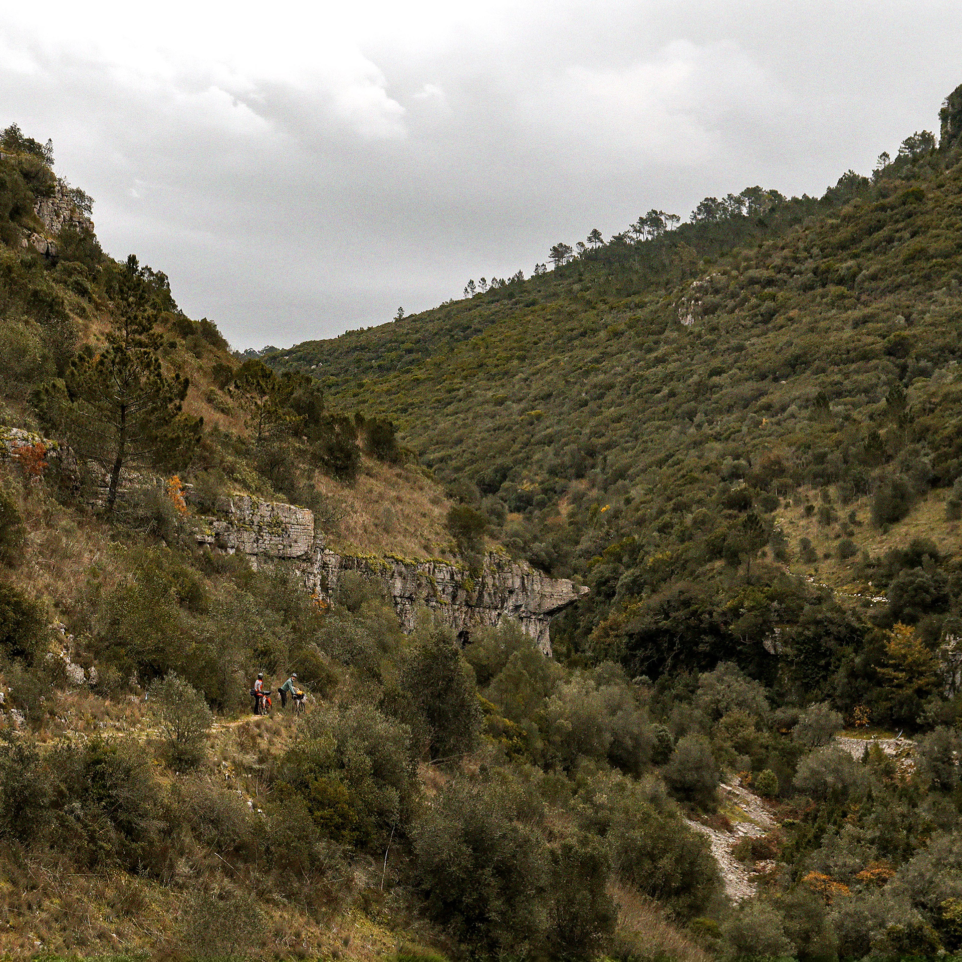
Partimos a meio da tarde. Ao sair de Tomar, o trilho marca uma transição geológica imediata com a entrada no Maciço de Sicó. O arranque faz-se por um singletrack nas margens do Rio Nabão, rodeado por galerias ripicolas belos bosques de carvalho-português. Aqui, levar a bicicleta à mão é inevitável.
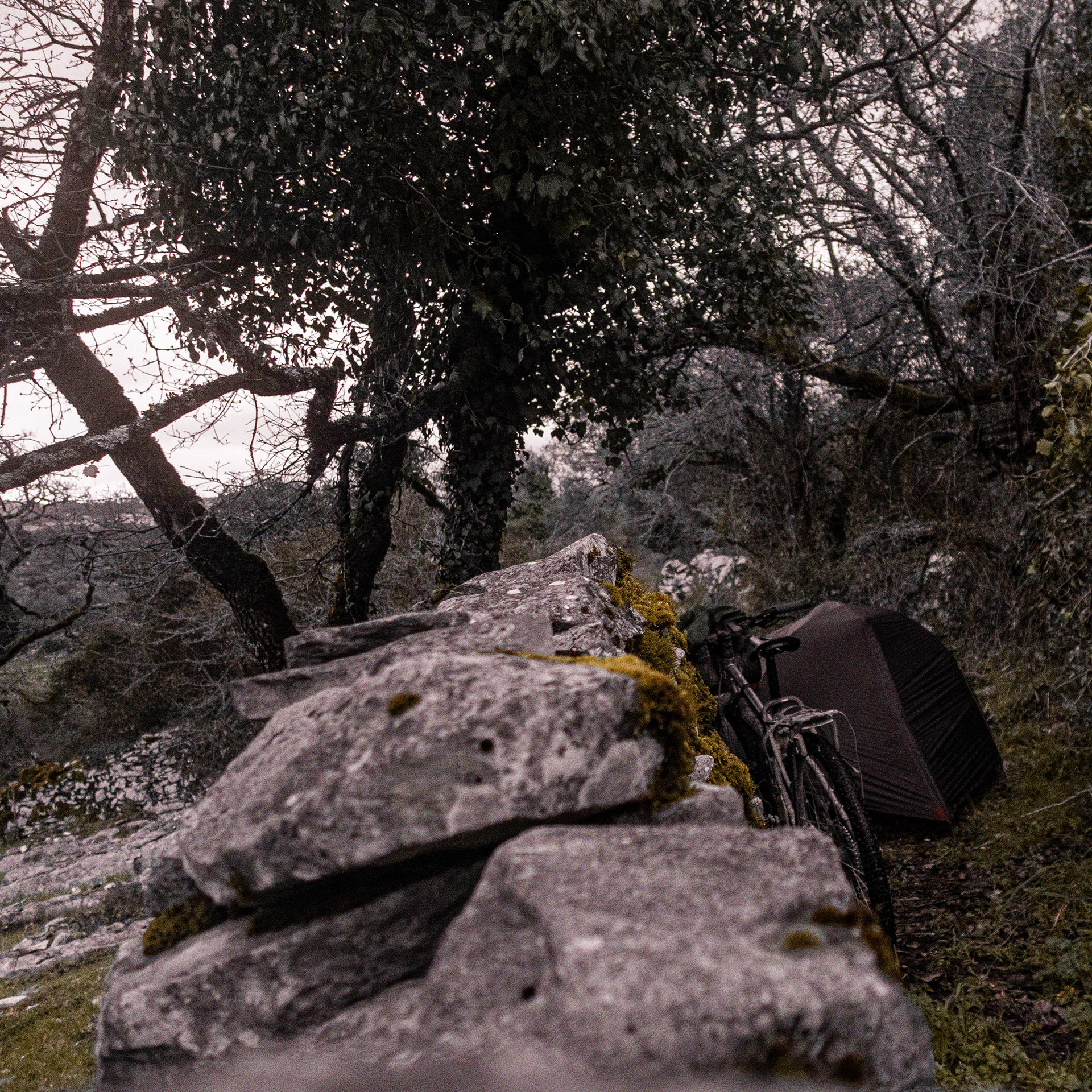
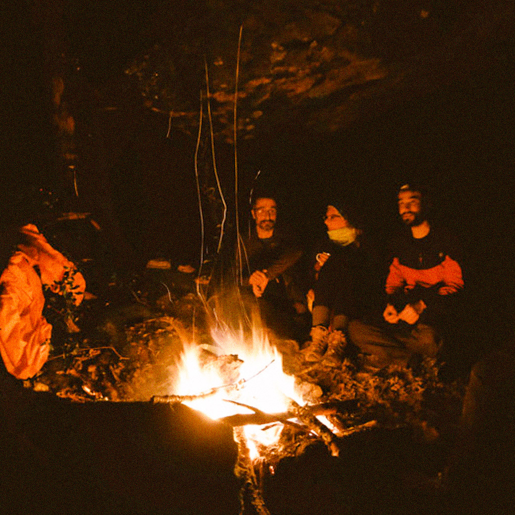
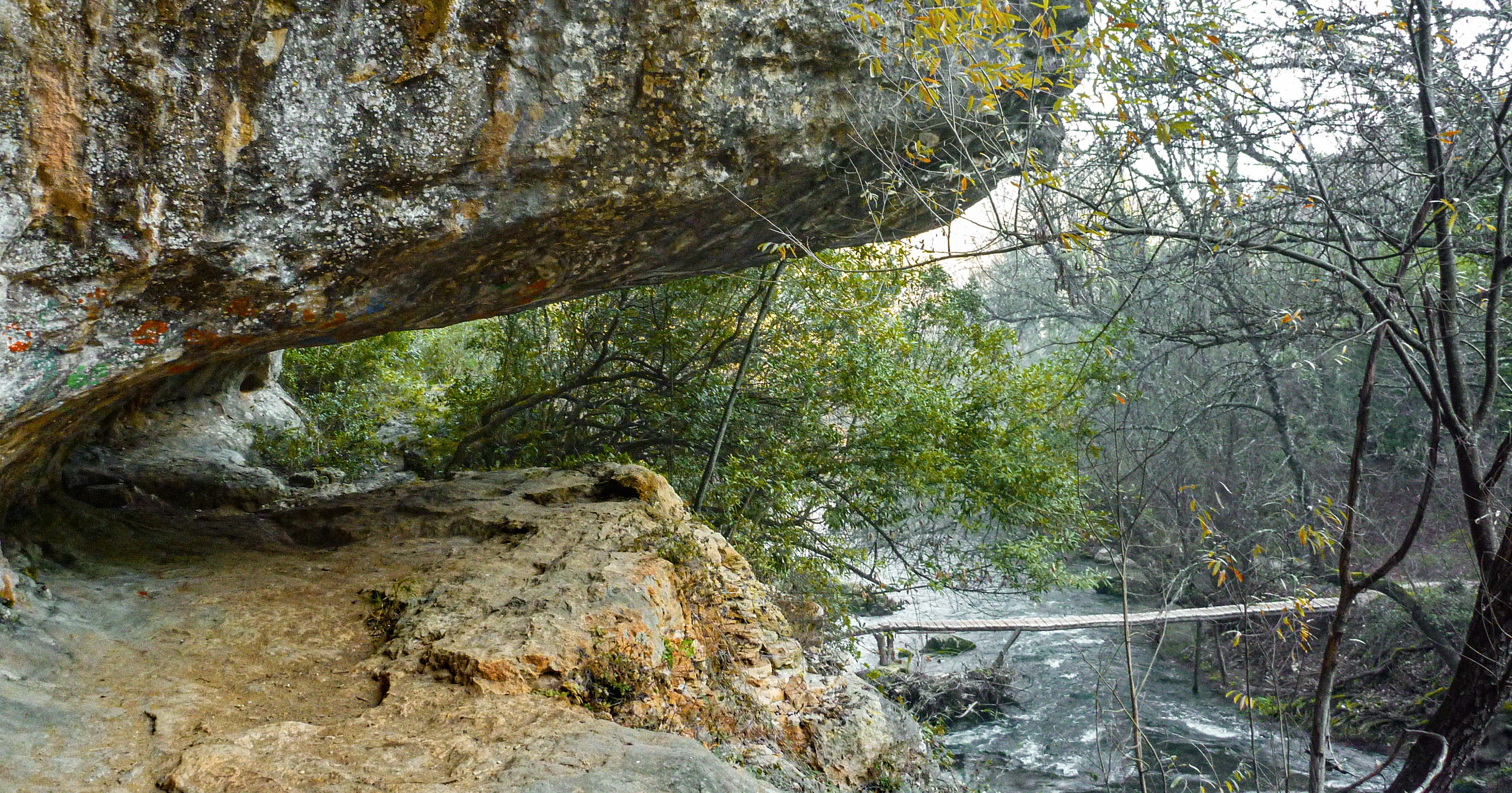
No Canhão do Nabão a beleza do local força uma paragem e perdemos a noção do tempo. Este local está equipado com percursos pedestres marcados, paredes de escalada e possibilita a prática da canoagem. É neste cenário que planeamos o final do dia: as reentrâncias e "covas" naturais nas paredes de rocha do canhão oferecem o abrigo perfeito para uma pernoita em total autonomia.
Tomar offered the perfect halfway stop for our journey. It was time to manage our pace, do some laundry, fine-tune the bikes, and catch up on some deep, much-needed sleep. While Tomar offers plenty of accommodation choices, Hostel 2300 is perfect for keeping the true spirit of adventure alive. We, however, got even luckier: the comforts of a local home treated us to a traditional, homemade regional menu. We had sopa de feijão (bean soup) and migas de broa de milho com feijão (cornbread crumbs with beans), paired with an excellent red wine from a Tomar winery.
The next morning was all about sleeping in, as the city practically begs you to explore its downtown on foot. A visit to the Mercado Municipal de Tomar is an absolute must. It is a fantastic spot to pick up fresh produce and chat with the locals. The market is open only in the morning, from Tuesday to Saturday. If your stop happens to fall on a Friday or Saturday, you can buy directly from the region's small-scale local farmers.
We still found time to drop by the Café Livraria Insensato before checking out what was on at the Complexo Cultural da Levada, which always hosts exhibitions and features a fascinating industrial heritage site. For photography enthusiasts, the Centro de Estudos em Fotografia always runs showcases focused on imagery and territory. The Museu de Arte Contemporânea is small but packs a great collection featuring key contemporary artists from the second half of the 20th century. These are easy, informal stops that seamlessly blend into the rhythm of the journey.
We hit the trail again mid-afternoon. Leaving Tomar, the route marks an immediate geological shift as you enter the Maciço de Sicó. The restart takes you along a singletrack by the banks of the Rio Nabão, framed by lush riverside canopies and beautiful Portuguese oak woodlands. Here, sections of hike-a-bike are unavoidable.
At the Canhão do Nabão, the stunning scenery forced us to pause, and we completely lost track of time. This area features marked hiking trails, climbing walls, and options for canoeing. It was in this exact setting that we planned the end of our day: the natural recesses and caves along the canyon’s rock walls provided the ultimate shelter for a bivouac in full autonomy.
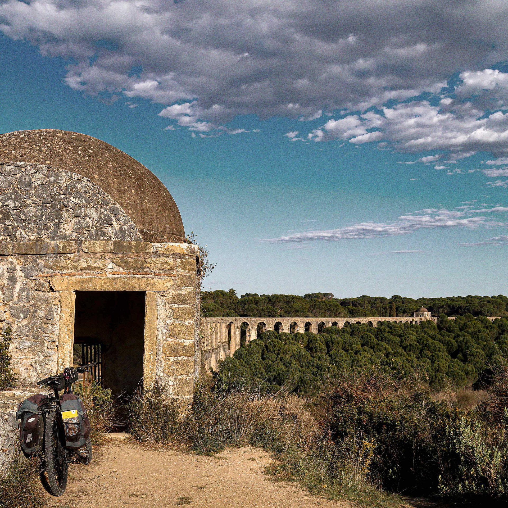
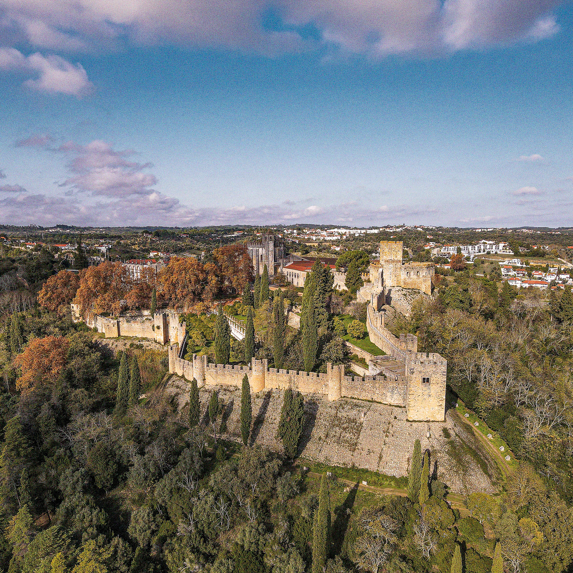
Convento de Cristo e Castelo Templário // © Foge comigo!
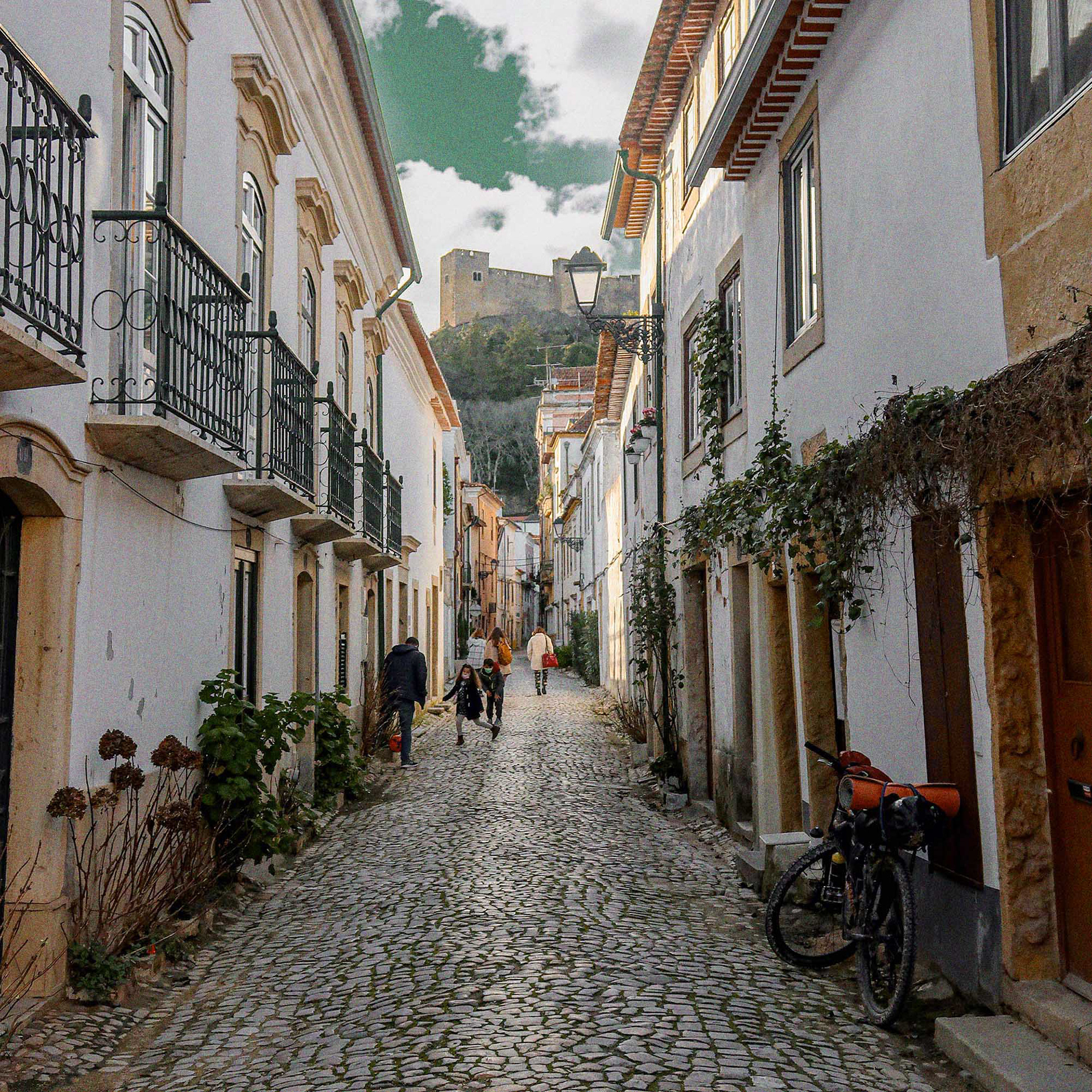
Tomar
Tomar
© Diogo Tavares @digstavares
Alvaiázere e MaCiço do sicó // Alvaiázere and the Sicó Massif
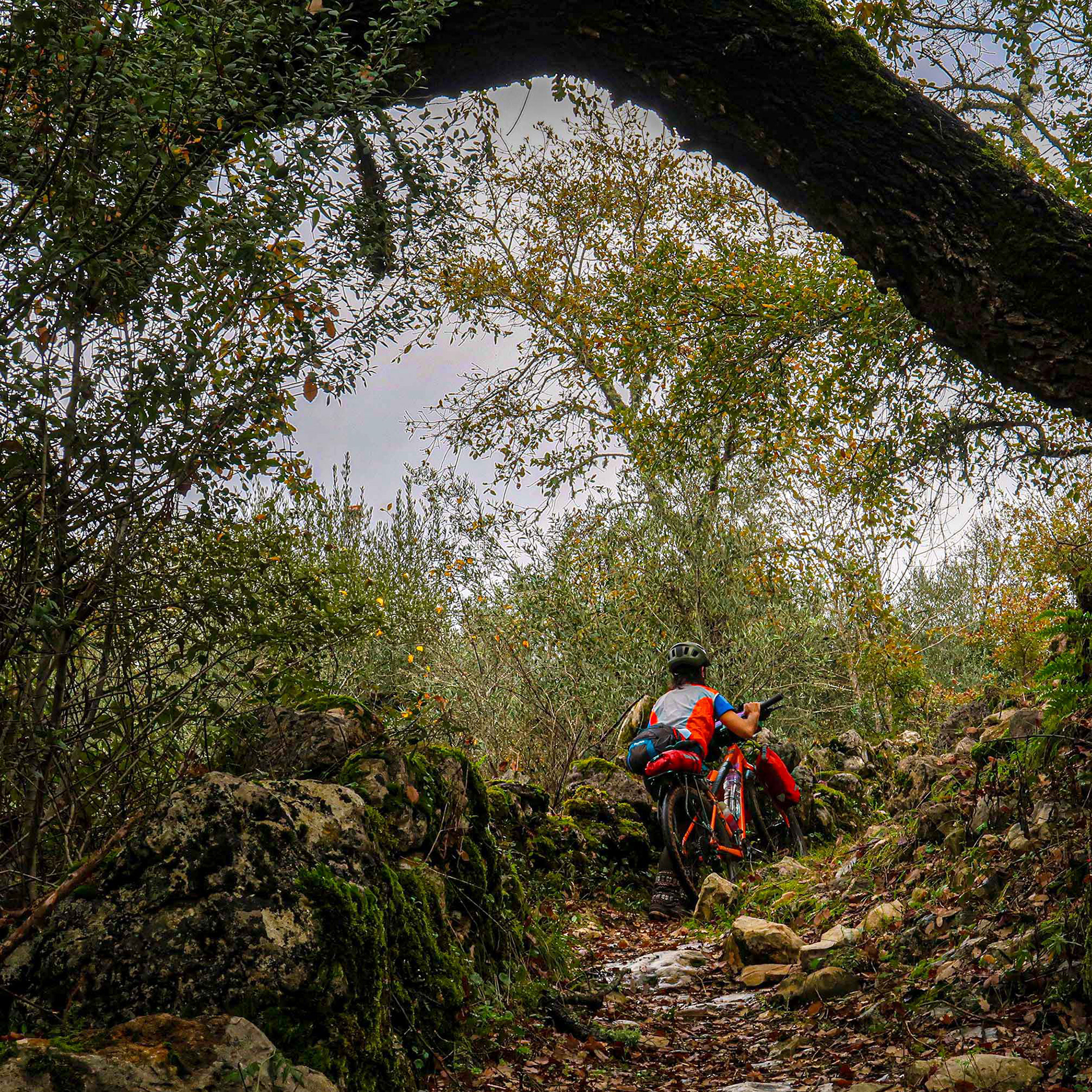
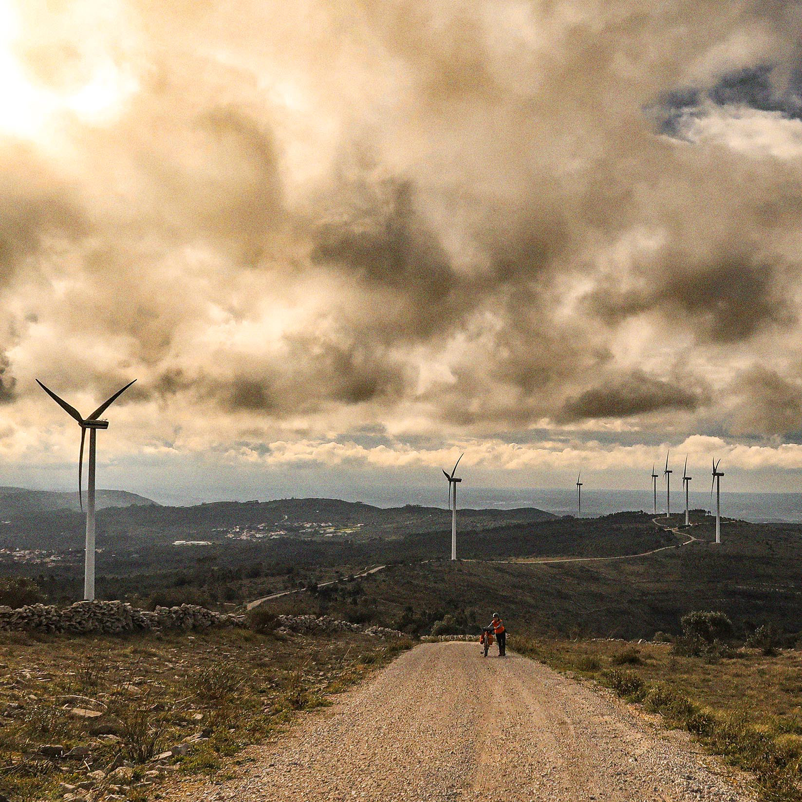
A partir daqui a ruralidade ganha contornos mais vincados e tradicionais do que no Parque Natural das Serras de Aires e Candeeiros. A paisagem e as gentes parecem mais isoladas e poucas foram as pessoas com quem nos cruzámos. A serra de Alvaiázere marcou o segundo ponto mais alto da rota.
Enfrentámos a subida sob calor intenso e conhecemos o Robert, um estrangeiro que nos ajudou prontamente com água para as nossas garrafas. A descida fez-se por um técnico campo de lapiás, de onde já se avistava o topo de Sicó. Nesta zona, os singletracks são os reis.
Em Ansião, aproveitámos para reabastecer. A busca pelo local ideal de pernoita na zona ainda nos demorou a encontrar. Durante a noite no acampamento, ouvimos o que pareceram ser pegadas de raposas e javalis.
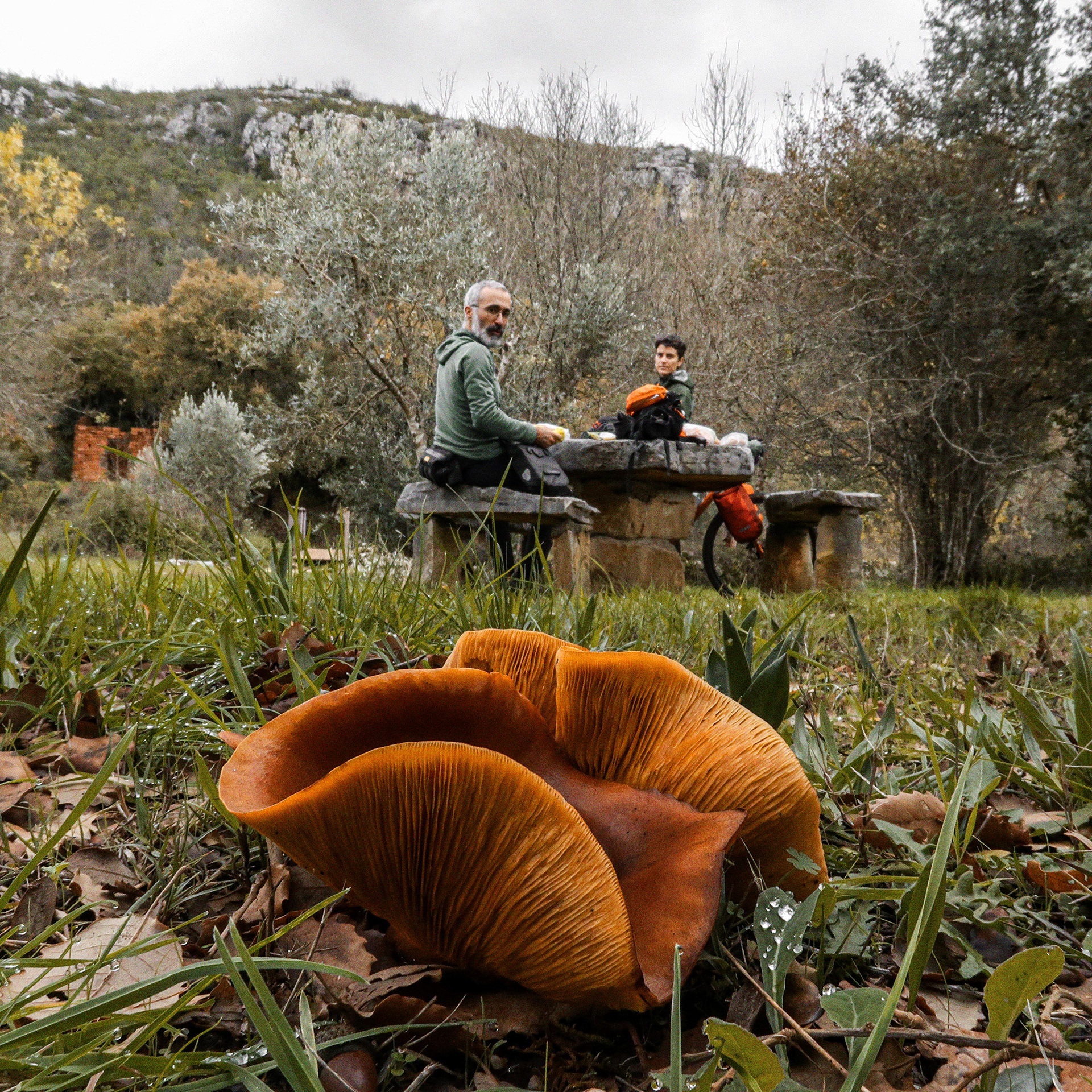
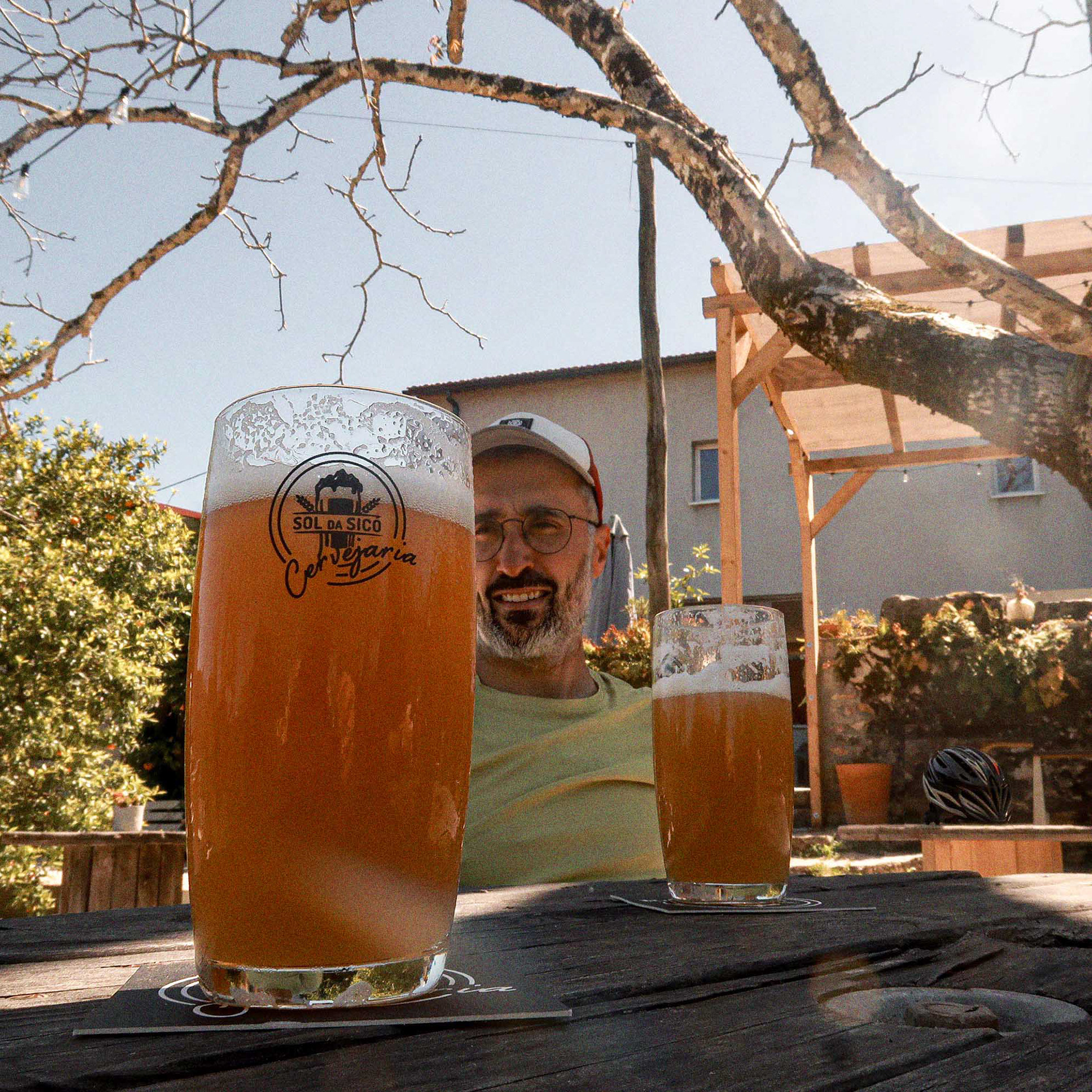
No dia seguinte, mais uma grande subida até ao cume mas o foco estava na Cervejaria Sol do Sicó, um refúgio de cerveja artesanal onde também provámos o famoso Queijo do Rabaçal No impressionante Vale de Poios encontrámos um grupo de escaladores vindos de longe, pendurados nas paredes verticais de calcário a substituir algum material com os seus berbequins. Neste vale, as vias desafiam os atletas com níveis técnicos que vão do 5a ao 8b.
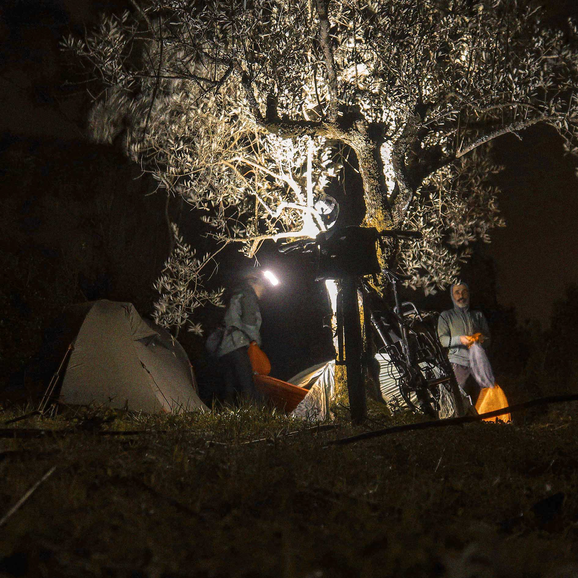
O final da secção reservou o local de pernoita mais cénico da viagem: as Buracas de Casmilo. Montámos o nosso bivaque dentro das impressionantes cavidades na rocha, numa noite estrelada de lua nova. Ao amanhecer, o trilho alcançou as ruínas romanas de Conímbriga e mais uma vez seguimos pelo caminho central Português de Santiago. À entrada, conhecemos o porteiro das ruínas e trocámos dois dedos de conversa sobre a rota.
From this point onwards, the landscape takes on a noticeably more rural and traditional character than that of the Serras de Aire e Candeeiros Natural Park. Both the countryside and its people feel increasingly remote, and encounters with others become few and far between. The climb to the summit of Alvaiázere marks the second-highest point of the entire route. We tackled the ascent in intense summer heat, grateful for an unexpected act of kindness from Robert, an expat resident who promptly offered to refill our bottles when our water supplies were running low.
The descent unfolded across a technical karren field, where the sharp limestone formations demanded constant attention. From here, the skyline of the Sicó Massif appeared on the horizon for the first time, providing a glimpse of what lay ahead. In this region, singletrack reigns supreme, and some of the route’s most rewarding riding begins to emerge.In Ansião, we took the opportunity to resupply before continuing our search for a suitable overnight spot. Finding the perfect campsite proved more difficult than expected, but eventually, we settled into a quiet bivouac surrounded by the stillness of the countryside. During the night, pawprints around the camp suggested visits from foxes and wild boars. The following morning brought yet another significant climb, but this time our thoughts were already fixed on a different reward: Sol do Sicó Brewery.
Hidden among the limestone hills, this small craft brewery serves as a welcome refuge for weary riders. Alongside its excellent beers, we enjoyed a tasting of the region’s most celebrated cheese, Queijo do Rabaçal, one of central Portugal’s gastronomic treasures.Further ahead, the spectacular Vale de Poios revealed another side of the massif. Suspended from towering limestone walls, a group of climbers had travelled from afar to replace aging bolts and maintain the area's sport climbing routes. The valley is one of Portugal’s premier limestone climbing destinations, with grades ranging from 5a to 8b, attracting climbers of every ability level.
As the day progressed, the route delivered what would become the most memorable overnight location of the entire journey: the Buracas de Casmilo. These enormous cavities carved into the limestone cliffs provided a natural shelter unlike any other. Beneath a moonless, star-filled sky, we set up our bivouac inside the rock formations themselves, surrounded by silence and the unmistakable feeling of sleeping within the landscape rather than merely passing through it. At dawn, the trail led us towards the Ruínas Romanas de Conímbriga. Once again, we merged onto sections of the Caminho Central Português to Santiago, sharing the path with pilgrims heading north. At the entrance to the archaeological site, we exchanged a few words with the caretaker, who listened with curiosity as we explained the route and the journey that had brought us there. By this stage, the Atlantic felt far away.The route had become fully immersed in the limestone world of central Portugal, where geology, history and human presence blend into a landscape unlike any other in the country.
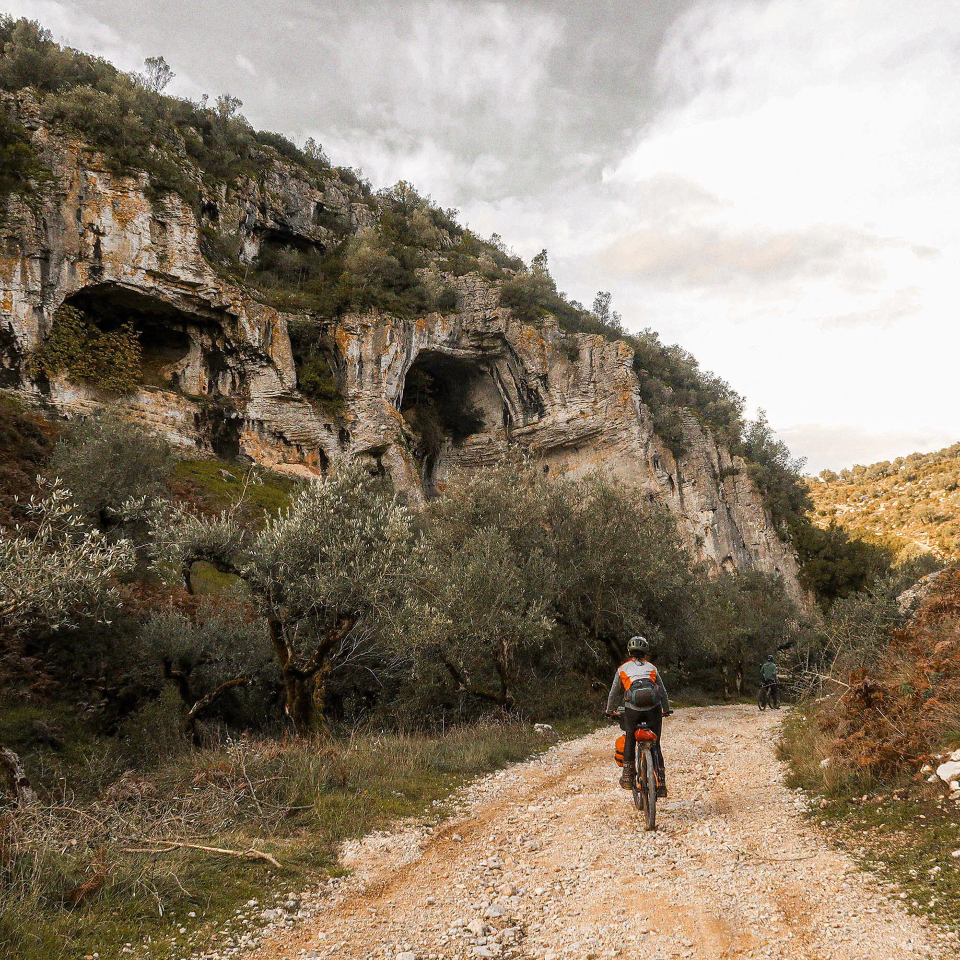
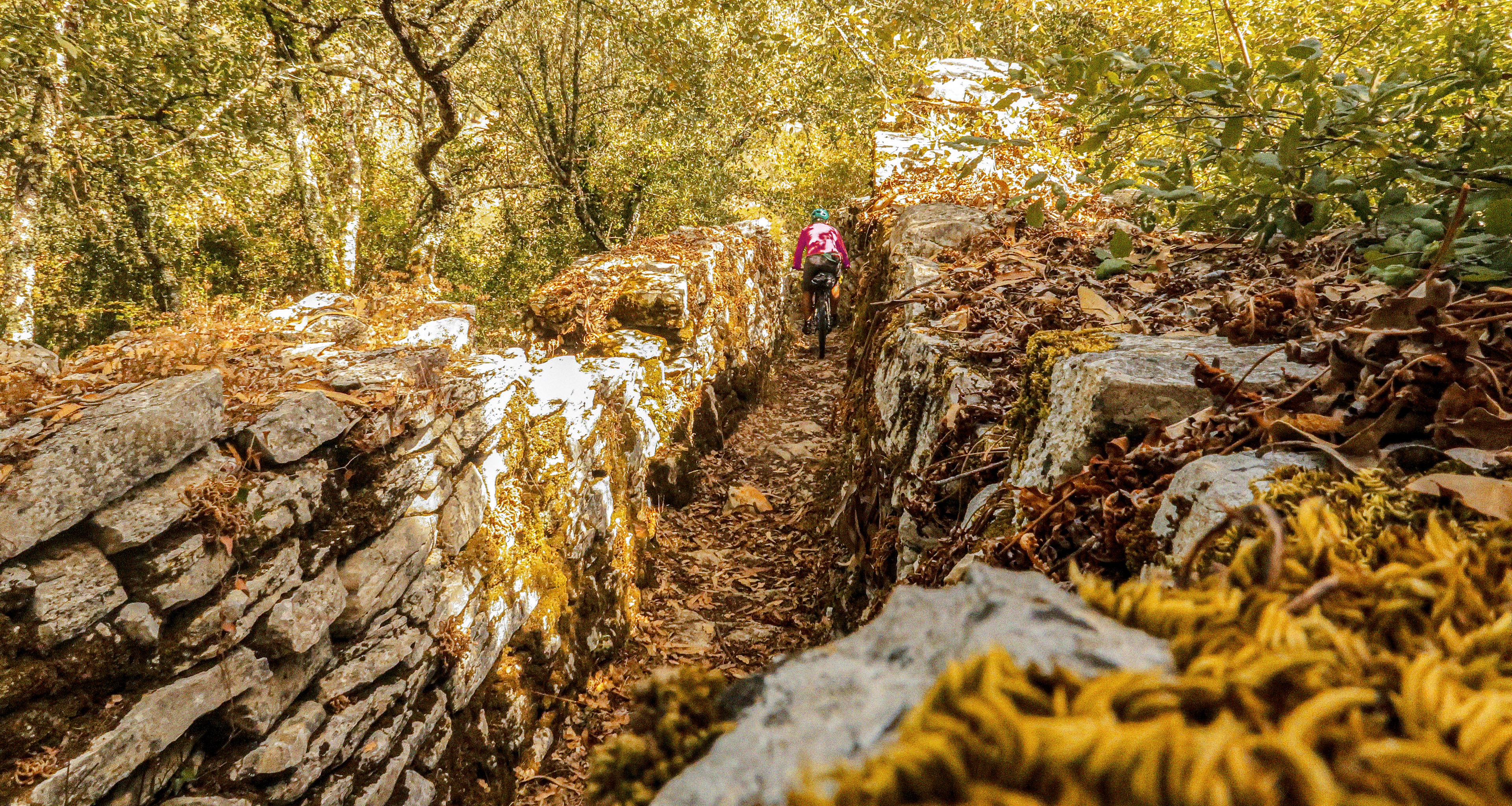
vale do rio mondego e cabo mondego // Mondego Valley and Cabo Mondego
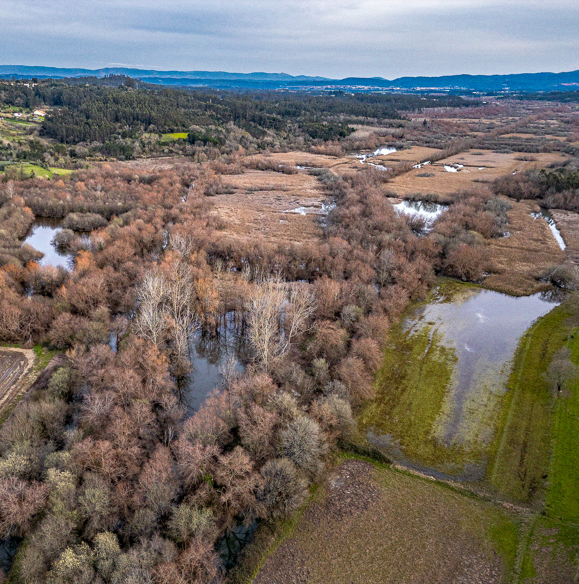
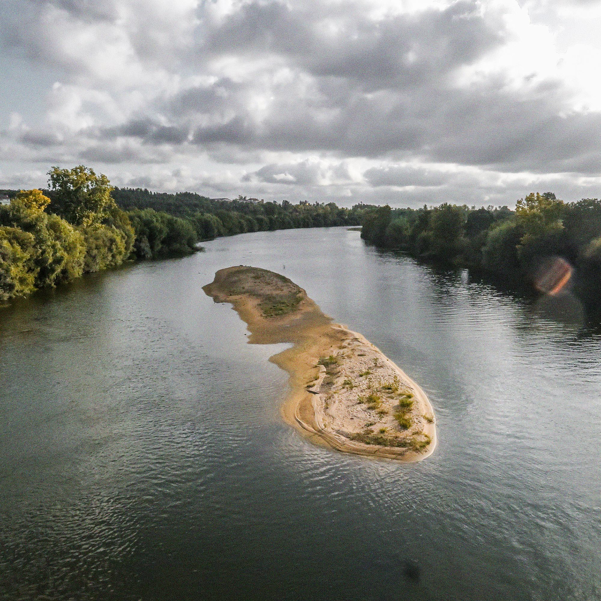
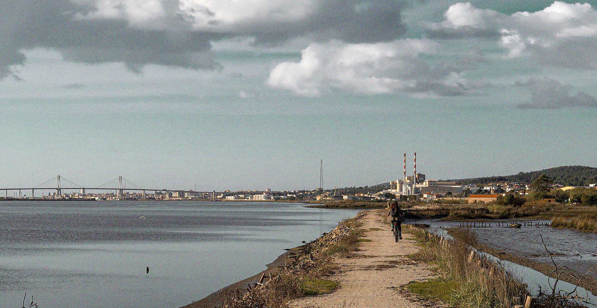
Ao deixar Conímbriga, abandonámos temporariamente o relevo calcário para rolar pelo Baixo Mondego. O traçado passou pela Reserva Natural do Paul de Arzila, um importante reduto de biodiversidade. Para descansar as pernas da dureza das secções anteriores, o percurso seguiu tranquilamente ao longo dos canais e diques do rio Mondego.
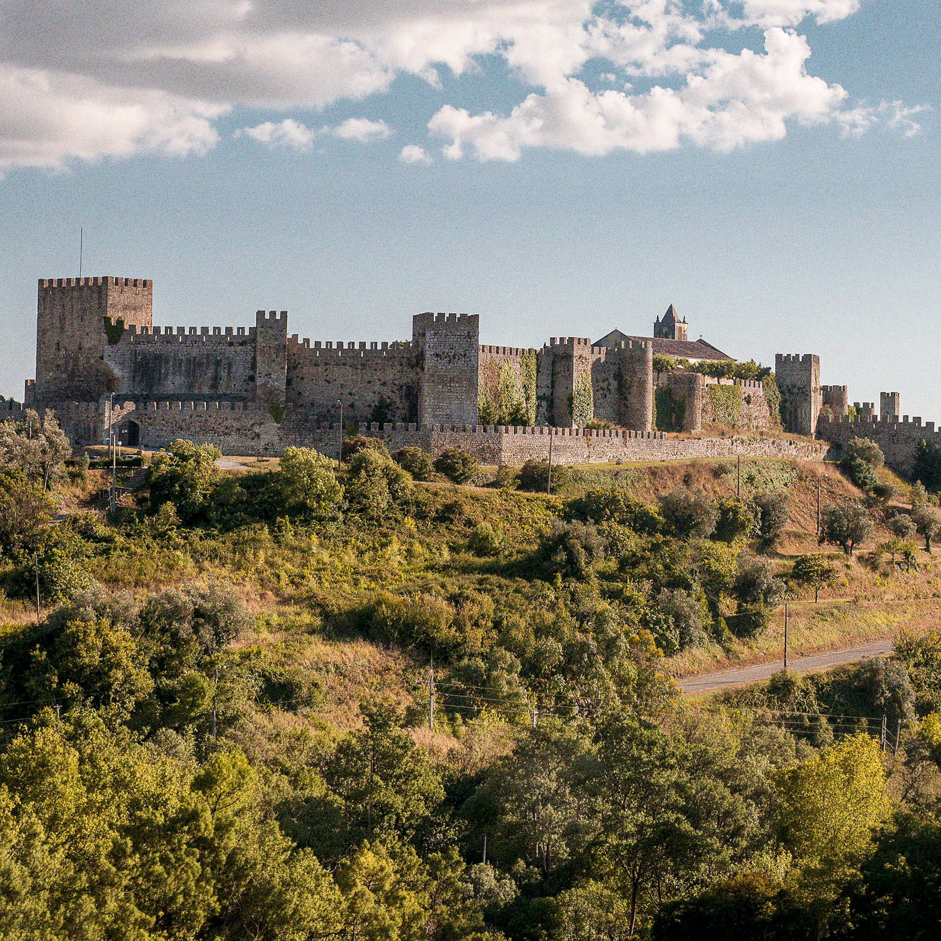
No topo das muralhas do Castelo de Montemor-o-Velho, a paragem foi obrigatória para observar a geometria desta paisagem e os extensos campos de arroz. Curiosamente, além da sua história medieval, este castelo recebeu algumas das maiores raves de trance psicadélico nos anos 90. A civilização aproxima-se, surgindo mais pessoas e alguns troços de asfalto secundário que exigem atenção redobrada, embora as estradas se mantenham calmas.
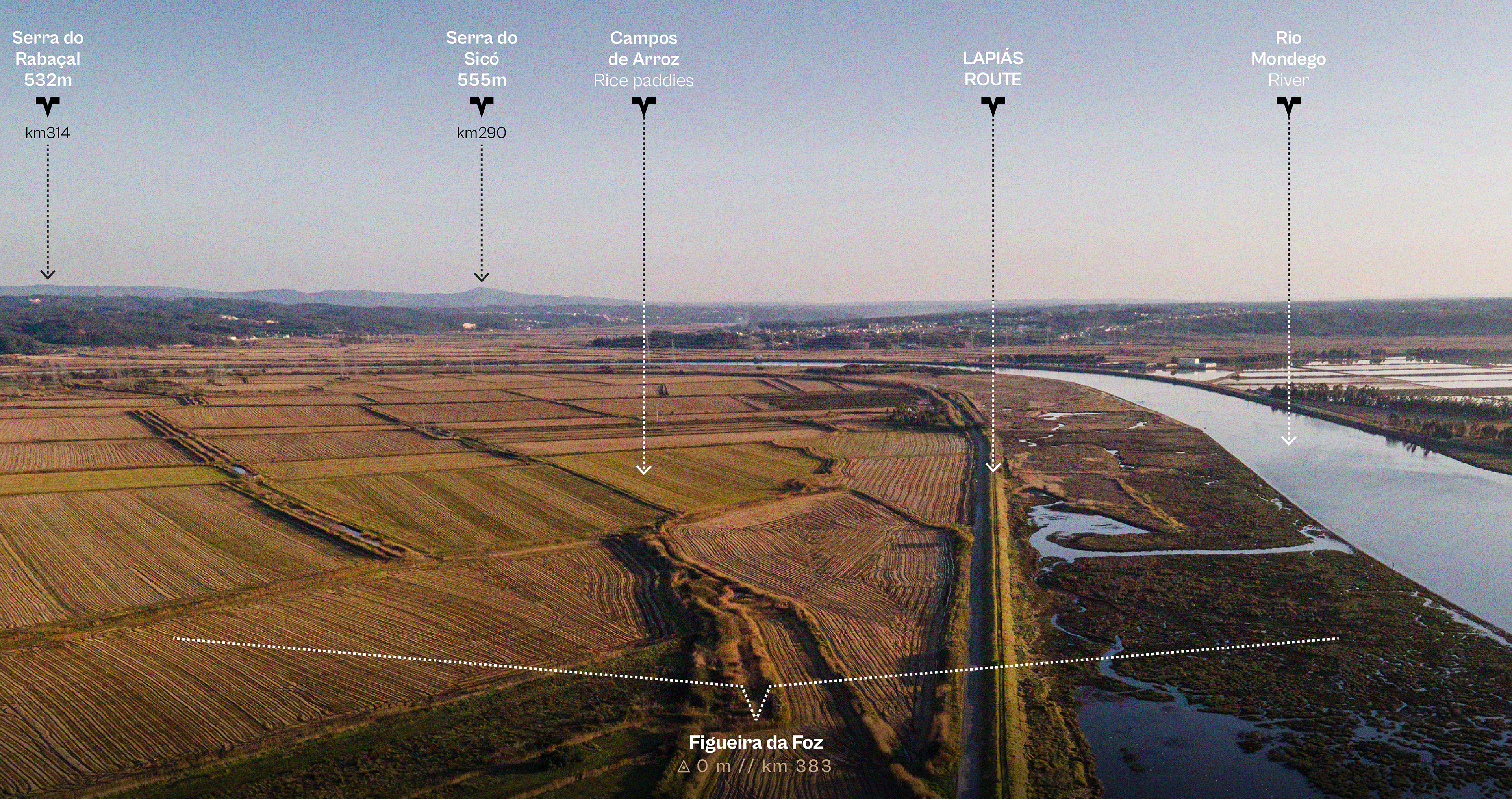
O destino final foi a Figueira da Foz.
O destino final foi a Figueira da Foz.
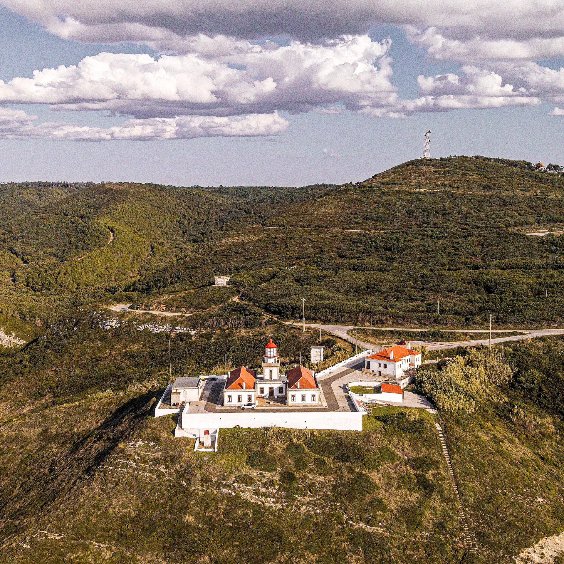
Atravessámos a cidade até ao Farol do Cabo Mondego, o ponto onde a rota "pica o ponto". Enquanto parávamos as bicicletas junto ao farol para contemplar o mar, parámos a falar com quem estava no local, que nos questionou, curioso, sobre os detalhes da viagem e do equipamento. Aqui, a jornada fecha com chave de ouro ao reencontrar o calcário: este cabo é o último grande penedo calcário da rota, entrando pelo mar adentro na base da Serra da Boa Viagem.
Leaving Conímbriga behind, the route temporarily departs from the limestone landscapes that have defined much of the journey, descending instead into the fertile plains of the Lower Mondego Valley. The terrain becomes gentler, offering a welcome contrast to the rugged climbs, technical trails and rocky plateaus of previous days. Passing through the Reserva Natural do Paul de Arzila, one of central Portugal’s most important biodiversity hotspots, the route follows a peaceful network of canals, embankments, and riverside tracks that accompany the Mondego River towards the Atlantic. For the first time in several days, the kilometers roll by effortlessly.
From the ramparts of the Castelo de Montemor-o-Velho, a stop is impossible to resist. The view stretches across an immense patchwork of rice fields, waterways and agricultural land, revealing the remarkable geometry of the Lower Mondego floodplain. Curiously, beyond its medieval history and strategic importance, the castle also hosted some of Portugal’s most legendary psychedelic trance gatherings during the 1990s—a surprising chapter in the story of a place that has witnessed centuries of change. As the route approaches the coast, signs of civilization become increasingly frequent. More people appear on the trail, and occasional stretches of tarmac require a little extra attention, although traffic remains light and the backroads pleasantly quiet.
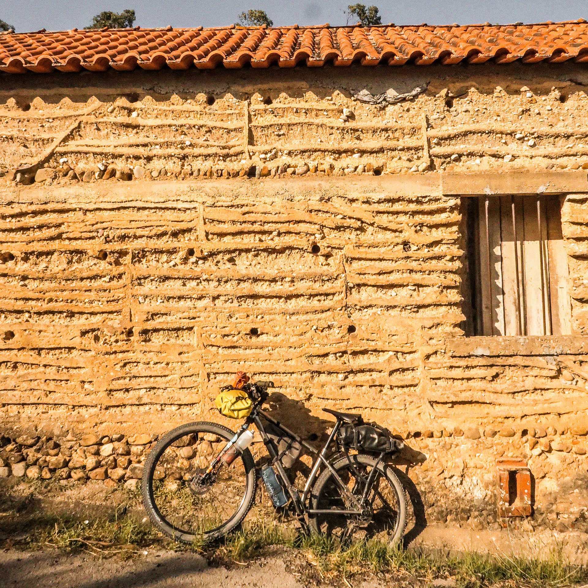
Eventually, the journey reaches Figueira da Foz. Crossing the city, we make our way towards the lighthouse at Cabo Mondego—the symbolic finish line of the route. Leaning our bikes against the lighthouse and gazing out over the Atlantic, we found ourselves answering the inevitable questions from curious visitors eager to learn where we had come from, how far we had travelled, and what kind of bikepacking setup had carried us across the country. It felt like the perfect ending. The journey closes where limestone and ocean meet once again. Cabo Mondego is the final great limestone outcrop of the route, projecting dramatically into the Atlantic at the foot of the Serra da Boa Viagem.
After hundreds of kilometers spent crossing Portugal’s most remarkable karst landscapes, the route returns to the rock that inspired its creation. The Atlantic stretches endlessly ahead. Behind lies a journey through cliffs, mountains, caves, plateaus, villages and stone—a crossing shaped by geology, history and the quiet rhythm of human-powered travel.
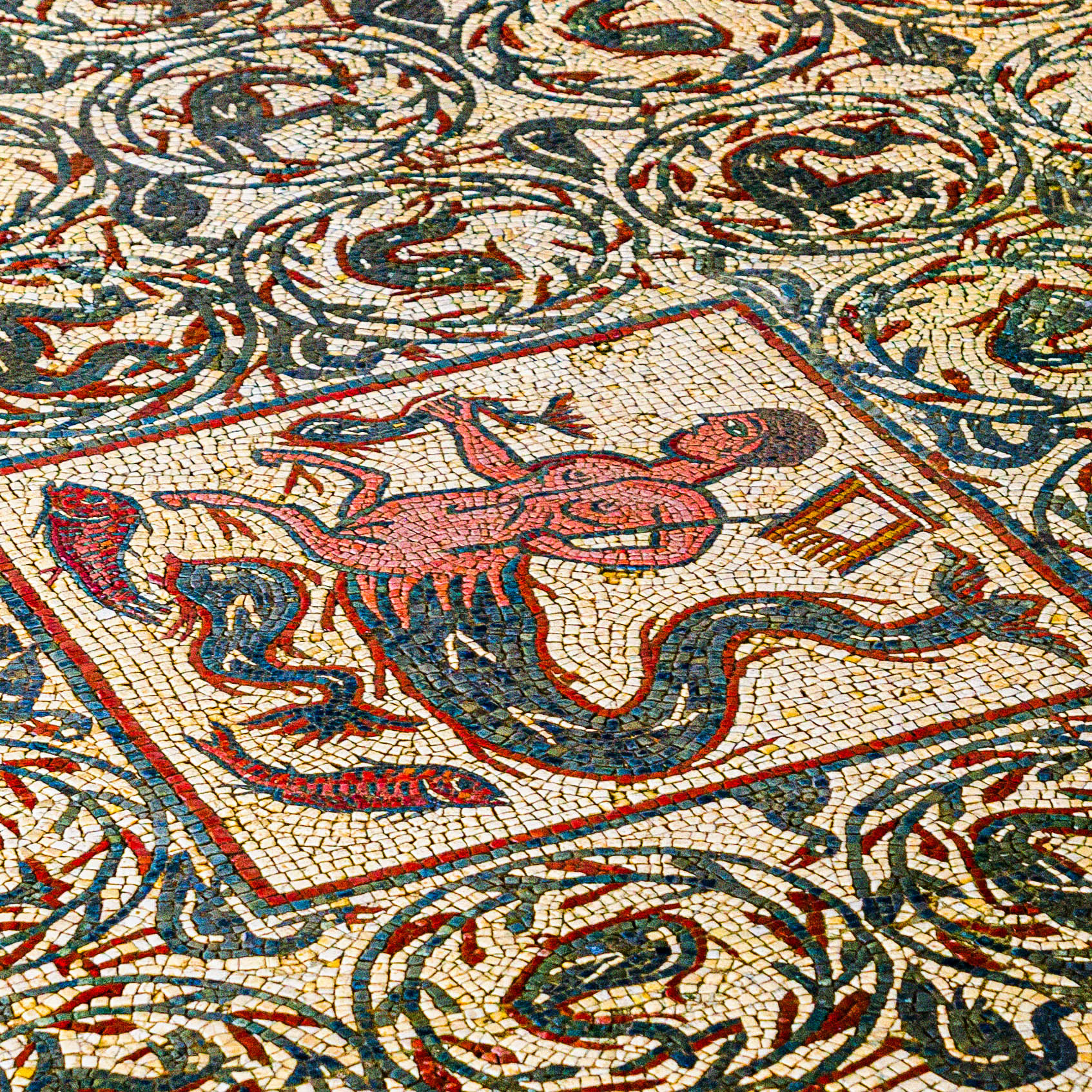
Conímbriga // © Fernando Romão
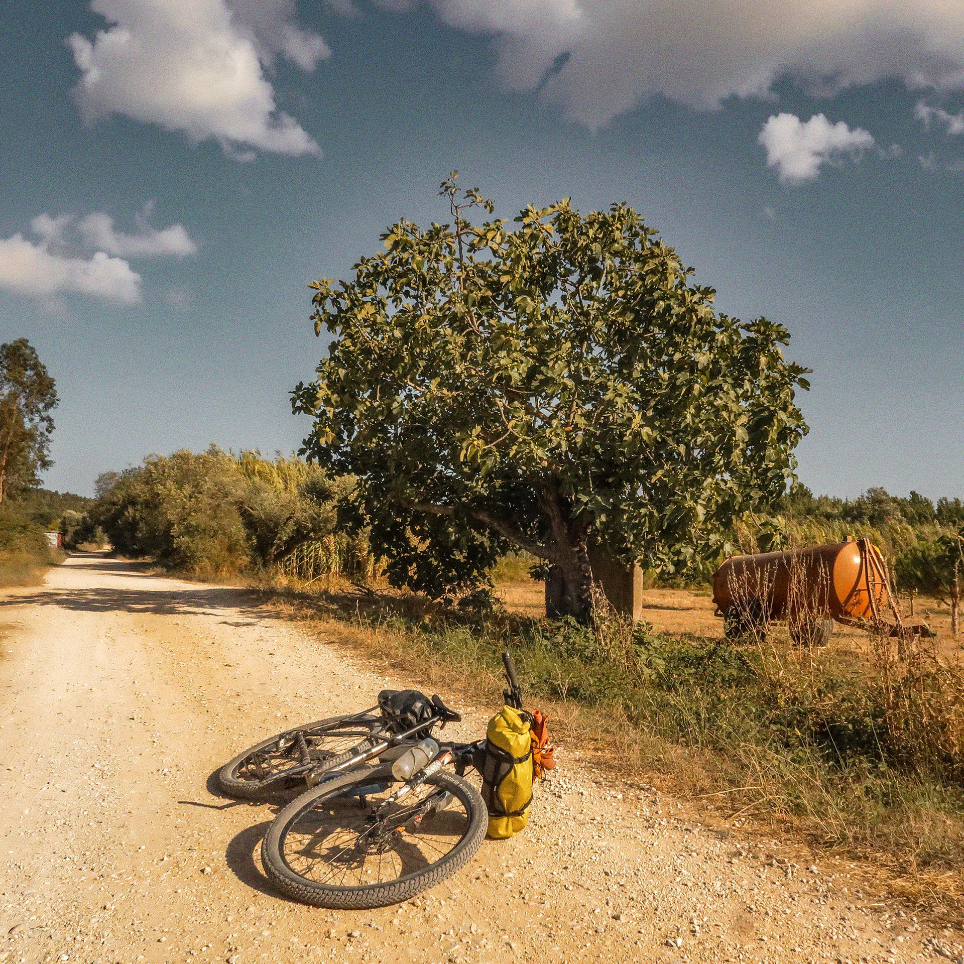
RN do Paúl da Arzila // © Fernando Romão
Montemor-o-Velho // © Fernando Romão
© Foge comigo!
✿ A Biodiversidade da Rota // The Route's Biodiversity
O ciclismo de aventura dá-nos o tempo e a oportunidade de conhecer melhor o mundo que nos rodeia. É certo que, em cima da bicicleta, passamos muito tempo em diálogo interno, lutando para aguentar o esforço, a vontade de desistir ou as preocupações que ficaram em casa; mas tudo isto faz parte da aventura.
Uma das técnicas que uso para mitigar a dor é observar e ouvir o que me rodeia, saindo de dentro dos meus próprios pensamentos. Esta rota é excecional para isso. Oferece-nos a oportunidade de descobrir ecossistemas únicos, desde o emblemático sobreiro, com a sua casca multifacetada, até aos raros núcleos de carvalho-português, que embora escassos a nível nacional, aqui ainda se podem contemplar e urge proteger. Mas a riqueza deste território vai muito além das árvores. Existe todo um mundo de pequenos seres que nos passam despercebidos e flores frágeis que, por vezes, pisamos com os nossos pneus sem termos consciência dos danos que causamos. No fim, não podemos esquecer a geologia — a verdadeira alma de tudo isto. É no calcário esculpido pelo tempo nos lapiás, nas grutas e nos algares, que toda esta vida encontra o seu suporte e a sua razão de ser.
Deixo-vos um desafio: conheçam melhor a ecologia deste território antes de o visitarem. Só conhecendo o podemos proteger.
Um agradecimento especial ao meu amigo Fernando Romão, fotógrafo de natureza, que me ajudou nesta recolha de seres únicos e belos. Além de fotógrafo, é também um excelente guia de viagens de exploração em Portugal na WILDLIFE PORTUGAL.
Bikepacking grants us the time and opportunity to truly connect with the world around us. It is true that, while in the saddle, we spend a lot of time in internal dialogue, struggling with physical pain, the urge to give up, or worries left at home; yet, this is all part of the adventure.
One of the techniques I use to mitigate the pain is to observe and listen to my surroundings, stepping outside of my own thoughts. This route is exceptional for that. It offers the chance to discover unique ecosystems, from the iconic cork oak, with its multifaceted bark, to the rare groves of Portuguese oak—which, although scarce nationwide, can still be admired here and urgently need protection. However, the richness of this territory goes far beyond the trees. There is an entire world of tiny beings that often go unnoticed, and fragile flowers that we might occasionally crush with our tires without even realizing the damage we cause. Ultimately, we must not forget the geology — the true soul of it all. It is within the limestone, carved by time into lapiás (limestone pavements), caves, and sinkholes, that all this life finds its foundation and its purpose.
I leave you with a challenge: learn more about the ecology of this territory before visiting. We can only protect what we truly know.
A special thank you to my friend Fernando Romão, a nature photographer who helped me gather these images of unique and beautiful beings. Besides being a talented photographer, he is also an excellent guide for exploration trips across Portugal with WILDLIFE PORTUGAL.
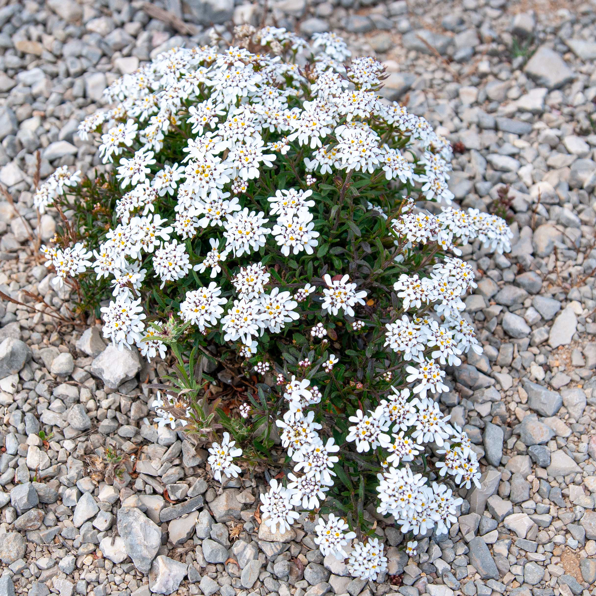
Iberis procumbens microcarpa // Iberis — Endémica de Portugal, adaptada a solos pedregosos // Portuguese endemic adapted to stony soils // © Fernando Romão
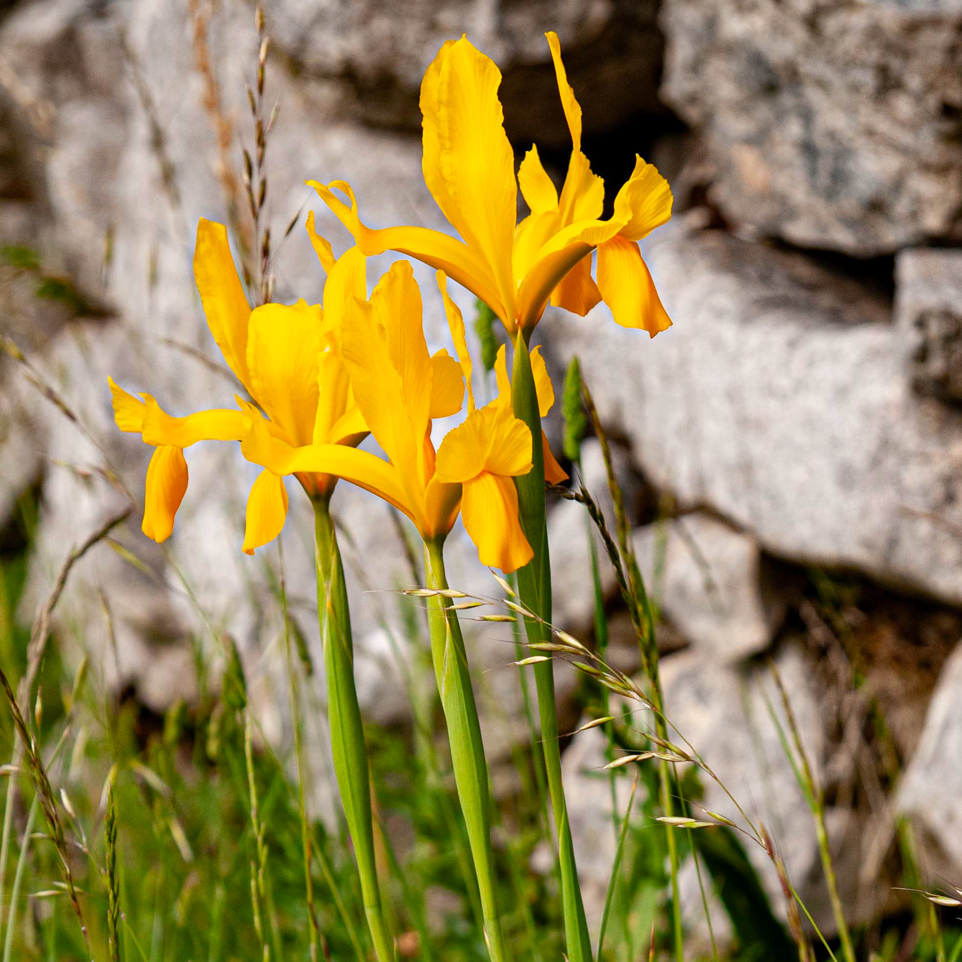
Iris xiphium var. lusitanica // Lírio-roxo (amarelo) — Variedade endémica rara de flores amarelas // Rare endemic variety with yellow flowers // © Fernando Romão
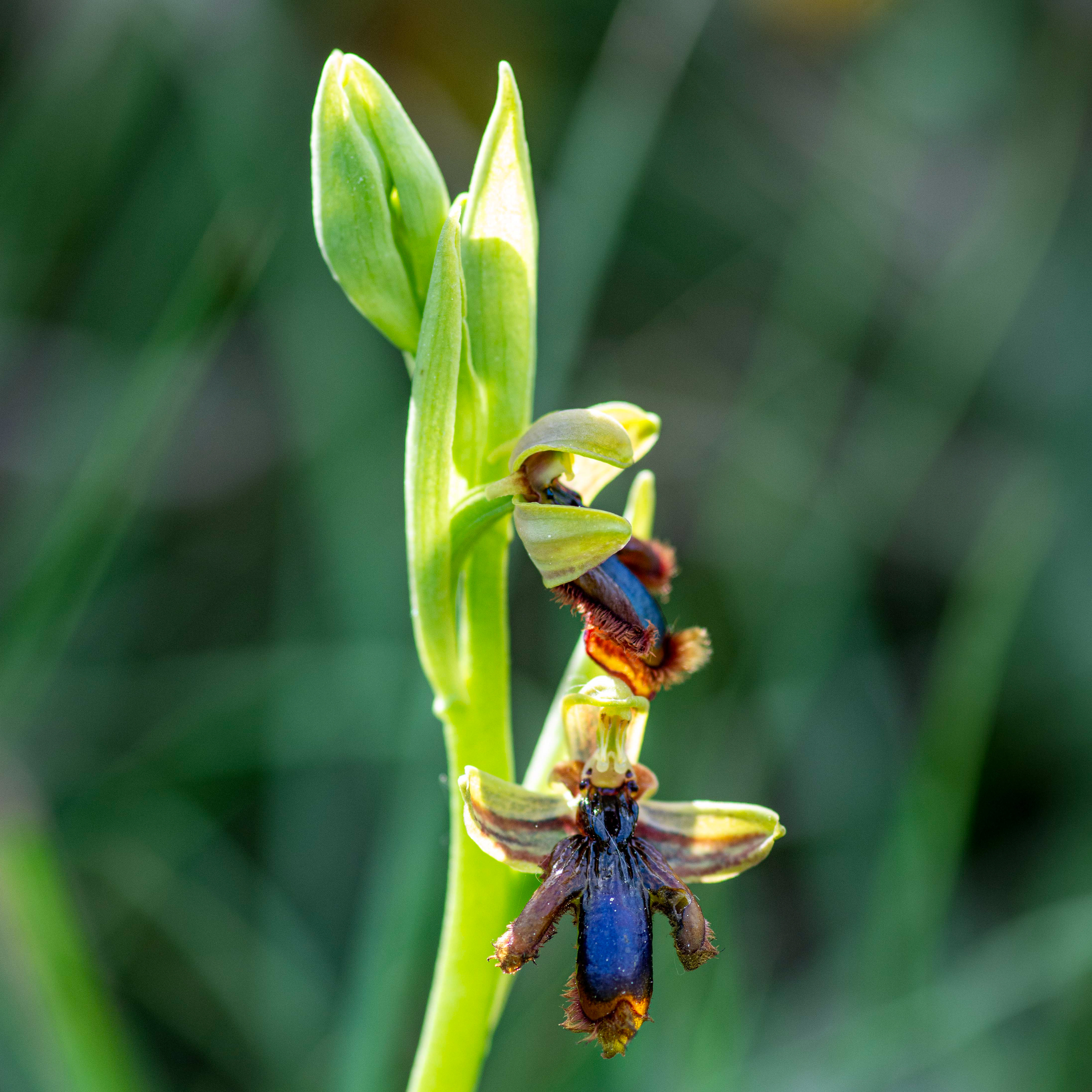
Ophrys speculum lusitanica // Erva-espelho — Subespécie endémica que mimetiza insetos // Endemic insect-mimicking subspecies // © Fernando Romão
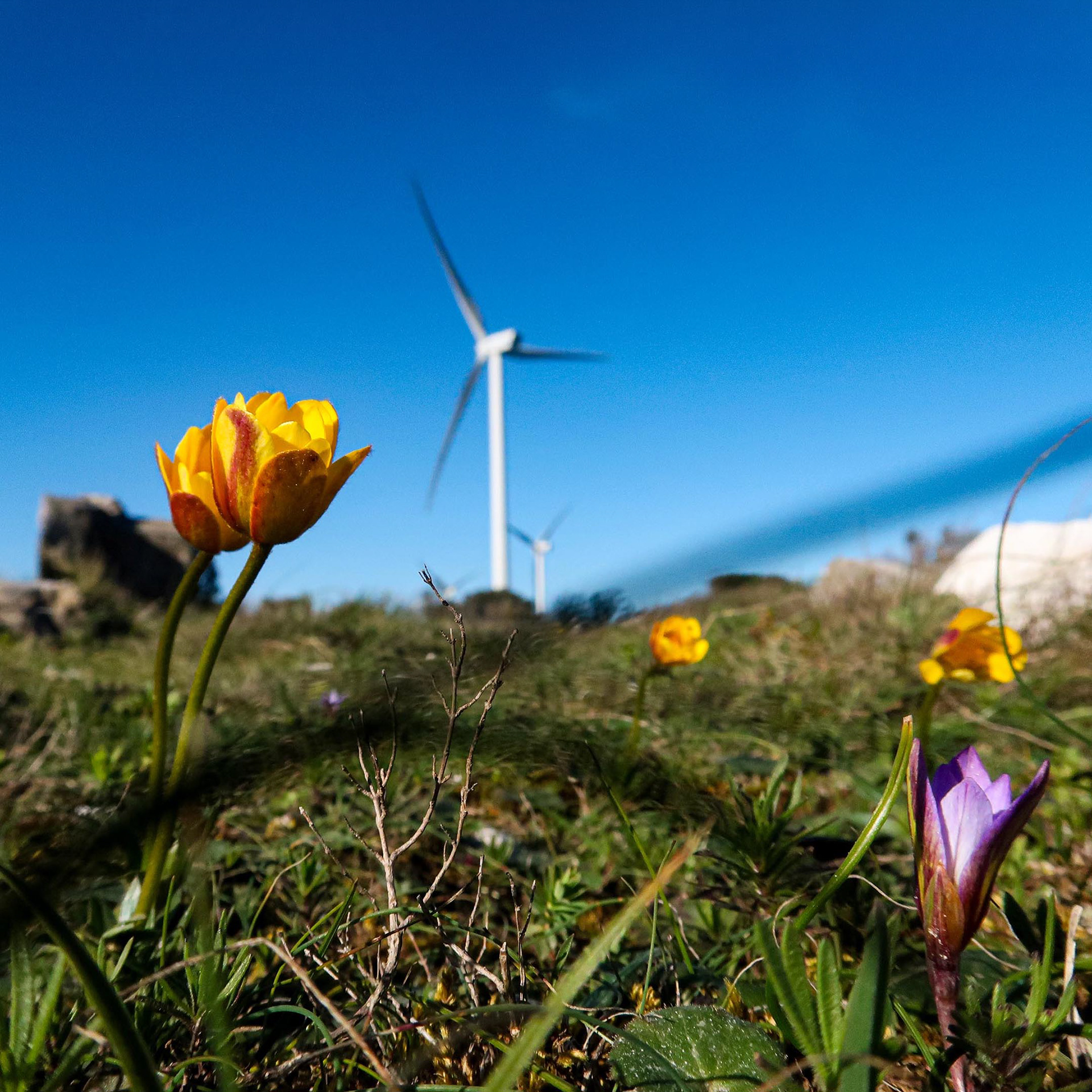
Anemone palmata // Anémona-dos-jardins — Planta perene primaveril de pétalas amarelas // Spring perennial with yellow petals © Rui Henrique
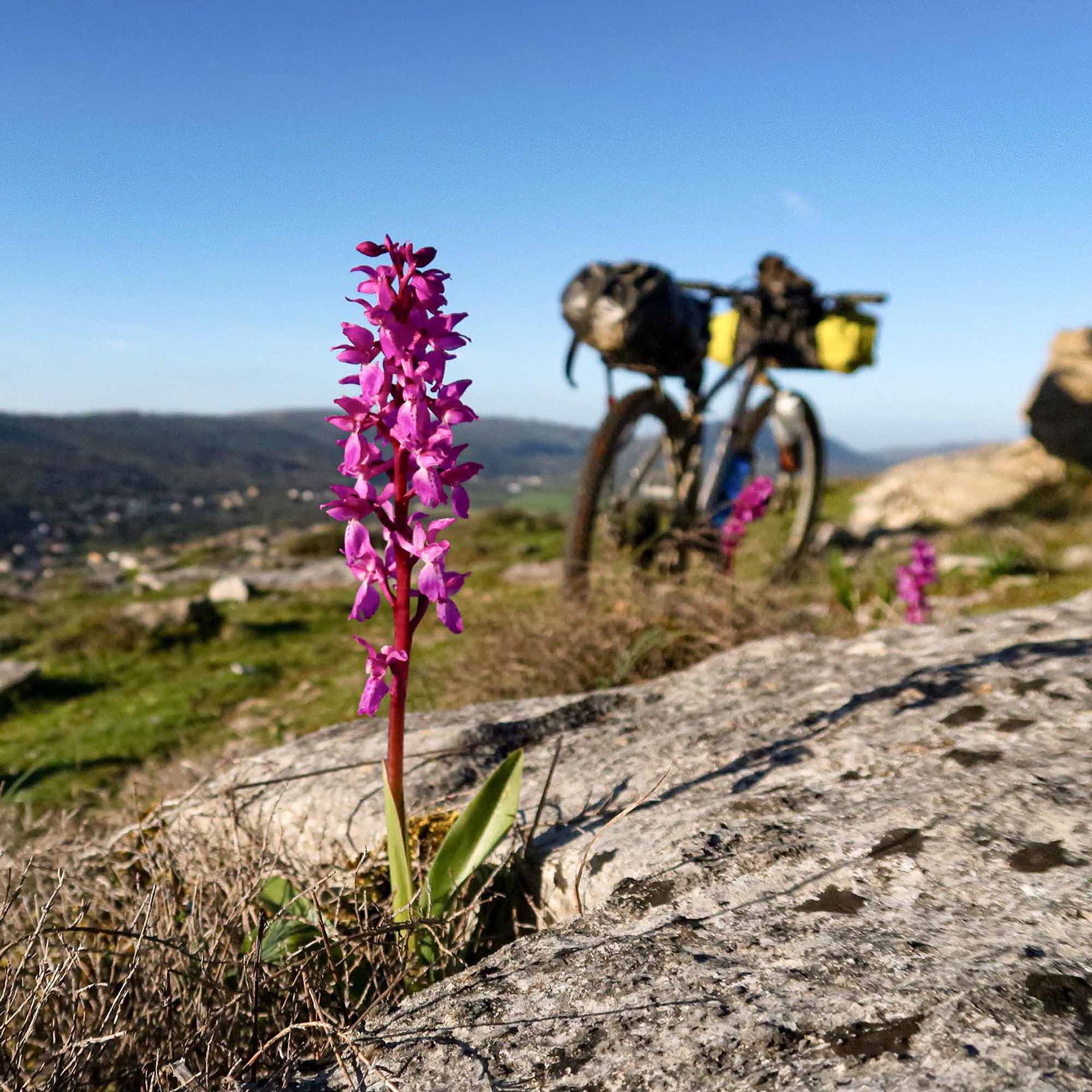
Orchis mascula // Satirião-macho — Orquídea silvestre protegida de inflorescência purpúrea sobre rocha calcária // Protected wild orchid with purple inflorescence on limestone rock // © Rui Henrique
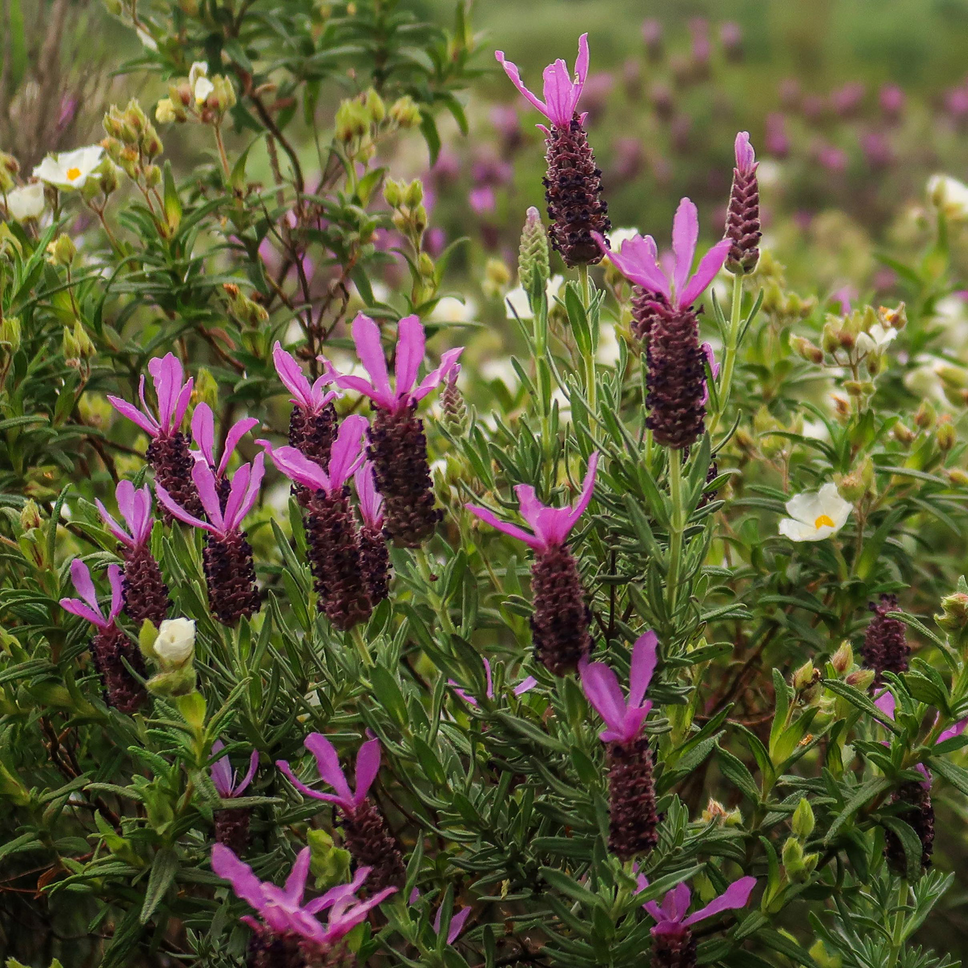
Lavandula stoechas // Rosmaninho — Arbusto aromático acompanhado por esteva // Aromatic shrub with gum rockrose // © Rui Henrique
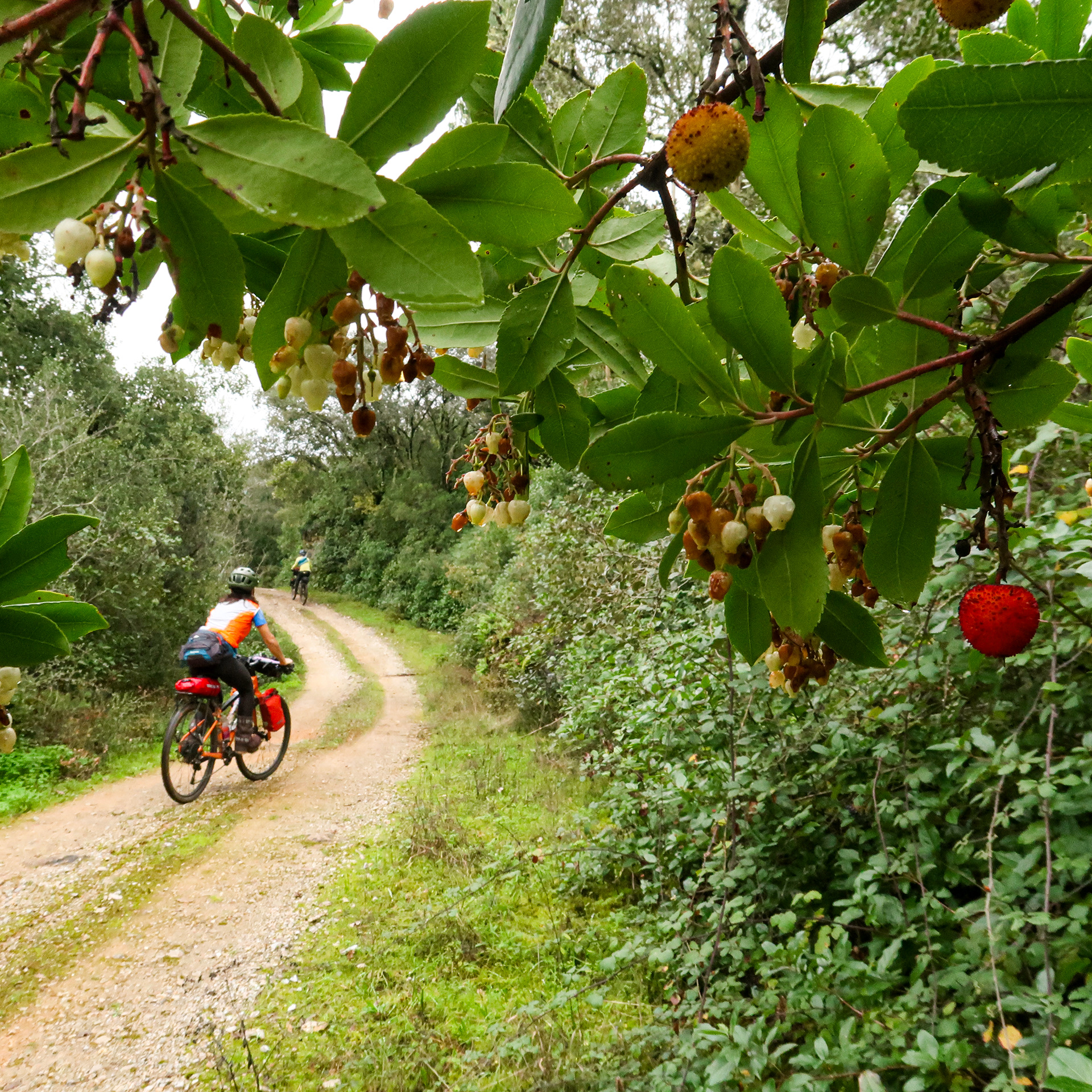
Arbutus unedo // Medronheiro — Árvore mediterrânica com floração e frutos simultâneos; os seus frutos maduros são comestíveis e muito saborosos // Strawberry Tree — Mediterranean tree with simultaneous flowers and fruits; its ripe berries are edible and very tasty // © Rui Henrique
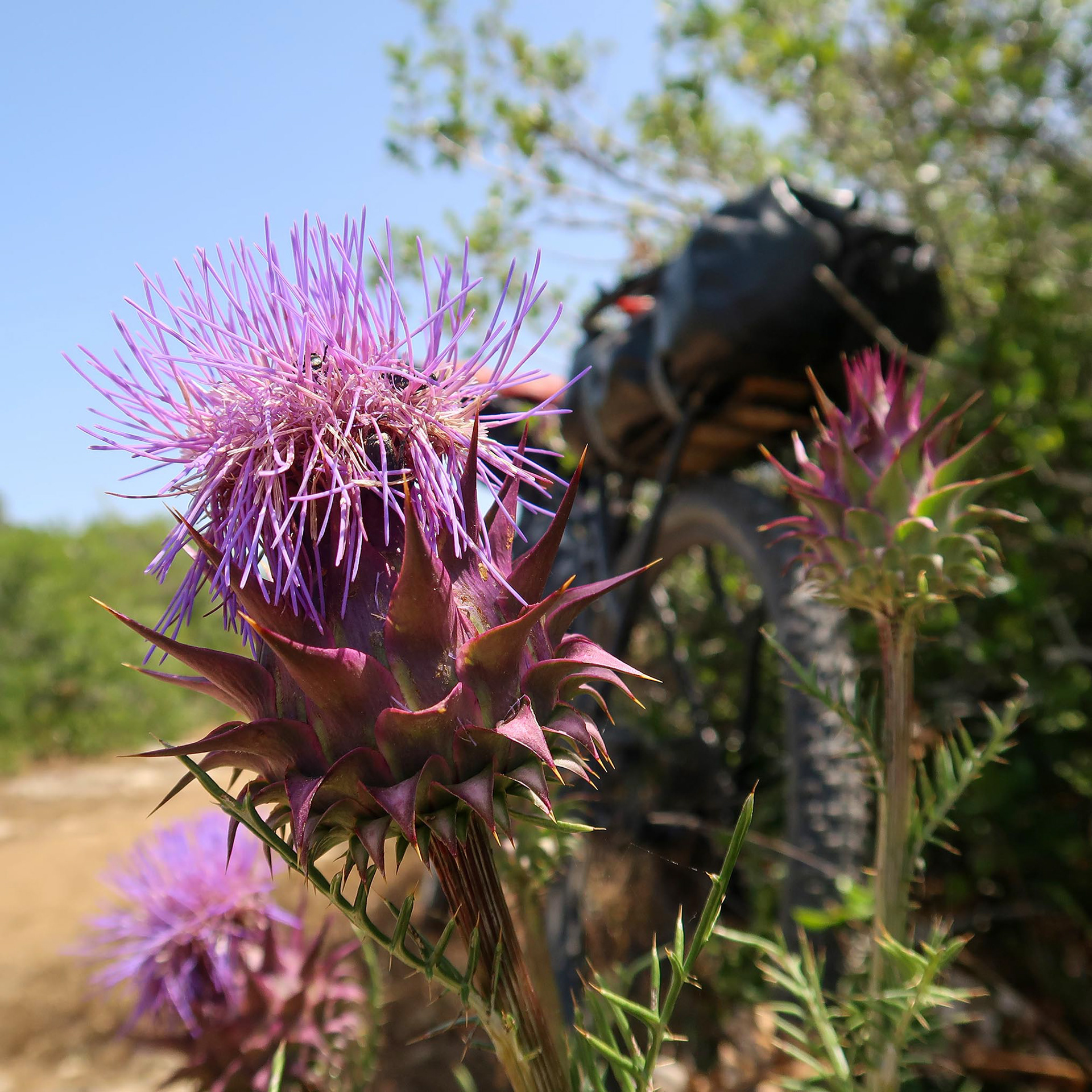
Cynara cardunculus // Cardo-hortense — Planta espinhosa de estrutura geométrica // Thorny plant with geometric structure // © Rui Henrique
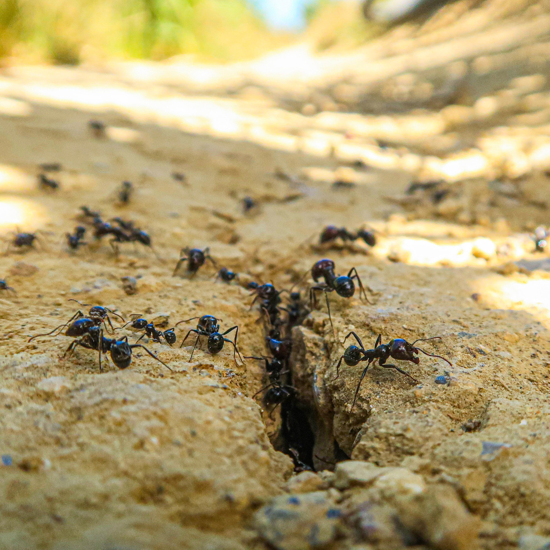
Messor barbarus // Formiga-ceifeira — Endémica da bacia do Mediterrâneo // Harvester ant — Endemic to the Mediterranean basin // © Rui Henrique
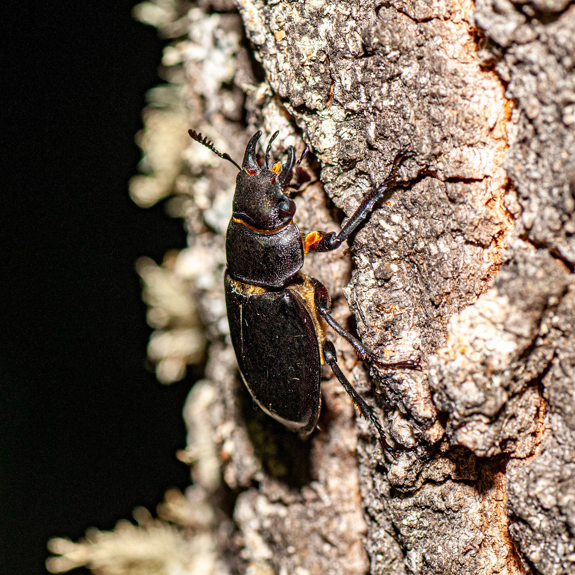
Lucanus barbarossa // Vaca-Ruiva — Grande escaravelho de carvalhais, distribuição limitada // Large oak forest beetle, limited distribution // © Fernando Romão
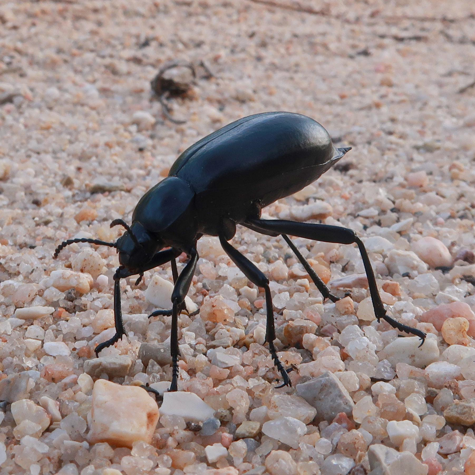
Blaps sp. // Manteigueiro — Escaravelho detritívoro em cascalho calcário // Detritivorous beetle on limestone gravel // © Rui Henrique
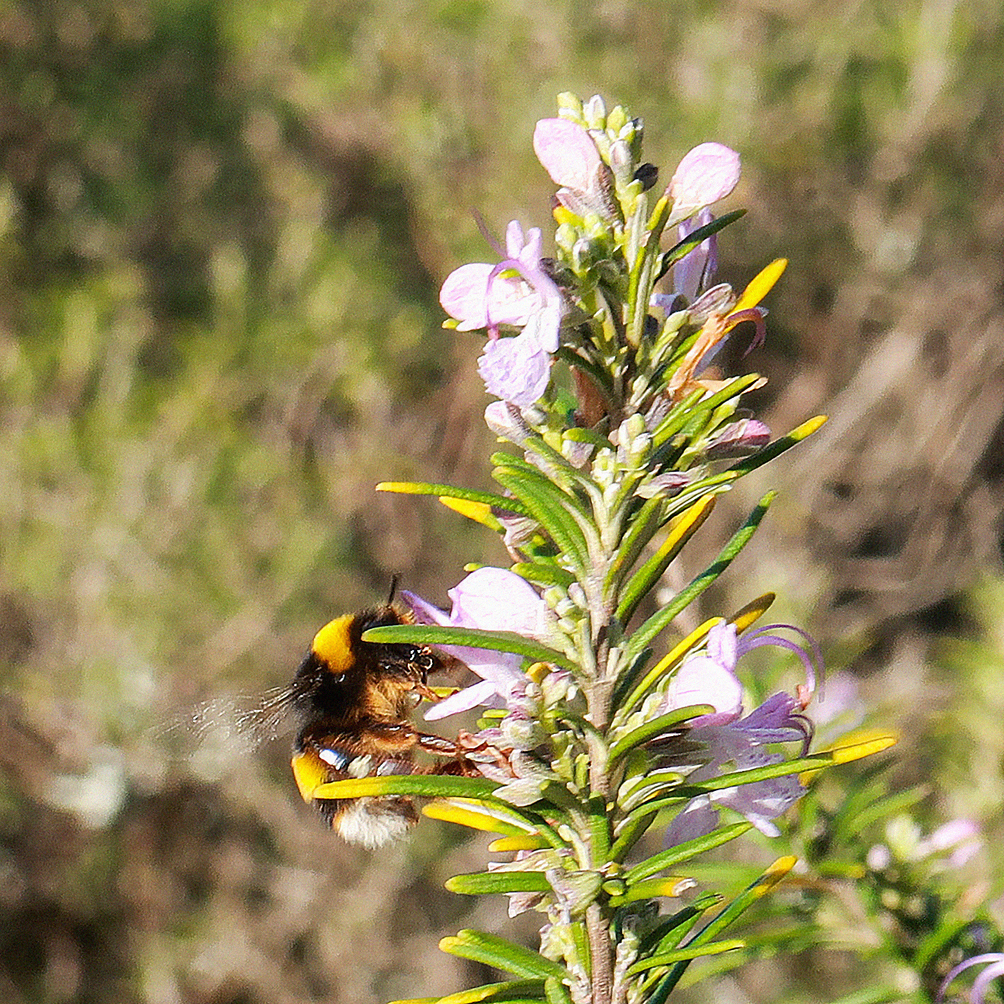
Bombus terrestris // Abelhão-terrestre — Polinizador robusto em flores de alecrim // Robust pollinator on rosemary flowers // © Rui Henrique
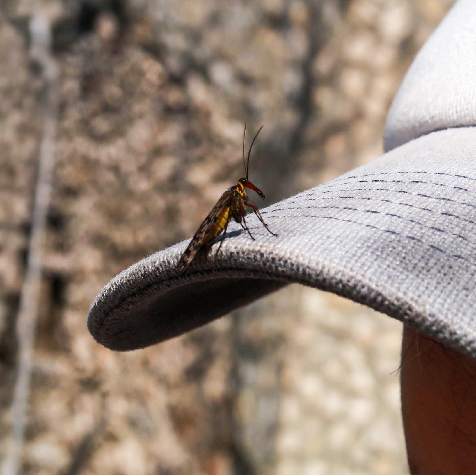
Panorpa sp. // Mosca-escorpião — Inseto detritívoro com rostro alongado // Scavenger insect with elongated rostrum // © Rui Henrique
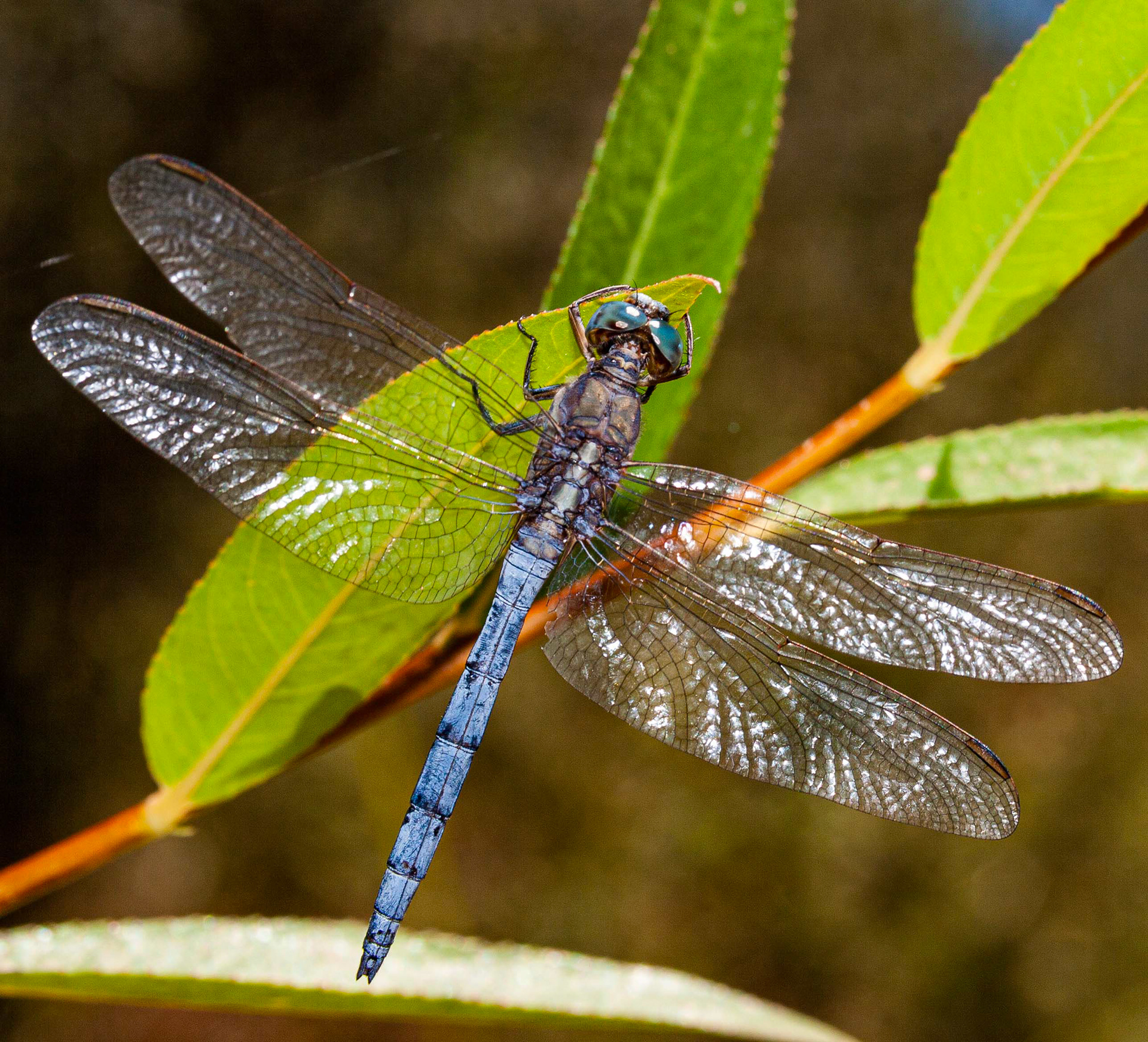
Orthetrum chrysostigma // Libélula — Libélula de abdómen azul em águas paradas // Blue-bodied dragonfly in still waters // © Fernando Romão
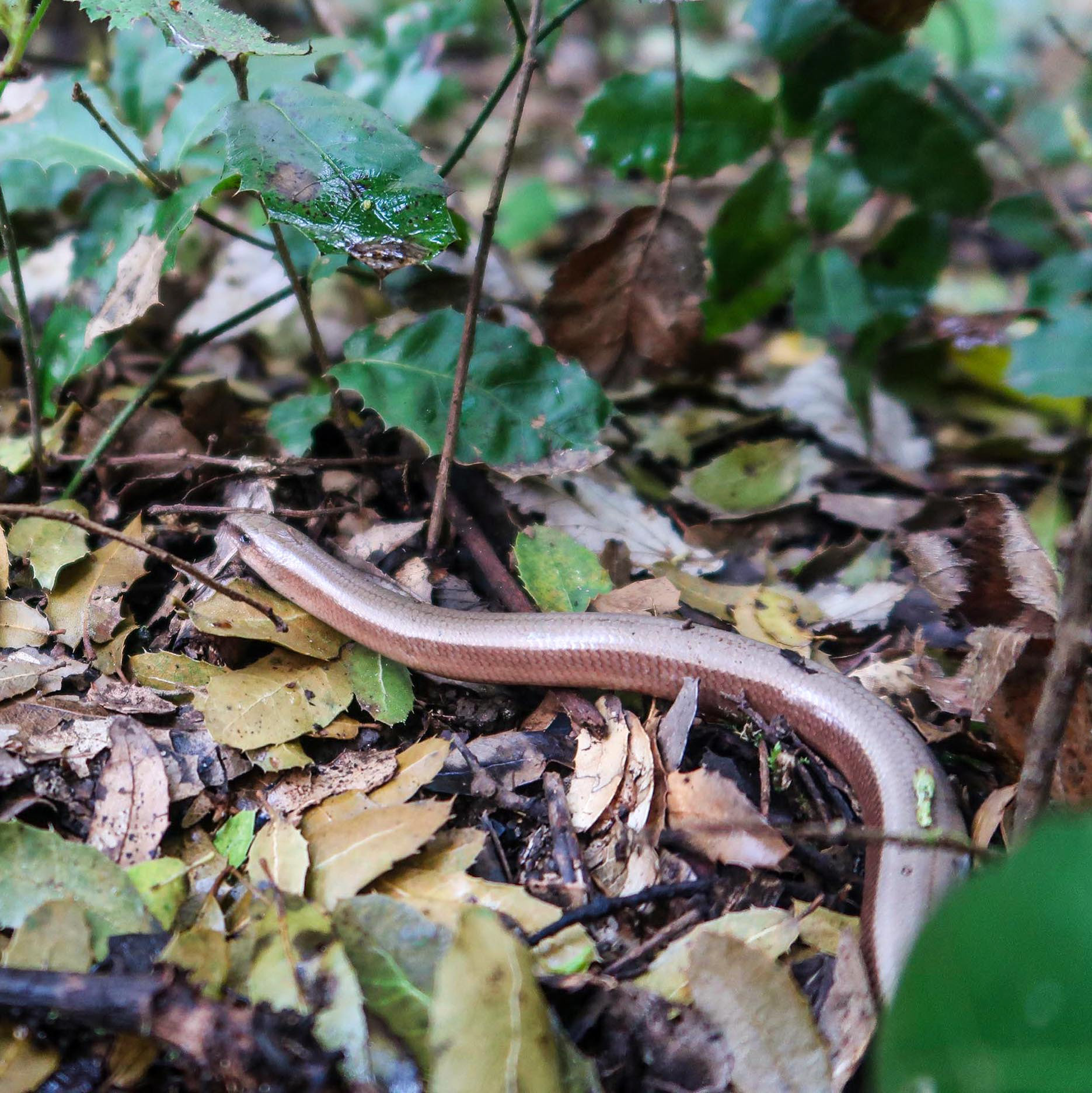
Anguis fragilis // Licranço — Lagarto ápode sob a sombra de carvalhais // Legless lizard under oak shade // © Rui Henrique
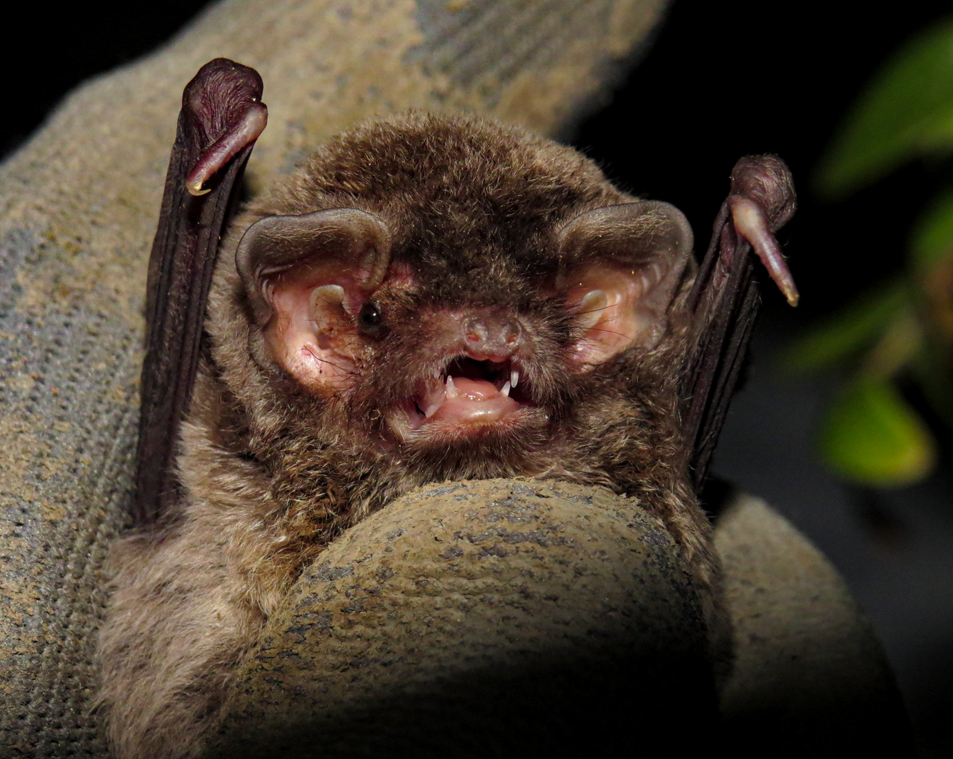
Miniopterus schreibersii // Morcego-de-peluche — Morcego cavernícola, estatuto Vulnerável // Cave-dwelling bat, Vulnerable status // © Yves Bas
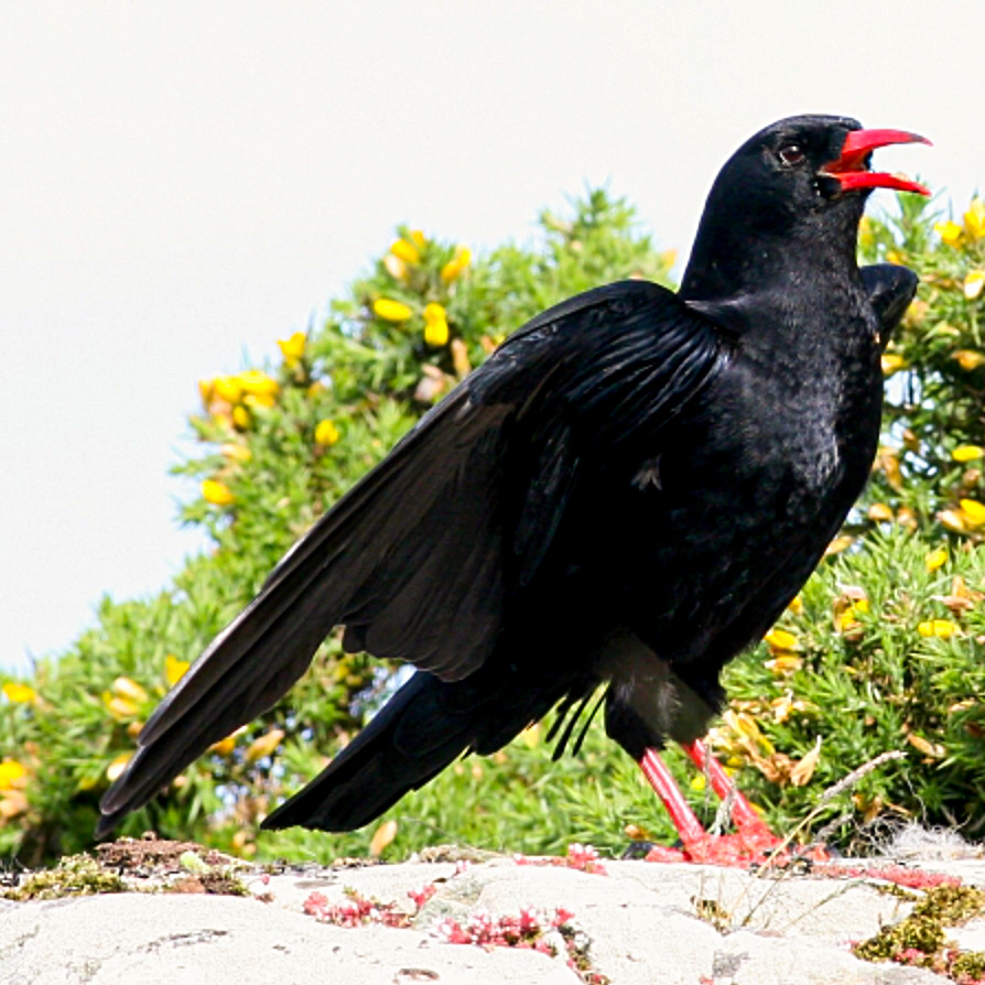
Pyrrhocorax pyrrhocorax // Gralha-de-bico-vermelho — Corvídeo raro, espécie "Em Perigo" em Portugal // Rare corvid, Endangered in Portugal // © Ken Billington
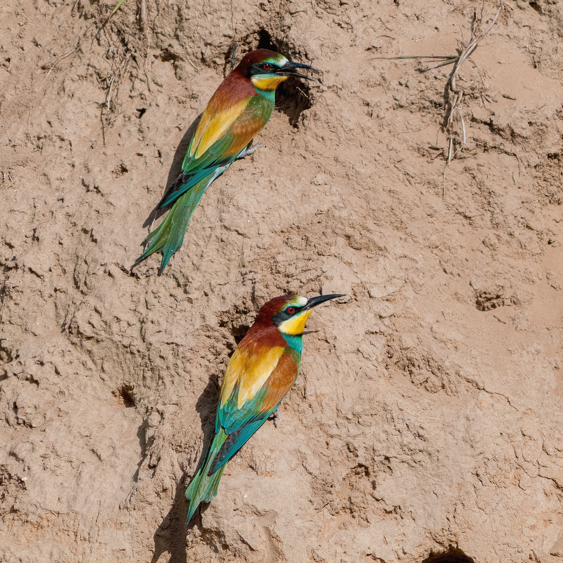
Merops apiaster // Abelharuco-europeu — 90% da sua dieta são abelhas // European bee-eater — 90% of its diet consists of bees // © Fernando Romão
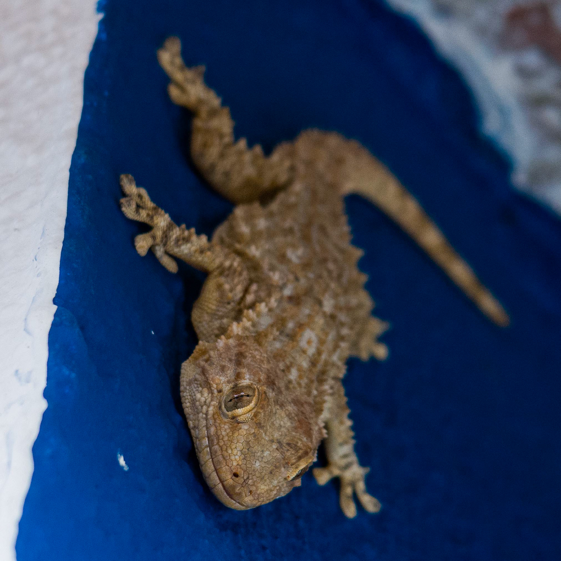
Moorish gecko // Osga comum — Fácil de encontrar nas paredes das casas e muros em Portugal // Moorish gecko — Easily found on the walls of houses and stone walls in Portugal // © Rui Henrique
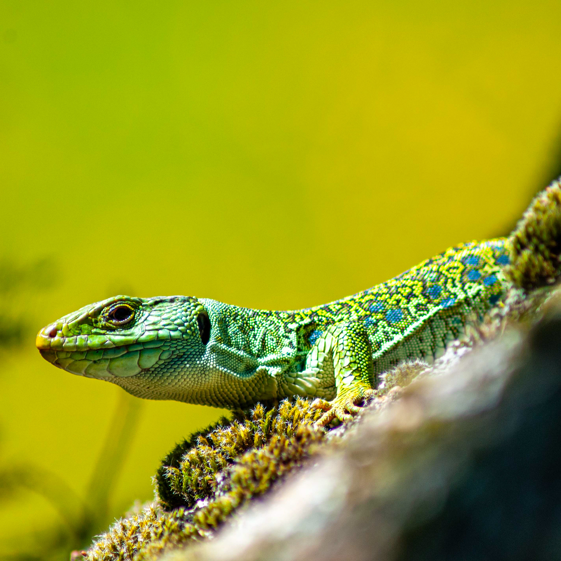
Timon lepidus // Sardão — Maior lagarto europeu, estatuto "Quase Ameaçado" // Largest European lizard, "Near Threatened" // © Fernando Romão
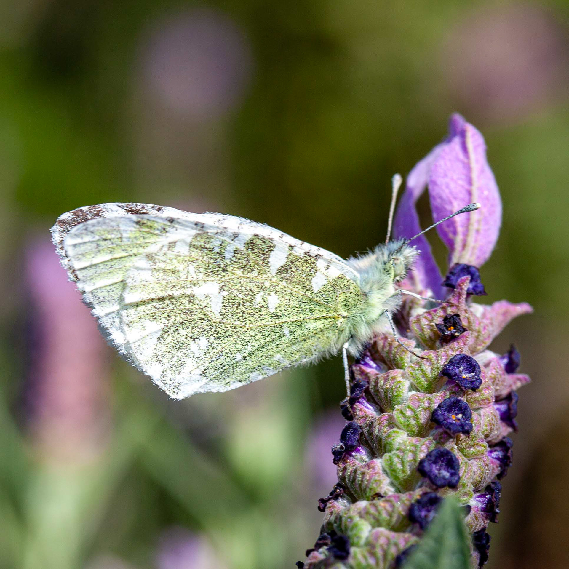
Euchloe tagis // Borboleta-marmoreada-portuguesa — Especialista de habitats calcários sobre rosmaninho // Localized limestone specialist on French lavender // © Fernando Romão
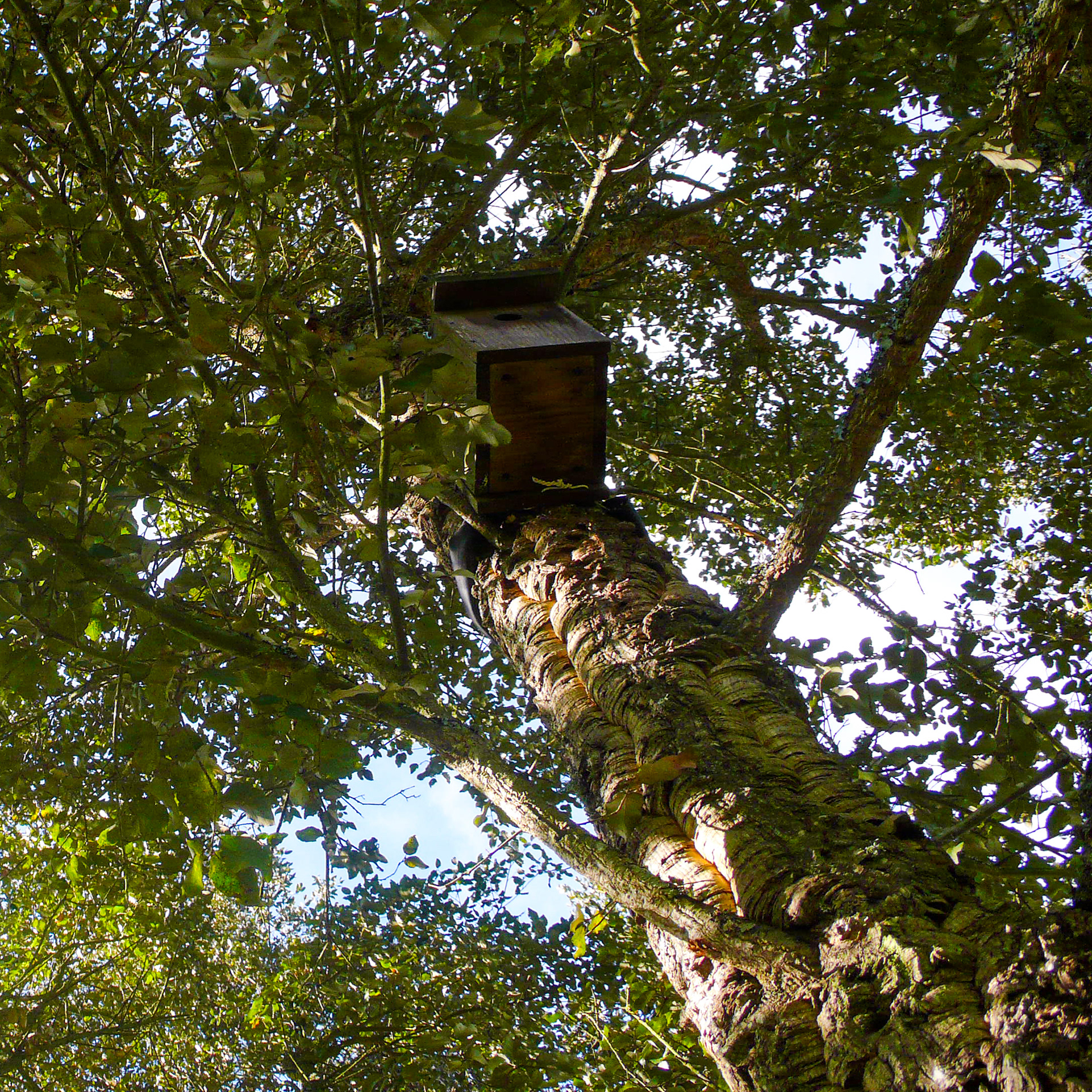
Quercus suber // Sobreiro — Árvore Nacional protegida por lei com abrigo para fauna // Cork Oak — National Tree protected by law with fauna nesting box // © Rui Henrique
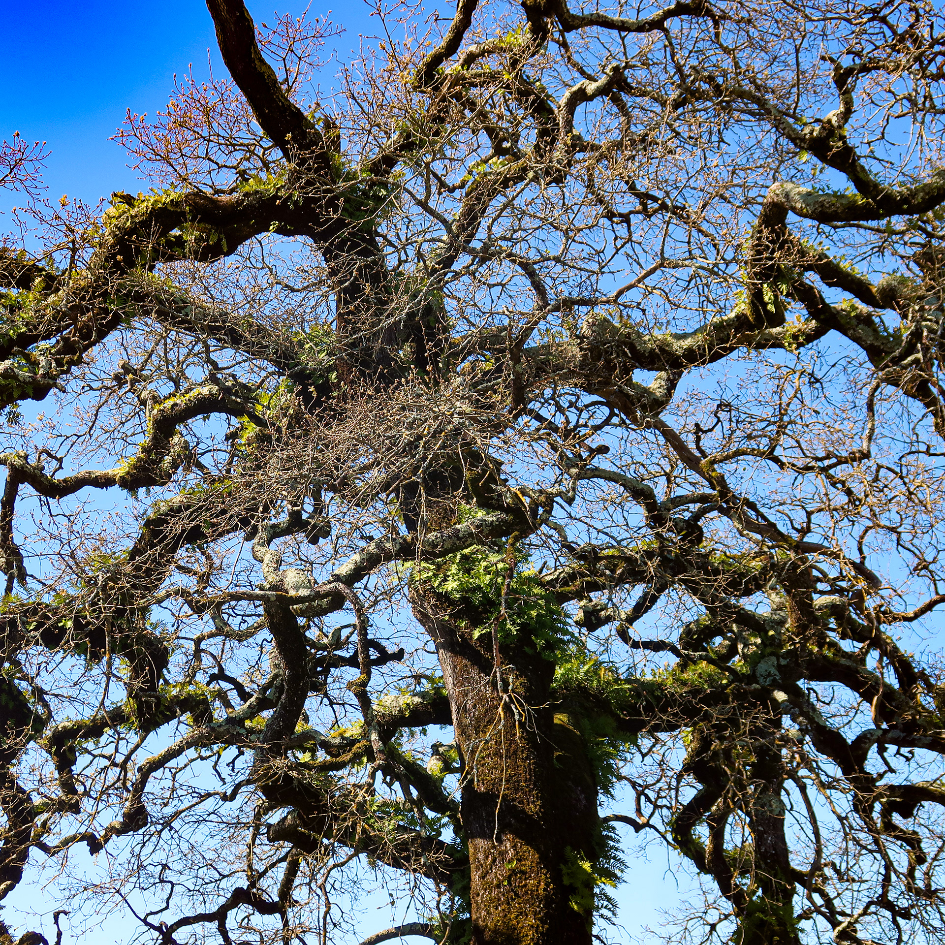
Quercus faginea // Carvalho-português — Carvalhal raro de carvalho-cerquinho com líquenes epífitos // Rare Portuguese oak grove with epiphytic lichens // © Rui Henrique
© Fotografias de Fernando Romão — Wildlife Portugal, exceto quando assinalado. // Photos by Fernando Romão — Wildlife Portugal, except where indicated.
✥ Informação Útil // Practical Information
☼ Sentido recomendado // Easier Direction:
☵ Estado do Piso // Surface Conditions:
O terreno é muito pedregoso e as pedras são afiadas. Recomenda-se preparação para terreno difícil e risco elevado de furos ou cortes nos pneus. Existem oficinas em Mafra, Rio Maior, Tomar e Figueira da Foz.
The terrain is very rocky with sharp stones. Equipment prepared for difficult terrain and a high risk of punctures is recommended. Bike shops are available in Mafra, Rio Maior, Tomar and Figueira da Foz.
The terrain is very rocky with sharp stones. Equipment prepared for difficult terrain and a high risk of punctures is recommended. Bike shops are available in Mafra, Rio Maior, Tomar and Figueira da Foz.
☼ Época ideal // Best season:
Recomendado de outubro a maio. O inverno é uma excelente opção, mas evite os meses de maior calor (meados de junho a setembro), quando as temperaturas atingem facilmente os 40°C em clima seco.
Recommended from October to May. Winter is an excellent option, but avoid the hottest months (mid-June to September), when temperatures easily reach 40°C in a dry climate.
Recommended from October to May. Winter is an excellent option, but avoid the hottest months (mid-June to September), when temperatures easily reach 40°C in a dry climate.
✿ Parques naturais atravessados // Natural parks crossed
△ Dormir, comer e beber // Sleep, Eat AND Drink
DORMIR
A rota foi desenhada para uma experiência de autonomia total e bivaque. Importa salientar que o campismo selvagem não é permitido por lei; contudo, a montagem de tenda para pernoita estrita (entre o anoitecer e o amanhecer) é tolerada se praticada com total discrição e respeito pela natureza. Alternativamente, a rota conta com diversas opções de alojamento local. Dada a escassez de oferta em algumas secções isoladas, a reserva antecipada é fortemente aconselhada.
A rota foi desenhada para uma experiência de autonomia total e bivaque. Importa salientar que o campismo selvagem não é permitido por lei; contudo, a montagem de tenda para pernoita estrita (entre o anoitecer e o amanhecer) é tolerada se praticada com total discrição e respeito pela natureza. Alternativamente, a rota conta com diversas opções de alojamento local. Dada a escassez de oferta em algumas secções isoladas, a reserva antecipada é fortemente aconselhada.
COMER
Abastecimento fácil. Se fores cozinhar, leva gás suficiente (rosca universal (EN417) é rara fora de Lisboa).
Abastecimento fácil. Se fores cozinhar, leva gás suficiente (rosca universal (EN417) é rara fora de Lisboa).
Água e Hidratação
Previne-te para as secções longas sem água pública potável. Fontes naturais são raras em terreno calcário. Se não encontrares torneiras, pede em cafés ou aos habitantes locais; são geralmente muito prestáveis. No verão, o cuidado deve ser redobrado. Os locais de bivaque sugeridos raramente têm água potável.
Previne-te para as secções longas sem água pública potável. Fontes naturais são raras em terreno calcário. Se não encontrares torneiras, pede em cafés ou aos habitantes locais; são geralmente muito prestáveis. No verão, o cuidado deve ser redobrado. Os locais de bivaque sugeridos raramente têm água potável.
SLEEP
The route was designed for an experience of total autonomy and wild camping/bivouacking. It is important to note that wild camping is prohibited by law; however, setting up a tent for strict overnight stays (between dusk and dawn) is tolerated if practiced with complete discretion and respect for nature. Alternatively, the route features several local accommodation options. Given the limited availability in some isolated sections, booking in advance is strongly advised.
EAT
Easy resupply. If cooking, bring enough gas (EN417 screw-top canisters are rare outside Lisbon).
Easy resupply. If cooking, bring enough gas (EN417 screw-top canisters are rare outside Lisbon).
Water & Hydration
Prepare for long sections without public water. Natural springs are rare in limestone terrain. If you can't find taps, ask in cafés or locals; they are usually very helpful. Take extra care in summer. The suggested bivouac sites rarely have potable water.
Prepare for long sections without public water. Natural springs are rare in limestone terrain. If you can't find taps, ask in cafés or locals; they are usually very helpful. Take extra care in summer. The suggested bivouac sites rarely have potable water.
⇄ Como Chegar de Comboio // How to Get There by Train
A forma mais fácil de aceder ao início e ao fim da rota é de comboio, tendo o percurso sido planeado especificamente para facilitar esta logística. O transporte de bicicletas é gratuito e permitido nos comboios Intercidades (IC), Regionais (R), Interregionais (IR) e Suburbanos (Sub). Note que, nos serviços Intercidades (IC), a reserva de lugar para a bicicleta é obrigatória. A Estação de Sintra dispõe de excelentes ligações a partir do centro de Lisboa. Para chegar à Figueira da Foz, as melhores estações de ligação são Alfarelos ou Coimbra-B. Para mais informações e horários, consulte o site oficial da Comboios de Portugal (CP).
Se tiveres tempo, regressa a Sintra pela EuroVelo 1 ao longo da costa. Se passares na altura certa, poderás aproveitar para ver a onda gigante da Nazaré, dada a conhecer à comunidade mundial do surf por Garrett McNamara
The easiest way to reach the start and finish points of the route is by train, as the itinerary was specifically designed to simplify this logistics. Bicycle transport is permitted on Intercidades (IC), Regional (R), Interregional (IR), and Suburban (Sub) trains. Please note that seat reservation for bicycles is mandatory on Intercidades (IC) services. Sintra Station is highly accessible, with frequent train connections from central Lisbon. To reach Figueira da Foz, the best connecting stations are Alfarelos or Coimbra-B. For more information and timetables, please visit the official Comboios de Portugal (CP) website.
If you have time, head back to Sintra along the coast via EuroVelo 1. If your timing is right, you can catch the big wave in Nazaré, introduced to the global surfing community by Garrett McNamara.
✥ PERIGO DE INCÊNCIO — REGRAS DE SEGURANÇA
// WILDFIRE DANGER — SAFETY REGULATIONS
// WILDFIRE DANGER — SAFETY REGULATIONS
Portugal apresenta um risco elevado de incêndio no verão. Esta rota atravessa zonas vulneráveis onde os fogos são frequentes. O uso de fogo é proibido do fim da primavera ao início do outono. Em caso de alerta vermelho, o uso de fogões (stoves) é também proibido. Consulta o nível de alerta antes de partir: ipma.pt
Portugal has a high wildfire risk, especially in summer. This route crosses vulnerable areas where fires are frequent. Open fires are prohibited from late spring to early autumn. During "Red Alerts," camping stoves are also banned. Check the current alert levels before starting at: ipma.pt
✥ ÉTICA // ETHICS
Pratica os princípios Leave No Trace: não deixes lixo, não faças fogueiras e respeita a propriedade privada. Preserva este ecossistema calcário frágil. Apoia a economia local: consome no pequeno comércio e aproveita o conhecimento das pessoas que vivem no território.
Follow Leave No Trace principles: pack out all trash, no campfires, and respect private property. Protect this fragile limestone ecosystem. Support the local economy: shop at small businesses and learn from the people who inhabit the territory.
✥ contactos úteis // KEY CONTACTS
EMERGÊNCIA // EMERGENCY: 112
EM CASO DE INCÊNDIO // IN CASE OF FIRE: 112
Linha SOS Ambiente e Território // ENVIRONMENTAL SOS LINE: (+351) 808 200 520
⚙ BESTAS VIVAS // LIVING BEASTS
Quando as bestas meigas falharam, sem estas bestas bem vivas, a Lapiás não seria possível.
When the benevolent beasts failed, without these very much living beasts, the Lapiás wouldn't be possible.
![Josué @josejosue_desenhos [Explorador da rota // Route pioneer]](https://cdn.myportfolio.com/7a2567f9-a1a5-4ac5-873d-d20e889d2683/b8bb8f18-e7c8-422b-9c9e-063cefed06a6_rw_1920.jpg?h=13ce5d28c0653a5afbe89abfed390dd6)
Josué @josejosue_desenhos [Explorador da rota // Route pioneer]
![Marta @80martas [Exploradora da rota // Route pioneer]](https://cdn.myportfolio.com/7a2567f9-a1a5-4ac5-873d-d20e889d2683/29b19f14-e424-43a6-a7a8-5c8d09405cfa_rw_1920.jpg?h=8685d4788b1ed8dabc2a4697dd617e32)
Marta @80martas [Exploradora da rota // Route pioneer]
![Miguel @almirantereis [Explorador da rota e ilustrador // Route pioneer and illustrator]](https://cdn.myportfolio.com/7a2567f9-a1a5-4ac5-873d-d20e889d2683/85a04ec6-d79e-4758-93c0-52bf157a547c_rw_1920.jpg?h=cf29fbce0f79e6fc376c571e19aac2f3)
Miguel @almirantereis [Explorador da rota e ilustrador // Route pioneer and illustrator]
![Fernando @wildlifeportugal [Fotografia // Photo]](https://cdn.myportfolio.com/7a2567f9-a1a5-4ac5-873d-d20e889d2683/17160fc0-dec7-43b2-b933-baf3c4cb8044_rw_1920.jpg?h=49333511be38dfa4dffd7cd3061d2608)
Fernando @wildlifeportugal [Fotografia // Photo]
![Rita @palavrasoltas.ritareis [Revisão // Proofreading]](https://cdn.myportfolio.com/7a2567f9-a1a5-4ac5-873d-d20e889d2683/71404f59-0bbb-4bdf-a55a-eedbc1d60673_rw_1920.jpg?h=7473053aa55b559875881164e8f13b62)
Rita @palavrasoltas.ritareis [Revisão // Proofreading]
![Carlos @grupetocafe [Revisão e tradução // Translation & Proofreading]](https://cdn.myportfolio.com/7a2567f9-a1a5-4ac5-873d-d20e889d2683/e2a5b99b-3e94-488c-b126-3be33b759241_rw_1920.jpg?h=836b8e4011c1ebd0d2daba517ca5e637)
Carlos @grupetocafe [Revisão e tradução // Translation & Proofreading]
Agradeço o contacto e o interesse pela Lápias. Entrarei em contacto assim que possível. // Thank you for your message and your interest in Lápias. I will get back to you as soon as possible.
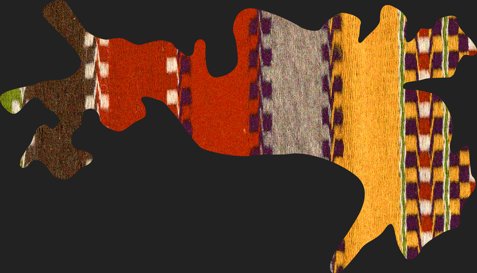
Mantas de Lã da Serra de Aire. Tecidas nos tradicionais ateliês de Minde (vistas sobre Minde entre os km 170 e 180), estas peças carregam séculos de história. O seu comércio secreto deu origem ao Minderico — ou piação dos charales —, uma língua única criada para proteger o negócio dos feirantes locais e hoje em risco de desaparecer // Serra de Aire Woolen Blankets. Woven in the traditional workshops of Minde (Views over Minde between km 170 and 180), these pieces carry centuries of history. Their secret trade gave rise to Minderico — or piação dos charales —, a unique secret language created to protect local traders' business and now at risk of disappearing.